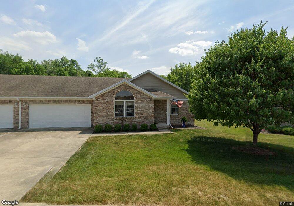
357 S Fork Dr Crawfordsville, IN 47933
Estimated Value: $198,000 - $221,000
2
Beds
2
Baths
1,470
Sq Ft
$145/Sq Ft
Est. Value
About This Home
This home is located at 357 S Fork Dr, Crawfordsville, IN 47933 and is currently estimated at $213,296, approximately $145 per square foot. 357 S Fork Dr is a home located in Montgomery County with nearby schools including Mollie B. Hoover Elementary School, Laura Hose Elementary School, and Meredith Nicholson Elementary School.
Ownership History
Date
Name
Owned For
Owner Type
Purchase Details
Closed on
Apr 24, 2017
Sold by
Wilbur Daniel Eugene
Bought by
Dill Sarah J
Current Estimated Value
Home Financials for this Owner
Home Financials are based on the most recent Mortgage that was taken out on this home.
Original Mortgage
$60,000
Outstanding Balance
$31,034
Interest Rate
4.23%
Mortgage Type
New Conventional
Estimated Equity
$182,262
Purchase Details
Closed on
Feb 24, 2010
Sold by
Bullerdick Genevieve and Anderson Janet
Bought by
Sommer Geneva I
Create a Home Valuation Report for This Property
The Home Valuation Report is an in-depth analysis detailing your home's value as well as a comparison with similar homes in the area
Home Values in the Area
Average Home Value in this Area
Purchase History
| Date | Buyer | Sale Price | Title Company |
|---|---|---|---|
| Dill Sarah J | -- | None Available | |
| Sommer Geneva I | -- | None Available |
Source: Public Records
Mortgage History
| Date | Status | Borrower | Loan Amount |
|---|---|---|---|
| Open | Dill Sarah J | $60,000 |
Source: Public Records
Tax History Compared to Growth
Tax History
| Year | Tax Paid | Tax Assessment Tax Assessment Total Assessment is a certain percentage of the fair market value that is determined by local assessors to be the total taxable value of land and additions on the property. | Land | Improvement |
|---|---|---|---|---|
| 2024 | $1,518 | $187,800 | $19,800 | $168,000 |
| 2023 | $1,488 | $191,800 | $19,800 | $172,000 |
| 2022 | $1,459 | $174,400 | $19,800 | $154,600 |
| 2021 | $1,431 | $150,000 | $19,800 | $130,200 |
| 2020 | $1,403 | $144,700 | $19,800 | $124,900 |
| 2019 | $1,459 | $145,200 | $19,800 | $125,400 |
| 2018 | $1,423 | $135,000 | $16,200 | $118,800 |
| 2017 | $1,559 | $133,900 | $16,200 | $117,700 |
| 2016 | $605 | $129,100 | $16,200 | $112,900 |
| 2014 | $568 | $126,400 | $16,200 | $110,200 |
| 2013 | $568 | $123,200 | $16,200 | $107,000 |
Source: Public Records
Map
Nearby Homes
- 3 Sterling Ln
- 1 Sterling Ln
- 00 N Nucor Rd
- 00 E Co Rd 350 Rd S
- 00 E State Road 32
- 1603 John St
- 1503 Payton St
- 408 Hughes St
- 411 Vandalia Ct
- 1404 Payton St
- 917 S State Road 47
- 1121 Mill St
- 1107 Danville Ave
- 0 S Us 231 Unit MBR22024646
- Ironwood Plan at Hawkview
- Chestnut Plan at Hawkview
- Ashton Plan at Hawkview
- Cooper Plan at Hawkview
- Juniper Plan at Hawkview
- Norway Plan at Hawkview
- 357 Southfork Dr
- 355 Southfork Dr
- 355 S Fork Dr Unit 8
- 355 S Fork Dr
- 359 Southfork Dr
- 359 S Fork Dr
- 361 S Fork Dr
- 358 Southfork Dr
- 358 S Fork Dr
- 361 Southfork Dr
- 360 S Fork Dr Unit 10
- 360 S Fork Dr
- 360 Southfork Dr
- 356 Southfork Dr
- 356 S Fork Dr
- 362 Southfork Dr
- 363 Southfork Dr
- 363 S Fork Dr
- 1415 Trophy Ct
- 1415 Trophy Ct