Estimated Value: $699,000 - $899,000
3
Beds
3
Baths
3,253
Sq Ft
$237/Sq Ft
Est. Value
About This Home
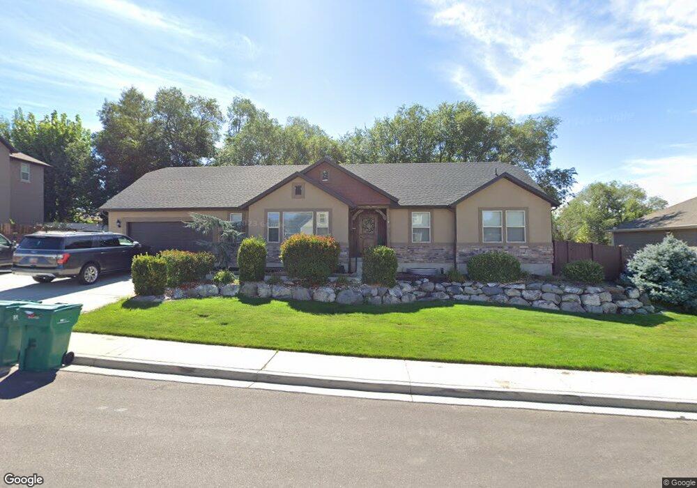
This home is located at 357 W 2070 N Unit 17, Lehi, UT 84043 and is currently estimated at $771,308, approximately $237 per square foot. 357 W 2070 N Unit 17 is a home located in Utah County with nearby schools including Eaglecrest Elementary School, Lehi Junior High School, and Skyridge High School.
Ownership History
Date
Name
Owned For
Owner Type
Purchase Details
Closed on
Jun 4, 2024
Sold by
Harper Daniel and Harper Jenalee
Bought by
Golub Shannon
Current Estimated Value
Purchase Details
Closed on
Dec 27, 2017
Sold by
Liddle Nathan S and Liddle Lisa D
Bought by
Harper Daniel and Harper Jenalee
Purchase Details
Closed on
Oct 6, 2014
Sold by
Boersma John and Boersma Allyson
Bought by
Harper Daniel and Harper Jenalee
Home Financials for this Owner
Home Financials are based on the most recent Mortgage that was taken out on this home.
Original Mortgage
$296,400
Interest Rate
4.08%
Mortgage Type
New Conventional
Purchase Details
Closed on
Aug 8, 2011
Sold by
Bd Homes Lehi Llc
Bought by
Boersma John and Boersma Allyson
Home Financials for this Owner
Home Financials are based on the most recent Mortgage that was taken out on this home.
Original Mortgage
$206,000
Interest Rate
4.46%
Mortgage Type
New Conventional
Create a Home Valuation Report for This Property
The Home Valuation Report is an in-depth analysis detailing your home's value as well as a comparison with similar homes in the area
Home Values in the Area
Average Home Value in this Area
Purchase History
| Date | Buyer | Sale Price | Title Company |
|---|---|---|---|
| Golub Shannon | -- | Us Title | |
| Harper Daniel | -- | None Available | |
| Harper Daniel | -- | Inwest Title Services | |
| Boersma John | -- | Affiliated First Title Co |
Source: Public Records
Mortgage History
| Date | Status | Borrower | Loan Amount |
|---|---|---|---|
| Previous Owner | Harper Daniel | $296,400 | |
| Previous Owner | Boersma John | $206,000 |
Source: Public Records
Tax History Compared to Growth
Tax History
| Year | Tax Paid | Tax Assessment Tax Assessment Total Assessment is a certain percentage of the fair market value that is determined by local assessors to be the total taxable value of land and additions on the property. | Land | Improvement |
|---|---|---|---|---|
| 2025 | $2,781 | $363,825 | $243,000 | $418,500 |
| 2024 | $2,781 | $325,435 | $0 | $0 |
| 2023 | $2,621 | $333,080 | $0 | $0 |
| 2022 | $2,699 | $332,420 | $0 | $0 |
| 2021 | $2,415 | $449,800 | $140,600 | $309,200 |
| 2020 | $2,277 | $419,200 | $130,200 | $289,000 |
| 2019 | $2,056 | $393,400 | $130,200 | $263,200 |
Source: Public Records
Map
Nearby Homes
- 497 W 2200 N
- 595 W 2200 N
- 497 W 2280 N
- 1755 N 250 W
- 2287 N 750 W
- 1817 W Bad Rock Cir
- 4333 N Baiken Ridge Dr Unit 1020
- 192 E 2200 N
- 1011 W Mountain Way Unit 316
- 537 W Sandhill Dr
- 902 W 1500 N
- 668 W Sandhill Dr
- 2539 N 300 E
- 804 W 2700 N
- 1610 N 1125 W
- 2687 N 900 W
- 1329 N 100 E Unit 21
- 1272 W 1800 N
- 2778 N 930 W
- 1301 N 900 W Unit 12
- 357 W 2070 N
- 385 W 2070 N Unit 16
- 327 W 2070 N Unit 18
- 2055 N 300 W
- 358 W 2070 N Unit 8
- 358 W 2070 N
- 386 W 2070 N Unit 9
- 2085 N 300 W Unit 7
- 415 W 2070 N Unit 15
- 328 W 2070 N
- 313 W 2100 N
- 355 W 2100 N Unit 5
- 416 W 2070 N Unit 10
- 383 W 2100 N Unit 4
- 325 W 2100 N
- 325 W 2100 N Unit 6
- 2060 N 300 W
- 443 W 2070 N Unit 14
- 443 W 2070 N
- 413 W 2100 N Unit 3