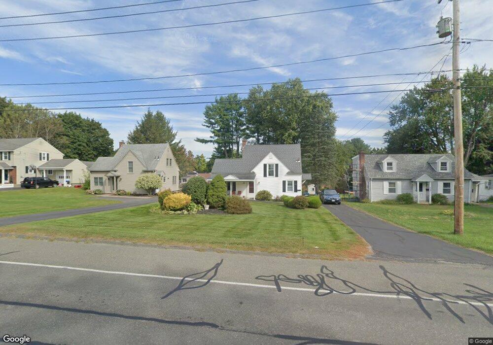
357 Williams St Pittsfield, MA 01201
Estimated Value: $273,313 - $331,000
2
Beds
1
Bath
1,057
Sq Ft
$291/Sq Ft
Est. Value
About This Home
This home is located at 357 Williams St, Pittsfield, MA 01201 and is currently estimated at $308,078, approximately $291 per square foot. 357 Williams St is a home located in Berkshire County with nearby schools including Egremont Elementary School, Theodore Herberg Middle School, and Pittsfield High School.
Ownership History
Date
Name
Owned For
Owner Type
Purchase Details
Closed on
Mar 26, 2015
Sold by
Blake Christine A
Bought by
Blake Ft and Blake
Current Estimated Value
Purchase Details
Closed on
Mar 27, 1998
Sold by
Scelsi Josephine M and Scelsi Joseph M
Bought by
Blake Christine A
Home Financials for this Owner
Home Financials are based on the most recent Mortgage that was taken out on this home.
Original Mortgage
$74,900
Interest Rate
6.96%
Mortgage Type
Purchase Money Mortgage
Create a Home Valuation Report for This Property
The Home Valuation Report is an in-depth analysis detailing your home's value as well as a comparison with similar homes in the area
Home Values in the Area
Average Home Value in this Area
Purchase History
| Date | Buyer | Sale Price | Title Company |
|---|---|---|---|
| Blake Ft | -- | -- | |
| Blake Ft | -- | -- | |
| Blake Ft | -- | -- | |
| Blake Christine A | $89,900 | -- | |
| Blake Christine A | $89,900 | -- |
Source: Public Records
Mortgage History
| Date | Status | Borrower | Loan Amount |
|---|---|---|---|
| Previous Owner | Blake Christine A | $74,900 |
Source: Public Records
Tax History Compared to Growth
Tax History
| Year | Tax Paid | Tax Assessment Tax Assessment Total Assessment is a certain percentage of the fair market value that is determined by local assessors to be the total taxable value of land and additions on the property. | Land | Improvement |
|---|---|---|---|---|
| 2025 | $4,324 | $241,000 | $88,300 | $152,700 |
| 2024 | $4,290 | $232,500 | $88,300 | $144,200 |
| 2023 | $3,844 | $209,800 | $78,500 | $131,300 |
| 2022 | $3,513 | $189,300 | $73,600 | $115,700 |
| 2021 | $3,151 | $163,700 | $73,600 | $90,100 |
| 2020 | $3,189 | $161,800 | $73,600 | $88,200 |
| 2019 | $2,962 | $152,500 | $68,700 | $83,800 |
| 2018 | $2,989 | $149,400 | $68,700 | $80,700 |
| 2017 | $2,776 | $141,400 | $63,800 | $77,600 |
| 2016 | $2,636 | $140,500 | $63,800 | $76,700 |
| 2015 | $2,675 | $148,100 | $63,800 | $84,300 |
Source: Public Records
Map
Nearby Homes
- 381 Williams St
- 106 Sampson Pkwy
- 99 Cambridge Ave
- 40 Sampson Pkwy
- 25 E New Lenox Rd
- 11 Sampson Pkwy
- 51 Foote Ave
- 16 Revere Pkwy
- 25 Putnam Ave
- 44 Marcella Ave
- 66 Holmes Rd
- 39 Lexington Pkwy
- 31 Lexington Pkwy
- 75 Livingston Ave
- 206 Dawes Ave
- 30 Belvidere Ave
- 20 Marshall Ave
- 81 Northumberland Rd
- 63 Reuter Ave
- 3 Tampa Ct
- 351 Williams St
- 363 Williams St
- 369 Williams St
- 347 Williams St
- 138 Sampson Pkwy
- 126 Sampson Pkwy
- 373 Williams St
- 146 Sampson Pkwy
- 341 Williams St
- 118 Sampson Pkwy
- 377 Williams St
- 152 Sampson Pkwy
- 333 Williams St
- 112 Sampson Pkwy
- 158 Sampson Pkwy
- 340 Williams St
- 331 Williams St
- 141 Sampson Pkwy
- 125 Sampson Pkwy
- 368 Williams St