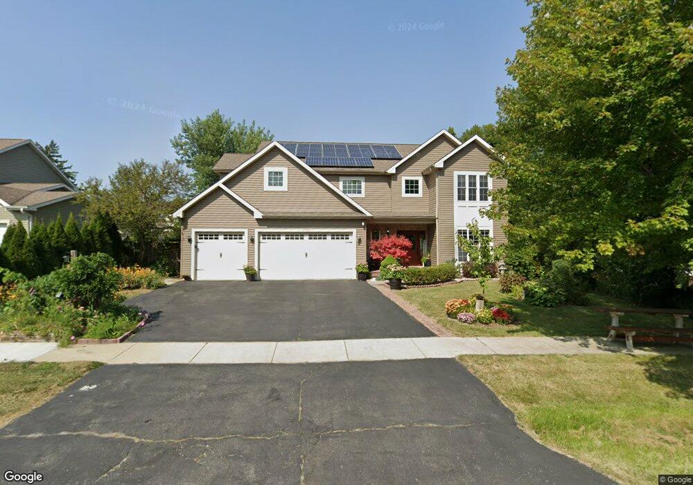
3570 Atlantic Ave Gurnee, IL 60031
Shore Highlands NeighborhoodEstimated Value: $423,000 - $480,000
4
Beds
3
Baths
2,403
Sq Ft
$187/Sq Ft
Est. Value
About This Home
This home is located at 3570 Atlantic Ave, Gurnee, IL 60031 and is currently estimated at $449,273, approximately $186 per square foot. 3570 Atlantic Ave is a home located in Lake County with nearby schools including Spaulding Elementary School, Viking Middle School, and Warren Township High School.
Ownership History
Date
Name
Owned For
Owner Type
Purchase Details
Closed on
Nov 16, 2007
Sold by
Grubbs Robert
Bought by
Francisco Rolando L and Gonzales Alma Grace
Current Estimated Value
Home Financials for this Owner
Home Financials are based on the most recent Mortgage that was taken out on this home.
Original Mortgage
$355,000
Outstanding Balance
$225,653
Interest Rate
6.47%
Mortgage Type
Purchase Money Mortgage
Estimated Equity
$223,620
Create a Home Valuation Report for This Property
The Home Valuation Report is an in-depth analysis detailing your home's value as well as a comparison with similar homes in the area
Home Values in the Area
Average Home Value in this Area
Purchase History
| Date | Buyer | Sale Price | Title Company |
|---|---|---|---|
| Francisco Rolando L | $355,000 | None Available |
Source: Public Records
Mortgage History
| Date | Status | Borrower | Loan Amount |
|---|---|---|---|
| Open | Francisco Rolando L | $355,000 |
Source: Public Records
Tax History
| Year | Tax Paid | Tax Assessment Tax Assessment Total Assessment is a certain percentage of the fair market value that is determined by local assessors to be the total taxable value of land and additions on the property. | Land | Improvement |
|---|---|---|---|---|
| 2024 | $12,388 | $140,176 | $10,438 | $129,738 |
| 2023 | $11,717 | $130,142 | $9,691 | $120,451 |
| 2022 | $11,717 | $122,597 | $9,968 | $112,629 |
| 2021 | $10,333 | $114,250 | $9,289 | $104,961 |
| 2020 | $10,020 | $111,442 | $9,061 | $102,381 |
| 2019 | $9,775 | $108,207 | $8,798 | $99,409 |
| 2018 | $9,991 | $109,327 | $8,228 | $101,099 |
| 2017 | $9,892 | $106,194 | $7,992 | $98,202 |
| 2016 | $9,612 | $101,466 | $7,636 | $93,830 |
| 2015 | $9,357 | $96,231 | $7,242 | $88,989 |
| 2014 | $9,482 | $100,561 | $7,151 | $93,410 |
| 2012 | $8,979 | $101,331 | $7,206 | $94,125 |
Source: Public Records
Map
Nearby Homes
- 1430 N Green Bay Rd
- 3517 Glen Flora Ave
- 36107 N Green Bay Rd
- 3821 Cheyenne Rd
- 1070 Belle Plaine Ave
- 35400 N Green Bay Rd
- 12933 W Polo Ave
- 963 Belle Plaine Ave
- 3370 W Brooke Ave Unit 410
- 3877 Grandview Ave
- 2928 W Country Club Ave
- 3000 W Country Club Ave
- 2946 W Country Club Ave
- 2810 W Atlantic Ave
- 3320 Sunset Ave
- 995 Norman Ave
- 13360 W Blanchard Rd
- 12535 W Blanchard Rd
- 36245 N Green Bay Rd
- 2508 W Atlantic Ave
- 3580 Atlantic Ave
- 3530 Atlantic Ave
- 3569 Atlantic Ave
- 3515 Atlantic Ave
- 3590 Atlantic Ave
- 3559 Keith Ave
- 3575 Keith Ave
- 1605 Belle Plaine Ave
- 3531 Keith Ave
- 3520 Atlantic Ave
- 1617 Belle Plaine Ave
- 3508 Atlantic Ave
- 1601 Belle Plaine Ave
- 3600 Atlantic Ave
- 3507 Keith Ave
- 3520 Pacific Ave
- 3601 Atlantic Ave
- 1616 Belle Plaine Ave
- 3528 Keith Ave
- 3510 Pacific Ave
Your Personal Tour Guide
Ask me questions while you tour the home.