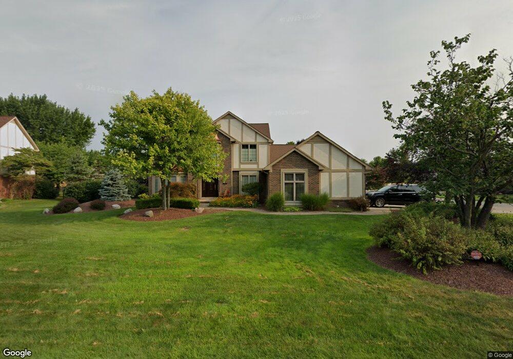
3570 Sherborn Dr Unit Bldg-Unit Rochester Hills, MI 48306
Estimated Value: $654,000 - $685,000
4
Beds
4
Baths
3,020
Sq Ft
$221/Sq Ft
Est. Value
About This Home
This home is located at 3570 Sherborn Dr Unit Bldg-Unit, Rochester Hills, MI 48306 and is currently estimated at $666,781, approximately $220 per square foot. 3570 Sherborn Dr Unit Bldg-Unit is a home located in Oakland County with nearby schools including Musson Elementary School, Van Hoosen Middle School, and Rochester Adams High School.
Ownership History
Date
Name
Owned For
Owner Type
Purchase Details
Closed on
Jun 29, 2018
Sold by
Chambery Scott R and Chambery Lynn M
Bought by
Wilson Jacob and Wilson Nichole
Current Estimated Value
Home Financials for this Owner
Home Financials are based on the most recent Mortgage that was taken out on this home.
Original Mortgage
$392,000
Outstanding Balance
$339,727
Interest Rate
4.5%
Mortgage Type
New Conventional
Estimated Equity
$327,054
Purchase Details
Closed on
Dec 19, 2016
Sold by
Chambery Scott R and Chambery Lynn M
Bought by
Chambery Scott R and Chambery Lynn M
Purchase Details
Closed on
Jan 31, 1997
Sold by
Wong Edward N
Bought by
Chambery Scott R
Create a Home Valuation Report for This Property
The Home Valuation Report is an in-depth analysis detailing your home's value as well as a comparison with similar homes in the area
Home Values in the Area
Average Home Value in this Area
Purchase History
| Date | Buyer | Sale Price | Title Company |
|---|---|---|---|
| Wilson Jacob | $490,000 | Cislo Title Company | |
| Chambery Scott R | -- | None Available | |
| Chambery Scott R | $295,000 | -- |
Source: Public Records
Mortgage History
| Date | Status | Borrower | Loan Amount |
|---|---|---|---|
| Open | Wilson Jacob | $392,000 |
Source: Public Records
Tax History Compared to Growth
Tax History
| Year | Tax Paid | Tax Assessment Tax Assessment Total Assessment is a certain percentage of the fair market value that is determined by local assessors to be the total taxable value of land and additions on the property. | Land | Improvement |
|---|---|---|---|---|
| 2022 | $4,023 | $233,150 | $0 | $0 |
| 2018 | $5,060 | $191,910 | $0 | $0 |
| 2017 | $4,959 | $189,670 | $0 | $0 |
| 2015 | -- | $179,300 | $0 | $0 |
| 2014 | -- | $163,670 | $0 | $0 |
| 2011 | -- | $140,840 | $0 | $0 |
Source: Public Records
Map
Nearby Homes
- 3634 Camden Ct
- 3640 Camden Ct
- 3674 Merriweather Ln
- 3273 Salem Dr
- 3879 Teakwood Ln
- 3534 Riverside Dr Unit 141
- 4035 Hillsdale Dr Unit 275
- 1906 Independence Ct
- 1609 Kilburn Rd N
- 423 Silvervale Dr
- 2935 Woodford Cir
- 3633 Thornwood Dr
- 2700 Mohawk Ln
- 5700 Rolling Hills Dr
- 3095 Bridgewater Rd Unit 30
- 3057 Bridgewater Rd
- 3639 Heatherwood Ct
- 5826 Murfield Dr
- 3780 Bald Mountain Rd
- 1513 Lomas Verdes
- 3570 Sherborn Dr
- 3576 Sherborn Dr
- 1339 Sherborn Ct
- 1367 Sherborn Ct
- 1330 Sherborn Ct
- 3582 Sherborn Dr
- 3579 Sherborn Dr
- 1336 Sherborn Ct
- 3573 Sherborn Dr
- 3567 Sherborn Dr
- 1342 Sherborn Ct
- 3585 Sherborn Dr
- 1373 Sherborn Ct
- 3561 Sherborn Dr
- 1326 Kingspath Dr
- 1360 Sherborn Ct
- 1366 Sherborn Ct
- 1332 Kingspath Dr
- 3555 Sherborn Dr
- 1327 Arbor Creek Dr