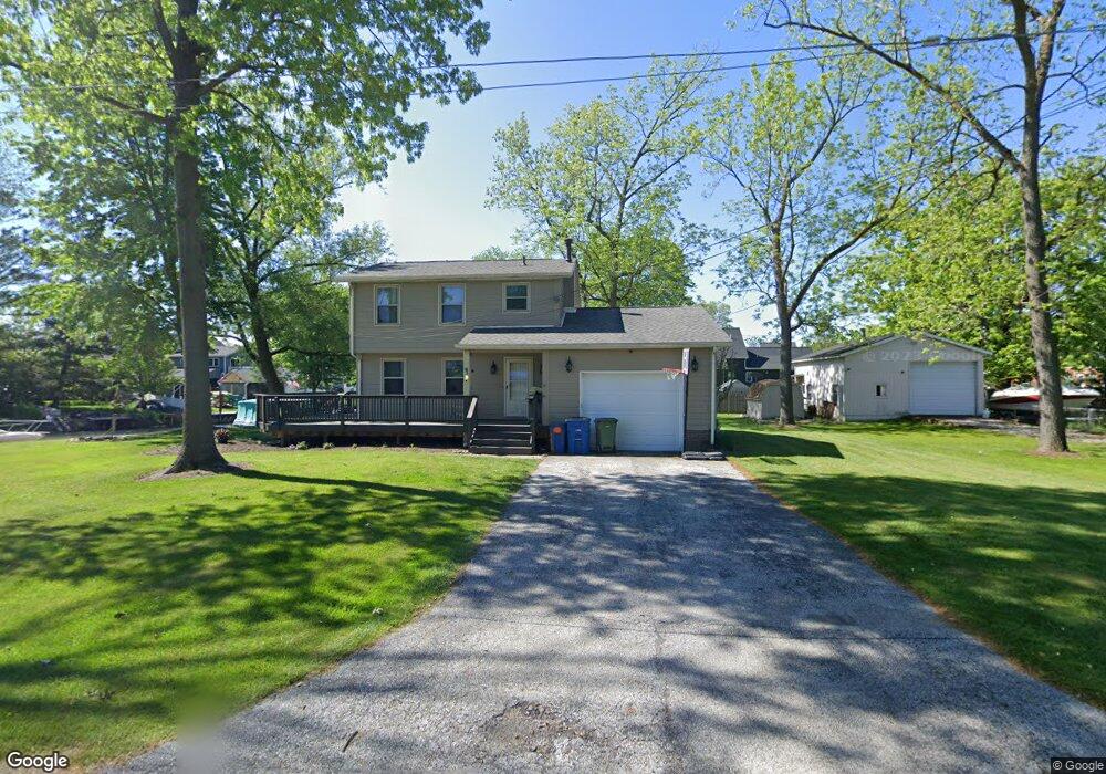
35708 King Dr Eastlake, OH 44095
Estimated Value: $218,000 - $319,000
3
Beds
2
Baths
1,354
Sq Ft
$201/Sq Ft
Est. Value
About This Home
This home is located at 35708 King Dr, Eastlake, OH 44095 and is currently estimated at $272,149, approximately $200 per square foot. 35708 King Dr is a home located in Lake County with nearby schools including Jefferson Elementary School, Eastlake Middle School, and North High School.
Ownership History
Date
Name
Owned For
Owner Type
Purchase Details
Closed on
Jul 8, 2010
Sold by
Nielson Mark C
Bought by
Bonfiglio Joseph D
Current Estimated Value
Home Financials for this Owner
Home Financials are based on the most recent Mortgage that was taken out on this home.
Original Mortgage
$174,643
Outstanding Balance
$116,920
Interest Rate
4.87%
Mortgage Type
FHA
Estimated Equity
$155,229
Purchase Details
Closed on
Dec 4, 1978
Bought by
Nielson Delbert M
Create a Home Valuation Report for This Property
The Home Valuation Report is an in-depth analysis detailing your home's value as well as a comparison with similar homes in the area
Home Values in the Area
Average Home Value in this Area
Purchase History
| Date | Buyer | Sale Price | Title Company |
|---|---|---|---|
| Bonfiglio Joseph D | $177,000 | Chicago Title Insurance Co | |
| Nielson Delbert M | -- | -- |
Source: Public Records
Mortgage History
| Date | Status | Borrower | Loan Amount |
|---|---|---|---|
| Open | Bonfiglio Joseph D | $174,643 |
Source: Public Records
Tax History Compared to Growth
Tax History
| Year | Tax Paid | Tax Assessment Tax Assessment Total Assessment is a certain percentage of the fair market value that is determined by local assessors to be the total taxable value of land and additions on the property. | Land | Improvement |
|---|---|---|---|---|
| 2024 | -- | $70,070 | $27,290 | $42,780 |
| 2023 | $6,415 | $66,380 | $21,830 | $44,550 |
| 2022 | $4,244 | $66,380 | $21,830 | $44,550 |
| 2021 | $4,065 | $63,270 | $18,720 | $44,550 |
| 2020 | $3,977 | $55,020 | $16,280 | $38,740 |
| 2019 | $4,312 | $55,020 | $16,280 | $38,740 |
| 2018 | $4,230 | $54,710 | $26,050 | $28,660 |
| 2017 | $4,370 | $54,710 | $26,050 | $28,660 |
| 2016 | $3,994 | $54,710 | $26,050 | $28,660 |
| 2015 | $3,550 | $54,710 | $26,050 | $28,660 |
| 2014 | $3,366 | $54,710 | $26,050 | $28,660 |
| 2013 | $3,367 | $54,710 | $26,050 | $28,660 |
Source: Public Records
Map
Nearby Homes
- 35682 W Island Dr
- 35462 Dewey Dr
- 2048 Forest Dr
- 35783 Lakeshore Blvd
- V/L 13-14 Carlton Dr
- V/L 12 Carlton Dr
- V/L 11 Carlton Dr
- 35940 Matoma Blvd
- V/L Highland #69 Dr
- 91 Sunset Cove Cir
- 34859 Lake Shore Blvd
- 36536 Lakehurst Dr
- 4 Owaissa Dr
- 36756 Valleyview Dr
- 34329 Sylvia Dr
- 518 Saint Lawrence Blvd
- 34152 Oak Knoll St
- 847 Audrey Dr
- 764 E 347th St
- 34779 Beach Park Ave
- 35672 King Dr
- 35667 Admiral Dr
- 35656 King Dr
- 35639 Admiral Dr
- 35677 King Dr
- 35732 W Island Dr
- 35726 W Island Dr
- 35651 King Dr
- 35736 W Island Dr
- 35720 W Island Dr
- 35714 W Island Dr
- 35625 Admiral Dr
- 35704 W Island Dr
- 35652 Admiral Dr
- 35692 W Island Dr
- 35625 King Dr
- 35599 Admiral Dr
- 35638 Admiral Dr
- 35610 King Dr
- 35688 W Island Dr