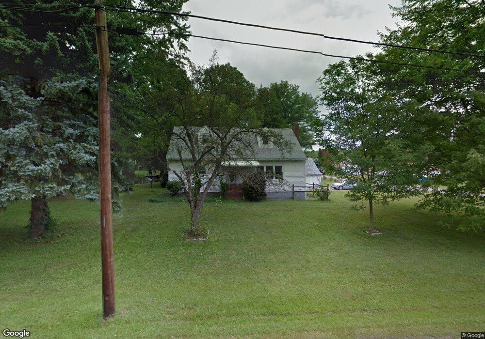
3579 Franklin Ave Hubbard, OH 44425
Estimated Value: $120,000 - $163,000
3
Beds
2
Baths
1,040
Sq Ft
$137/Sq Ft
Est. Value
About This Home
This home is located at 3579 Franklin Ave, Hubbard, OH 44425 and is currently estimated at $142,726, approximately $137 per square foot. 3579 Franklin Ave is a home located in Trumbull County with nearby schools including Hubbard Elementary School, Hubbard Middle School, and Hubbard High School.
Ownership History
Date
Name
Owned For
Owner Type
Purchase Details
Closed on
Jun 16, 1999
Sold by
Klug Scott E and Klug Lisa L
Bought by
Dennison James S and Dennison Wanda L
Current Estimated Value
Purchase Details
Closed on
Jan 6, 1997
Sold by
Est Allen W Lowry
Bought by
Klug Scott E and Klug Lisa L
Home Financials for this Owner
Home Financials are based on the most recent Mortgage that was taken out on this home.
Original Mortgage
$39,200
Interest Rate
7.6%
Mortgage Type
New Conventional
Purchase Details
Closed on
Jan 1, 1990
Bought by
Allen W Lowry
Create a Home Valuation Report for This Property
The Home Valuation Report is an in-depth analysis detailing your home's value as well as a comparison with similar homes in the area
Home Values in the Area
Average Home Value in this Area
Purchase History
| Date | Buyer | Sale Price | Title Company |
|---|---|---|---|
| Dennison James S | $68,500 | -- | |
| Klug Scott E | $49,000 | -- | |
| Allen W Lowry | -- | -- |
Source: Public Records
Mortgage History
| Date | Status | Borrower | Loan Amount |
|---|---|---|---|
| Previous Owner | Klug Scott E | $39,200 |
Source: Public Records
Tax History Compared to Growth
Tax History
| Year | Tax Paid | Tax Assessment Tax Assessment Total Assessment is a certain percentage of the fair market value that is determined by local assessors to be the total taxable value of land and additions on the property. | Land | Improvement |
|---|---|---|---|---|
| 2024 | $1,796 | $31,160 | $4,170 | $26,990 |
| 2023 | $1,796 | $31,160 | $4,170 | $26,990 |
| 2022 | $1,630 | $25,170 | $4,170 | $21,000 |
| 2021 | $1,637 | $25,170 | $4,170 | $21,000 |
| 2020 | $1,643 | $25,170 | $4,170 | $21,000 |
| 2019 | $1,602 | $23,250 | $4,170 | $19,080 |
| 2018 | $1,556 | $23,250 | $4,170 | $19,080 |
| 2017 | $1,551 | $23,250 | $4,170 | $19,080 |
| 2016 | $1,445 | $22,750 | $3,570 | $19,180 |
| 2015 | $1,450 | $22,750 | $3,570 | $19,180 |
| 2014 | $1,422 | $22,750 | $3,570 | $19,180 |
| 2013 | $1,482 | $23,770 | $3,570 | $20,200 |
Source: Public Records
Map
Nearby Homes
- 5843 Fairlawn Ave
- 3317 Beechwood Dr
- 3943 Logangate Rd
- 366 Westview Ave
- 229 Jacobs Rd
- 269 Westview Ave
- 0 Homestead Rd
- 279 Parish Ave
- 0 Powder Mill Run Unit 5127327
- 0 Powder Mill Run Unit 5127333
- 2010 Powder Mill Run
- V/L Jacobs Rd
- 2021 Crestwood Blvd
- 665 Wendemere Dr
- 663 Meadowland Dr
- 254 Christian Ave
- 3712 Logan Way
- 2051 Blair Ave
- 1363 Country Club Dr
- 1720 Jacobs Rd
- 3578 Homewood Ave
- 3574 Franklin Ave
- 3597 Franklin Ave
- 3564 Homewood Ave
- 3580 Franklin Ave
- 3564 Franklin Ave
- 3556 Homewood Ave
- 5972 Fairlawn Ave
- 5930 Fairlawn Ave
- 3575 Homewood Ave
- 3577 Liberty Ave
- 3569 Liberty Ave
- 3563 Homewood Ave
- 3561 Liberty Ave
- 3539 Franklin Ave
- 3544 Homewood Ave
- 5984 Fairlawn Ave
- 3557 Homewood Ave
- 3597 Liberty Ave
- 3621 Franklin Ave