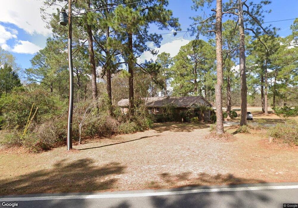
358 Ga Highway 87 S Cochran, GA 31014
Estimated Value: $230,000 - $424,000
3
Beds
3
Baths
3,356
Sq Ft
$96/Sq Ft
Est. Value
About This Home
This home is located at 358 Ga Highway 87 S, Cochran, GA 31014 and is currently estimated at $322,421, approximately $96 per square foot. 358 Ga Highway 87 S is a home with nearby schools including Bleckley County Primary School, Bleckley County Elementary School, and Bleckley Middle School.
Ownership History
Date
Name
Owned For
Owner Type
Purchase Details
Closed on
May 1, 2008
Sold by
Bryan John
Bought by
Coleman Edward F
Current Estimated Value
Home Financials for this Owner
Home Financials are based on the most recent Mortgage that was taken out on this home.
Original Mortgage
$184,300
Outstanding Balance
$116,594
Interest Rate
5.86%
Mortgage Type
New Conventional
Estimated Equity
$205,827
Purchase Details
Closed on
Dec 3, 2003
Sold by
Yearty Judy A
Bought by
Bryan John S and Bryan Janet L
Purchase Details
Closed on
Nov 5, 2003
Sold by
Yearty Judy A
Bought by
Yearty Austin and Yearty Judy A
Purchase Details
Closed on
Jun 16, 1994
Bought by
Yearty Judy A
Create a Home Valuation Report for This Property
The Home Valuation Report is an in-depth analysis detailing your home's value as well as a comparison with similar homes in the area
Home Values in the Area
Average Home Value in this Area
Purchase History
| Date | Buyer | Sale Price | Title Company |
|---|---|---|---|
| Coleman Edward F | $194,000 | -- | |
| Bryan John S | $170,000 | -- | |
| Yearty Austin | -- | -- | |
| Yearty Judy A | -- | -- |
Source: Public Records
Mortgage History
| Date | Status | Borrower | Loan Amount |
|---|---|---|---|
| Open | Coleman Edward F | $184,300 |
Source: Public Records
Tax History Compared to Growth
Tax History
| Year | Tax Paid | Tax Assessment Tax Assessment Total Assessment is a certain percentage of the fair market value that is determined by local assessors to be the total taxable value of land and additions on the property. | Land | Improvement |
|---|---|---|---|---|
| 2024 | $2,792 | $104,360 | $9,640 | $94,720 |
| 2023 | $2,896 | $104,360 | $9,640 | $94,720 |
| 2022 | $2,584 | $94,960 | $9,640 | $85,320 |
| 2021 | $2,262 | $77,680 | $9,640 | $68,040 |
| 2020 | $2,261 | $77,640 | $9,600 | $68,040 |
| 2019 | $2,306 | $79,062 | $6,144 | $72,918 |
| 2018 | $2,326 | $79,062 | $6,144 | $72,918 |
| 2017 | $2,323 | $79,062 | $6,144 | $72,918 |
| 2016 | $2,326 | $79,062 | $6,144 | $72,918 |
| 2015 | -- | $79,062 | $6,144 | $72,918 |
| 2014 | -- | $79,062 | $6,144 | $72,918 |
| 2013 | -- | $79,062 | $6,144 | $72,918 |
Source: Public Records
Map
Nearby Homes
- 119 Moll Dr
- 150 Wood Oak Cir
- 0 Wood Oak Cir Unit 233873
- 0 Wood Oak Cir Unit 9278951
- 124 Pine Hill Dr
- RV Park Mac Thompson Rd
- Land Mac Thompson Rd
- 406 Mac Thompson Rd
- 0 Willow Creek Run
- 238 Wood Oak Cir
- 288 Frank Cook Rd
- 105 Hillcrest Dr
- Lots Crest Dr
- LAND Crest Dr
- 0 Mac Thompson Rd Unit 255994
- 0 Mac Thompson Rd Unit 16072590
- 134 Easy St
- 157 10th St SE
- 116 Pecan St
- 112 Pecan St
- 120 Browning Dr
- 128 Browning Dr
- 124 Albert Grimsley Dr
- 135 Browing Dr
- 0 Browning Dr Unit 7623621
- 0 Browning Dr
- 114 Moll Dr
- 130 Albert Grimsley Dr
- 138 Browning Dr
- 0 Moll Dr Unit 10029432
- 0 Moll Dr Unit 7017431
- 0 Moll Dr Unit 8795343
- 0 Moll Dr Unit 8841889
- 0 Moll Dr
- 135 Browning Dr
- 328 S 2nd St
- S Highway 87 By Pass
- 144 Albert Grimsley Dr
- 141 Browning Dr
- 144 Browning Dr