Estimated Value: $281,933 - $314,000
--
Bed
--
Bath
1,991
Sq Ft
$152/Sq Ft
Est. Value
About This Home
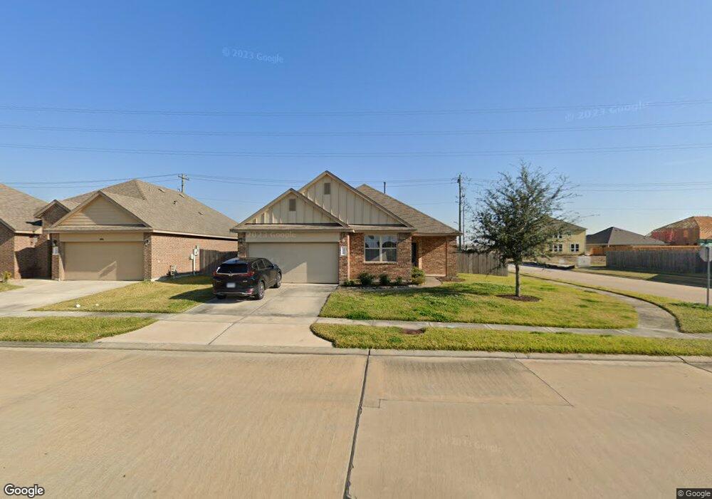
This home is located at 358 Kendall Crest Dr, Alvin, TX 77511 and is currently estimated at $302,233, approximately $151 per square foot. 358 Kendall Crest Dr is a home with nearby schools including Mark Twain Elementary School, G.W. Harby Junior High School, and Alvin High School.
Ownership History
Date
Name
Owned For
Owner Type
Purchase Details
Closed on
Aug 21, 2015
Sold by
D R Horton Texas Ltd
Bought by
Cogbill Keith
Current Estimated Value
Home Financials for this Owner
Home Financials are based on the most recent Mortgage that was taken out on this home.
Original Mortgage
$161,135
Outstanding Balance
$126,947
Interest Rate
4.08%
Mortgage Type
New Conventional
Estimated Equity
$175,286
Create a Home Valuation Report for This Property
The Home Valuation Report is an in-depth analysis detailing your home's value as well as a comparison with similar homes in the area
Home Values in the Area
Average Home Value in this Area
Purchase History
| Date | Buyer | Sale Price | Title Company |
|---|---|---|---|
| Cogbill Keith | -- | Dhi Title |
Source: Public Records
Mortgage History
| Date | Status | Borrower | Loan Amount |
|---|---|---|---|
| Open | Cogbill Keith | $161,135 |
Source: Public Records
Tax History Compared to Growth
Tax History
| Year | Tax Paid | Tax Assessment Tax Assessment Total Assessment is a certain percentage of the fair market value that is determined by local assessors to be the total taxable value of land and additions on the property. | Land | Improvement |
|---|---|---|---|---|
| 2025 | $7,888 | $309,320 | $66,090 | $243,230 |
| 2023 | $7,888 | $285,887 | $66,090 | $249,710 |
| 2022 | $8,922 | $259,897 | $37,600 | $228,470 |
| 2021 | $8,475 | $236,270 | $37,600 | $198,670 |
| 2020 | $8,352 | $230,280 | $37,600 | $192,680 |
| 2019 | $8,202 | $221,460 | $24,760 | $196,700 |
| 2018 | $7,537 | $203,200 | $24,760 | $178,440 |
| 2017 | $7,386 | $197,120 | $24,760 | $172,360 |
| 2016 | $7,637 | $203,820 | $29,720 | $174,100 |
Source: Public Records
Map
Nearby Homes
- 380 Kendall Crest Dr
- 368 Selah Ct
- 356 Selah Ct
- 394 Kendall Crest Dr
- 396 Kendall Crest Dr
- 418 Kendall Crest Dr
- 414 Kendall Crest Dr
- 404 Kendall Crest Dr
- 390 Kendall Crest Dr
- 397 Kendall Crest Dr
- 431 Kendall Crest Dr
- 406 Kendall Crest Dr
- 350 Selah Ct
- 415 Kendall Crest Dr
- 424 Kendall Crest Dr
- 432 Kendall Crest Dr
- 340 Kendall Crest Dr
- 5307 Camerford Ct
- 334 Kendall Crest Dr
- 726 Rim Water Dr
- 360 Kendall Crest Dr
- 362 Kendall Crest Dr
- 356 Kendall Crest Dr
- 364 Kendall Crest Dr
- 5199 Kendall Cove Ct
- 354 Kendall Crest Dr
- 366 Kendall Crest Dr
- 361 Selah Ct
- 352 Kendall Crest Dr
- 367 Selah Ct
- 5200 Kendall Cove Ct
- 368 Kendall Crest Dr
- 5195 Kendall Cove Ct
- 5198 Kendall Cove Ct
- 350 Kendall Crest Dr
- 370 Kendall Crest Dr
- 5193 Kendall Cove Ct
- 5196 Kendall Cove Ct
- 371 Selah Ct Unit 2698299-90389
- 348 Kendall Crest Dr