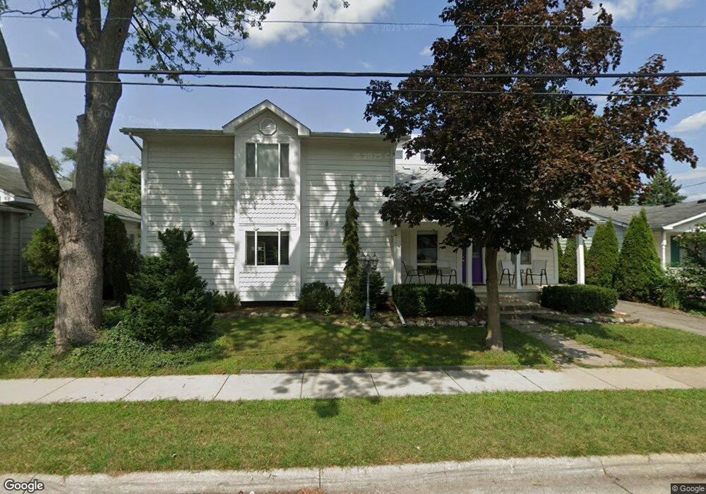
358 Maple St Plymouth, MI 48170
Estimated Value: $866,000 - $1,240,000
4
Beds
4
Baths
3,500
Sq Ft
$292/Sq Ft
Est. Value
About This Home
This home is located at 358 Maple St, Plymouth, MI 48170 and is currently estimated at $1,020,252, approximately $291 per square foot. 358 Maple St is a home located in Wayne County with nearby schools including Canton High School, Smith Elementary School, and East Middle School.
Ownership History
Date
Name
Owned For
Owner Type
Purchase Details
Closed on
Apr 6, 2024
Sold by
Bonkoski Phillip Joseph and Baxi Tiffany Indra
Bought by
Bonkoski Phillip Joseph and Baxi Tiffany Indra
Current Estimated Value
Purchase Details
Closed on
Mar 7, 2023
Sold by
Bonkoski Phillip
Bought by
Bonkoski Phillip Joseph and Baxi Tiffany Indra
Purchase Details
Closed on
Feb 10, 2021
Sold by
Disalvo Georgia and Disalvo Peter David
Bought by
Bonkoski Phillip
Purchase Details
Closed on
Mar 10, 2010
Sold by
Disalvo Peter David and Disalvo Georgia
Bought by
Disalvo Peter David and Disalvo Georgia
Home Financials for this Owner
Home Financials are based on the most recent Mortgage that was taken out on this home.
Original Mortgage
$122,850
Interest Rate
5.01%
Mortgage Type
New Conventional
Create a Home Valuation Report for This Property
The Home Valuation Report is an in-depth analysis detailing your home's value as well as a comparison with similar homes in the area
Home Values in the Area
Average Home Value in this Area
Purchase History
| Date | Buyer | Sale Price | Title Company |
|---|---|---|---|
| Bonkoski Phillip Joseph | -- | None Listed On Document | |
| Bonkoski Phillip Joseph | -- | None Listed On Document | |
| Bonkoski Phillip Joseph | -- | Liberty Title | |
| Bonkoski Phillip | $505,000 | Title One Inc | |
| Disalvo Peter David | -- | Title Source Inc |
Source: Public Records
Mortgage History
| Date | Status | Borrower | Loan Amount |
|---|---|---|---|
| Previous Owner | Disalvo Peter David | $122,850 |
Source: Public Records
Tax History Compared to Growth
Tax History
| Year | Tax Paid | Tax Assessment Tax Assessment Total Assessment is a certain percentage of the fair market value that is determined by local assessors to be the total taxable value of land and additions on the property. | Land | Improvement |
|---|---|---|---|---|
| 2025 | $11,229 | $445,600 | $0 | $0 |
| 2024 | $11,229 | $406,700 | $0 | $0 |
| 2023 | $10,938 | $396,100 | $0 | $0 |
| 2022 | $11,594 | $270,000 | $0 | $0 |
| 2021 | $7,436 | $360,600 | $0 | $0 |
| 2020 | $7,417 | $352,900 | $0 | $0 |
| 2019 | $6,530 | $314,400 | $0 | $0 |
| 2018 | $5,518 | $183,800 | $0 | $0 |
| 2017 | $1,169 | $176,700 | $0 | $0 |
| 2016 | $3,656 | $111,600 | $0 | $0 |
| 2015 | $8,373 | $100,680 | $0 | $0 |
| 2013 | $8,111 | $93,620 | $0 | $0 |
| 2011 | -- | $84,970 | $0 | $0 |
Source: Public Records
Map
Nearby Homes
- 278 Maple St
- 256 Maple St
- 381 Hamilton St
- 300 Hamilton St Unit 201
- 300 Hamilton St Unit 306
- 525 W Ann Arbor Trail
- 628 Maple St
- 644 Maple St
- 636 Maple St
- 190 Hamilton St
- 660 Maple St
- 668 Maple St
- 543 Deer St
- 163 Hamilton St
- 730 Penniman Ave Unit 205
- 333 N Sydney Ct
- 364 N Sydney Ct
- 396 N Sydney Ct
- 303 N Sydney Ct
- 372 N Sydney Ct
- 370 Maple St
- 340 Maple St
- 308 Maple St
- 338 Maple St
- 345 W Ann Arbor Trail
- 345 W Ann Arbor Trail Ct
- 369 W Ann Arbor Trail
- 347 W Ann Arbor Trail
- 326 Maple St
- 349 W Ann Arbor Trail Ct
- 395 W Ann Arbor Trail
- 333 W Ann Arbor Trail
- 489 Hamilton
- 325 W Ann Arbor Trail
- 387 Maple St
- 359 Maple St
- 333 Maple St
- 314 Maple St
- 373 Maple St
- 351 Maple St Unit Bldg-Unit