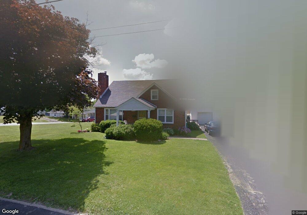
358 Muth Rd Mansfield, OH 44903
Estimated Value: $132,000 - $144,356
2
Beds
1
Bath
1,310
Sq Ft
$106/Sq Ft
Est. Value
About This Home
This home is located at 358 Muth Rd, Mansfield, OH 44903 and is currently estimated at $138,339, approximately $105 per square foot. 358 Muth Rd is a home located in Richland County with nearby schools including Goal Digital Academy and Discovery School.
Ownership History
Date
Name
Owned For
Owner Type
Purchase Details
Closed on
Nov 13, 2019
Sold by
Woodley Henry F
Bought by
Wooley Henry F and Wooley Dianna I
Current Estimated Value
Purchase Details
Closed on
Apr 26, 2019
Sold by
Wooley Henry F and Wooley Dianna I
Bought by
Bartlett Chad A and Bartlett Joanna M
Home Financials for this Owner
Home Financials are based on the most recent Mortgage that was taken out on this home.
Original Mortgage
$67,200
Outstanding Balance
$59,201
Interest Rate
4.3%
Mortgage Type
Seller Take Back
Estimated Equity
$79,138
Purchase Details
Closed on
Jun 7, 2002
Sold by
Wooley Ricky A
Bought by
Wooley Henry F Dianna
Create a Home Valuation Report for This Property
The Home Valuation Report is an in-depth analysis detailing your home's value as well as a comparison with similar homes in the area
Home Values in the Area
Average Home Value in this Area
Purchase History
| Date | Buyer | Sale Price | Title Company |
|---|---|---|---|
| Wooley Henry F | -- | None Available | |
| Bartlett Chad A | $78,200 | None Available | |
| Wooley Henry F Dianna | $36,000 | -- |
Source: Public Records
Mortgage History
| Date | Status | Borrower | Loan Amount |
|---|---|---|---|
| Open | Bartlett Chad A | $67,200 |
Source: Public Records
Tax History
| Year | Tax Paid | Tax Assessment Tax Assessment Total Assessment is a certain percentage of the fair market value that is determined by local assessors to be the total taxable value of land and additions on the property. | Land | Improvement |
|---|---|---|---|---|
| 2024 | $1,811 | $37,810 | $4,410 | $33,400 |
| 2023 | $1,810 | $37,810 | $4,410 | $33,400 |
| 2022 | $1,564 | $27,370 | $3,780 | $23,590 |
| 2021 | $1,574 | $27,370 | $3,780 | $23,590 |
| 2020 | $1,610 | $27,370 | $3,780 | $23,590 |
| 2019 | $1,785 | $27,370 | $3,780 | $23,590 |
| 2018 | $1,721 | $27,370 | $3,780 | $23,590 |
| 2017 | $1,675 | $27,370 | $3,780 | $23,590 |
| 2016 | $1,707 | $27,050 | $4,770 | $22,280 |
| 2015 | $1,631 | $27,050 | $4,770 | $22,280 |
| 2014 | $1,609 | $27,050 | $4,770 | $22,280 |
| 2012 | $613 | $27,060 | $5,030 | $22,030 |
Source: Public Records
Map
Nearby Homes
- 356 S Linden Rd
- 686 Barnard Ave
- 679 Coleman Rd
- 244 S Trimble Rd Unit 246
- 616 Cline Ave
- 232 S Trimble Rd Unit 234
- 143 Fairlawn Ave
- 135 Fairlawn Ave
- 216 S Trimble Rd Unit 218
- 129 Fairlawn Ave
- 535 Woodhill Rd
- 189 Westwood Ave
- 988 Kentland Dr
- 455 Marion Ave
- 0 Bally Row Unit Lot 22930 223011207
- 0 Bally Row Unit Lot 22929 223011206
- 0 Bally Row Unit Lot 22940 223011208
- 655 Woodhill Rd
- 116 Stewart Ave S
- 133 Stewart Ave S
Your Personal Tour Guide
Ask me questions while you tour the home.