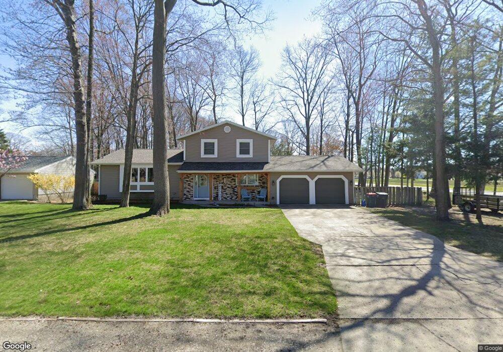
3580 Rood Rd Norton Shores, MI 49441
Roosevelt Park NeighborhoodEstimated Value: $317,000 - $360,000
4
Beds
2
Baths
1,960
Sq Ft
$176/Sq Ft
Est. Value
About This Home
This home is located at 3580 Rood Rd, Norton Shores, MI 49441 and is currently estimated at $345,359, approximately $176 per square foot. 3580 Rood Rd is a home located in Muskegon County with nearby schools including Mona Shores High School, West Shore Lutheran School, and St. Francis De Sales Elementary School.
Ownership History
Date
Name
Owned For
Owner Type
Purchase Details
Closed on
Jun 9, 2005
Sold by
Flowers Thomas and Flowers Alisa
Bought by
Vanderlinde Joseph J and Vanderlinde Debbie L
Current Estimated Value
Home Financials for this Owner
Home Financials are based on the most recent Mortgage that was taken out on this home.
Original Mortgage
$112,000
Outstanding Balance
$58,696
Interest Rate
5.82%
Mortgage Type
Fannie Mae Freddie Mac
Estimated Equity
$286,663
Create a Home Valuation Report for This Property
The Home Valuation Report is an in-depth analysis detailing your home's value as well as a comparison with similar homes in the area
Home Values in the Area
Average Home Value in this Area
Purchase History
| Date | Buyer | Sale Price | Title Company |
|---|---|---|---|
| Vanderlinde Joseph J | $169,500 | -- |
Source: Public Records
Mortgage History
| Date | Status | Borrower | Loan Amount |
|---|---|---|---|
| Open | Vanderlinde Joseph J | $112,000 |
Source: Public Records
Tax History Compared to Growth
Tax History
| Year | Tax Paid | Tax Assessment Tax Assessment Total Assessment is a certain percentage of the fair market value that is determined by local assessors to be the total taxable value of land and additions on the property. | Land | Improvement |
|---|---|---|---|---|
| 2025 | $2,810 | $171,000 | $0 | $0 |
| 2024 | $2,203 | $137,600 | $0 | $0 |
| 2023 | $2,104 | $119,900 | $0 | $0 |
| 2022 | $2,565 | $103,800 | $0 | $0 |
| 2021 | $2,492 | $93,800 | $0 | $0 |
| 2020 | $2,464 | $86,900 | $0 | $0 |
| 2019 | $2,419 | $77,500 | $0 | $0 |
| 2018 | $2,362 | $71,300 | $0 | $0 |
| 2017 | $2,307 | $68,200 | $0 | $0 |
| 2016 | $1,787 | $63,300 | $0 | $0 |
| 2015 | -- | $59,800 | $0 | $0 |
| 2014 | $2,144 | $59,600 | $0 | $0 |
| 2013 | -- | $55,600 | $0 | $0 |
Source: Public Records
Map
Nearby Homes
- 1243 Crandall Ave
- 3684 Harris Dr
- 3246 Royal Oak Rd
- 3320 Davis Rd
- 1012 Beechtree Ct
- 1448 Marlboro Rd
- 1045 Le Roux Rd Unit 178
- 3920 Braeburn Dr
- 1480 Marlboro Rd
- 1744 W Norton Ave
- 3854 Greuling Rd
- 3658 Lake Harbor Rd
- 3891 Wickham Dr
- 1733 Woodside Rd
- 1582 Haverhill Rd
- 1377 Princeton Rd
- 858 Winslow Ct
- 1947 Spencer Dr
- 1936 Lawnel Ave
- 1059 W Summit Ave
- 3566 Rood Rd
- 1366 Seminole Rd
- 3585 Rood Rd
- 3556 Rood Rd
- 3551 Norlock St
- 3567 Rood Rd
- 1350 Seminole Rd
- 1351 Marianne Ave
- 1422 Seminole Rd
- 3553 Rood Rd
- 1422 Seminole Rd
- 3526 Rood Rd
- 3527 Norlock St
- 1430 Seminole Rd
- 3537 Rood Rd
- 1336 Seminole Rd
- 1335 Marianne Ave
- 3523 Rood Rd
- 996 Seminole Rd
- 1440 Seminole Rd