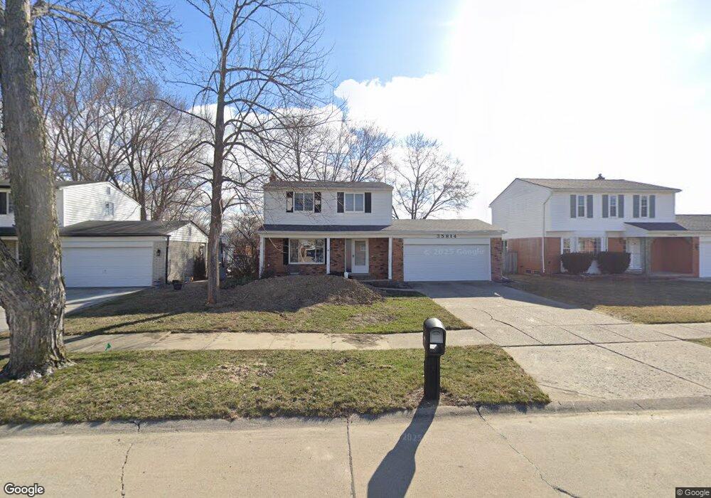
35814 Dunston Dr Sterling Heights, MI 48310
Estimated Value: $312,000 - $340,000
--
Bed
1
Bath
1,452
Sq Ft
$223/Sq Ft
Est. Value
About This Home
This home is located at 35814 Dunston Dr, Sterling Heights, MI 48310 and is currently estimated at $323,152, approximately $222 per square foot. 35814 Dunston Dr is a home located in Macomb County with nearby schools including Susick Elementary School, Grissom Middle School, and Sterling Heights Senior H.S..
Ownership History
Date
Name
Owned For
Owner Type
Purchase Details
Closed on
Nov 29, 2007
Sold by
Bedford John M
Bought by
Bedford Kelly A
Current Estimated Value
Purchase Details
Closed on
Aug 22, 2003
Sold by
Bedford John M and Bedford Kelly Ann
Bought by
Bedford John M and Bedford Kelly Ann
Home Financials for this Owner
Home Financials are based on the most recent Mortgage that was taken out on this home.
Original Mortgage
$132,000
Interest Rate
6.18%
Mortgage Type
Purchase Money Mortgage
Purchase Details
Closed on
Sep 18, 1998
Sold by
Jones Barbara G
Bought by
Bedford John M
Create a Home Valuation Report for This Property
The Home Valuation Report is an in-depth analysis detailing your home's value as well as a comparison with similar homes in the area
Home Values in the Area
Average Home Value in this Area
Purchase History
| Date | Buyer | Sale Price | Title Company |
|---|---|---|---|
| Bedford Kelly A | -- | None Available | |
| Bedford John M | -- | Title Direct | |
| Bedford John M | $146,500 | -- |
Source: Public Records
Mortgage History
| Date | Status | Borrower | Loan Amount |
|---|---|---|---|
| Previous Owner | Bedford John M | $132,000 |
Source: Public Records
Tax History Compared to Growth
Tax History
| Year | Tax Paid | Tax Assessment Tax Assessment Total Assessment is a certain percentage of the fair market value that is determined by local assessors to be the total taxable value of land and additions on the property. | Land | Improvement |
|---|---|---|---|---|
| 2025 | $3,160 | $143,600 | $0 | $0 |
| 2024 | $3,048 | $135,200 | $0 | $0 |
| 2023 | $2,893 | $121,700 | $0 | $0 |
| 2022 | $2,806 | $107,800 | $0 | $0 |
| 2021 | $2,900 | $101,100 | $0 | $0 |
| 2020 | $2,757 | $96,700 | $0 | $0 |
| 2019 | $2,718 | $89,600 | $0 | $0 |
| 2018 | $2,740 | $81,900 | $0 | $0 |
| 2017 | $2,644 | $76,900 | $15,000 | $61,900 |
| 2016 | $2,588 | $76,900 | $0 | $0 |
| 2015 | -- | $71,000 | $0 | $0 |
| 2014 | -- | $59,600 | $0 | $0 |
Source: Public Records
Map
Nearby Homes
- 3131 Elmcrest Rd
- 3148 Marc Dr
- 3261 Lancaster Dr
- 3542 Marc Dr
- 3426 Janet Dr
- 2595 Elmcrest Rd
- 36268 Jeffrey Dr
- 4117 Mahogany Dr
- 2448 Oakcrest Rd
- 4215 Nickolas Dr
- 36614 Park Place Dr Unit 68
- 36619 Park Place Dr
- 35078 Cavant Dr
- 35272 Vito Dr
- 4231 Chris Dr
- 2109 Chesley Dr
- 36862 Park Place Dr Unit 2
- 2121 Chesley Dr
- 4655 Ashburton Place
- 4628 Dickson Dr
- 35752 Dunston Dr
- 35826 Dunston Dr
- 35740 Dunston Dr
- 35838 Dunston Dr
- 35813 Dunston Dr
- 35728 Dunston Dr
- 35751 Dunston Dr
- 35825 Dunston Dr
- 35852 Dunston Dr
- 35739 Dunston Dr
- 35837 Dunston Dr
- 35716 Dunston Dr
- 35727 Dunston Dr
- 35851 Dunston Dr
- 35704 Dunston Dr
- 35812 Shell Dr
- 35750 Shell Dr
- 35824 Shell Dr
- 35713 Dunston Dr
- 35738 Shell Dr