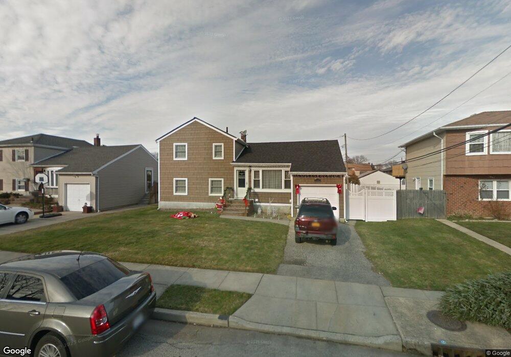
3583 Roanoke St Seaford, NY 11783
Estimated Value: $674,000 - $774,617
--
Bed
2
Baths
1,010
Sq Ft
$717/Sq Ft
Est. Value
About This Home
This home is located at 3583 Roanoke St, Seaford, NY 11783 and is currently estimated at $724,309, approximately $717 per square foot. 3583 Roanoke St is a home located in Nassau County with nearby schools including Seaford Middle School, Seaford Senior High School, and Maplewood School.
Ownership History
Date
Name
Owned For
Owner Type
Purchase Details
Closed on
Oct 14, 2009
Sold by
Dagostino Sam and Dagostino Gloria
Bought by
Kuffo Roy and Kuffo Michelle
Current Estimated Value
Home Financials for this Owner
Home Financials are based on the most recent Mortgage that was taken out on this home.
Original Mortgage
$333,841
Outstanding Balance
$218,992
Interest Rate
5.17%
Mortgage Type
Purchase Money Mortgage
Estimated Equity
$505,317
Create a Home Valuation Report for This Property
The Home Valuation Report is an in-depth analysis detailing your home's value as well as a comparison with similar homes in the area
Home Values in the Area
Average Home Value in this Area
Purchase History
| Date | Buyer | Sale Price | Title Company |
|---|---|---|---|
| Kuffo Roy | $340,000 | -- |
Source: Public Records
Mortgage History
| Date | Status | Borrower | Loan Amount |
|---|---|---|---|
| Open | Kuffo Roy | $333,841 |
Source: Public Records
Tax History Compared to Growth
Tax History
| Year | Tax Paid | Tax Assessment Tax Assessment Total Assessment is a certain percentage of the fair market value that is determined by local assessors to be the total taxable value of land and additions on the property. | Land | Improvement |
|---|---|---|---|---|
| 2025 | $14,379 | $507 | $210 | $297 |
| 2024 | $3,494 | $483 | $210 | $273 |
| 2023 | $13,493 | $483 | $210 | $273 |
| 2022 | $13,493 | $483 | $210 | $273 |
| 2021 | $18,531 | $474 | $206 | $268 |
| 2020 | $11,881 | $711 | $674 | $37 |
| 2019 | $11,463 | $711 | $674 | $37 |
| 2018 | $10,768 | $711 | $0 | $0 |
| 2017 | $6,534 | $711 | $550 | $161 |
| 2016 | $9,638 | $872 | $674 | $198 |
| 2015 | $3,553 | $872 | $674 | $198 |
| 2014 | $3,553 | $872 | $674 | $198 |
| 2013 | $3,333 | $872 | $674 | $198 |
Source: Public Records
Map
Nearby Homes
- 3563 Wadena St
- 3612 Ladonia St
- 3495 Roanoke St
- 3663 Roanoke St
- 3608 Tonopah St
- 2419 Cedar St
- 2601 Ocean Ave
- 0 Island Place Unit 3107575
- 2370 Narraganset Ave
- 2335 Maple St
- 2347 Pine St
- 2655 Ocean Ave
- 3541 Kenora Place
- 3570 Plover Place
- 2573 Harvard Ln
- 3532 Waverly Ave
- 2421 Atlantic Blvd
- 2333 Beech St
- 2175 Spruce St
- 3309 Nelson St
- 3577 Roanoke St
- 3589 Roanoke St
- 3584 Wadena St
- 3578 Wadena St
- 3571 Roanoke St
- 3595 Roanoke St
- 3590 Wadena St
- 3582 Roanoke St
- 3572 Wadena St
- 3576 Roanoke St
- 3596 Wadena St
- 3565 Roanoke St
- 3601 Roanoke St
- 3566 Wadena St
- 35 Roanoke St
- 3564 Roanoke St
- 3606 Wadena St
- 3583 Wadena St
- 3575 Wadena St
- 3589 Wadena St