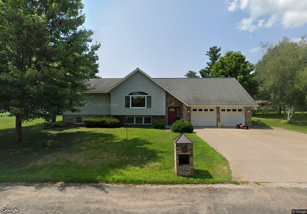
35865 Maple St Independence, WI 54747
Estimated Value: $330,000 - $380,739
Studio
--
Bath
--
Sq Ft
26,920
Sq Ft Lot
About This Home
This home is located at 35865 Maple St, Independence, WI 54747 and is currently estimated at $360,685. 35865 Maple St is a home located in Trempealeau County with nearby schools including Independence Elementary School, Independence High School, and Sts. Peter & Paul Elementary School.
Ownership History
Date
Name
Owned For
Owner Type
Purchase Details
Closed on
Sep 2, 2020
Sold by
Toraason Dawn M and Appleton Lori
Bought by
Tidquist Taryn B and Tidquist Craig M
Current Estimated Value
Home Financials for this Owner
Home Financials are based on the most recent Mortgage that was taken out on this home.
Original Mortgage
$227,700
Outstanding Balance
$199,358
Interest Rate
2.8%
Mortgage Type
New Conventional
Estimated Equity
$161,327
Purchase Details
Closed on
Aug 24, 2013
Sold by
Kloss Marie E
Bought by
Toraason Dawn M and Appleton Lori
Purchase Details
Closed on
Mar 15, 2012
Sold by
Kloss Donald and Kloss Donald N
Bought by
Kloss Donald N and Kloss Marie E
Create a Home Valuation Report for This Property
The Home Valuation Report is an in-depth analysis detailing your home's value as well as a comparison with similar homes in the area
Purchase History
| Date | Buyer | Sale Price | Title Company |
|---|---|---|---|
| Tidquist Taryn B | $253,000 | Town N' Country Title Llc | |
| Toraason Dawn M | -- | None Available | |
| Kloss Donald N | -- | None Available |
Source: Public Records
Mortgage History
| Date | Status | Borrower | Loan Amount |
|---|---|---|---|
| Open | Tidquist Taryn B | $227,700 |
Source: Public Records
Tax History
| Year | Tax Paid | Tax Assessment Tax Assessment Total Assessment is a certain percentage of the fair market value that is determined by local assessors to be the total taxable value of land and additions on the property. | Land | Improvement |
|---|---|---|---|---|
| 2025 | $7,167 | $346,400 | $28,600 | $317,800 |
| 2024 | $6,440 | $346,400 | $28,600 | $317,800 |
| 2023 | $6,453 | $247,300 | $21,500 | $225,800 |
| 2022 | $5,917 | $247,300 | $21,500 | $225,800 |
| 2021 | $5,076 | $247,300 | $21,500 | $225,800 |
| 2020 | $4,542 | $37,240 | $21,900 | $15,340 |
| 2019 | $4,841 | $175,300 | $21,900 | $153,400 |
| 2018 | $4,469 | $175,300 | $21,900 | $153,400 |
| 2017 | $4,679 | $175,300 | $21,900 | $153,400 |
| 2016 | $4,551 | $175,300 | $21,900 | $153,400 |
| 2015 | $4,414 | $175,300 | $21,900 | $153,400 |
| 2014 | $5,001 | $175,300 | $21,900 | $153,400 |
| 2011 | $4,662 | $175,300 | $21,900 | $153,400 |
Source: Public Records
Map
Nearby Homes
- 23365 Cherrywood St
- 23395 Cherrywood St
- 23325 Cherrywood St
- 23375 Cherrywood St
- 36097 Aspen Ct
- 35951 Osseo Rd
- 36092 Aspen Ct
- 36087 Aspen Ct
- 0 Wisconsin 121
- 36133 Aspen Ct
- 36129 Willow Ct
- 36134 Willow Ct
- 36151 Aspen Ct
- 36143 Willow Ct
- 36159 Willow Ct
- 36164 Willow Ct
- 36187 Aspen Ct
- 36179 Willow Ct
- 36174 Willow Ct
- 36188 Aspen Ct
Your Personal Tour Guide
Ask me questions while you tour the home.