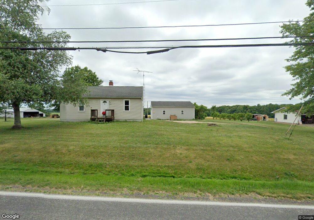
3587 Cook Rd Rootstown, OH 44272
Estimated Value: $140,944 - $244,000
2
Beds
1
Bath
720
Sq Ft
$271/Sq Ft
Est. Value
About This Home
This home is located at 3587 Cook Rd, Rootstown, OH 44272 and is currently estimated at $195,236, approximately $271 per square foot. 3587 Cook Rd is a home located in Portage County with nearby schools including Rootstown Middle School - Schnee Building and Rootstown High School.
Ownership History
Date
Name
Owned For
Owner Type
Purchase Details
Closed on
Apr 10, 2002
Sold by
Wohlwend Kenneth P and Wohlwend Elaine C
Bought by
Wohlwend Kenneth and Wohlwend Elaine C
Current Estimated Value
Purchase Details
Closed on
Jun 15, 1999
Sold by
Haney James L
Bought by
Wohlwend Kenneth and Hall Elaine C
Home Financials for this Owner
Home Financials are based on the most recent Mortgage that was taken out on this home.
Original Mortgage
$83,420
Outstanding Balance
$22,418
Interest Rate
7.28%
Estimated Equity
$172,818
Purchase Details
Closed on
Jan 28, 1994
Bought by
Haney James L
Create a Home Valuation Report for This Property
The Home Valuation Report is an in-depth analysis detailing your home's value as well as a comparison with similar homes in the area
Purchase History
| Date | Buyer | Sale Price | Title Company |
|---|---|---|---|
| Wohlwend Kenneth | -- | -- | |
| Wohlwend Kenneth | $86,000 | -- | |
| Haney James L | $63,000 | -- |
Source: Public Records
Mortgage History
| Date | Status | Borrower | Loan Amount |
|---|---|---|---|
| Open | Wohlwend Kenneth | $83,420 |
Source: Public Records
Tax History
| Year | Tax Paid | Tax Assessment Tax Assessment Total Assessment is a certain percentage of the fair market value that is determined by local assessors to be the total taxable value of land and additions on the property. | Land | Improvement |
|---|---|---|---|---|
| 2024 | $1,612 | $39,200 | $9,240 | $29,960 |
| 2023 | $1,508 | $32,730 | $8,160 | $24,570 |
| 2022 | $1,483 | $32,730 | $8,160 | $24,570 |
| 2021 | $1,475 | $32,730 | $8,160 | $24,570 |
| 2020 | $1,340 | $28,600 | $7,770 | $20,830 |
| 2019 | $1,344 | $28,600 | $7,770 | $20,830 |
| 2018 | $1,248 | $25,130 | $8,260 | $16,870 |
| 2017 | $1,248 | $25,130 | $8,260 | $16,870 |
| 2016 | $1,214 | $25,130 | $8,260 | $16,870 |
| 2015 | $1,228 | $25,130 | $8,260 | $16,870 |
| 2014 | $1,251 | $25,130 | $8,260 | $16,870 |
| 2013 | $1,242 | $25,130 | $8,260 | $16,870 |
Source: Public Records
Map
Nearby Homes
- 4312 Apple Orchard
- 3689 Cherry Hill
- 3701 State Route 44
- 4225 Hattrick Rd
- 0 Lynn Rd Unit 5110102
- 0 Tallmadge Rd Unit 5189301
- 0 Tallmadge Rd Unit 5189314
- 3637 Old Forge Rd
- 3021 Hartville Rd
- V/L 2 Lynn Rd
- V/L Lynn Rd
- 4415 Farmette Dr
- 4691 Scenic Dr
- 4958 Bassett Rd
- sub lot Lane Ave
- 2547 Industry Rd
- 4087 Industry
- 3080 Saxe Rd
- 4140 Sandy Lake Rd
- 4058 Bayberry Knoll Ln
- 3595 Cook Rd
- 3584 Cook Rd
- 3615 Cook Rd
- 3550 Cook Rd
- 3622 Cook Rd
- 3636 Cook Rd
- 3617 Cook Rd
- 3544 Cook Rd
- 3607 Cook Rd
- 3657 Cook Rd
- 3530 Cook Rd
- 3650 Cook Rd
- 3660 Cranberry Hill
- 3664 Cranberry Hill
- 3518 Cook Rd
- 3663 Cranberry Hill
- 3670 Cook Rd
- 3668 Cranberry Hill
- 3667 Cranberry Hill
- 4402 Apple Orchard
Your Personal Tour Guide
Ask me questions while you tour the home.