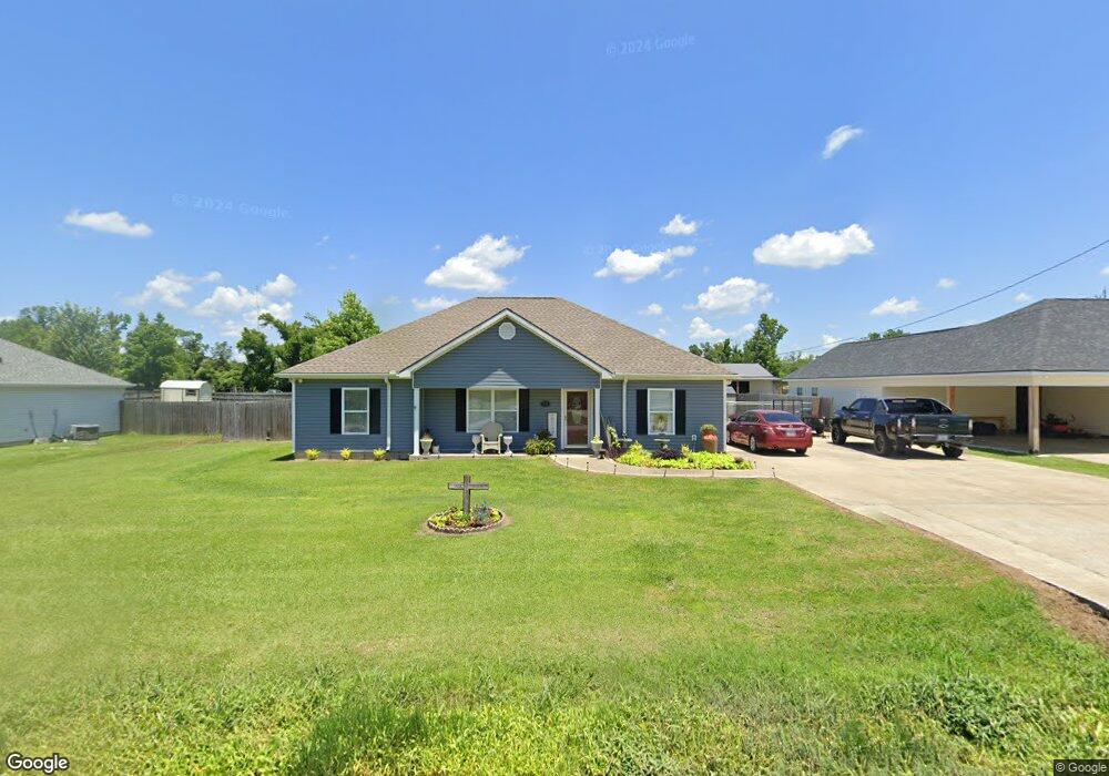
359 E Dick Hayes Rd Westlake, LA 70669
Estimated Value: $162,000 - $242,000
--
Bed
--
Bath
--
Sq Ft
1,786
Sq Ft Lot
About This Home
This home is located at 359 E Dick Hayes Rd, Westlake, LA 70669 and is currently estimated at $198,878. 359 E Dick Hayes Rd is a home located in Calcasieu Parish with nearby schools including Westwood Elementary School, Western Heights Elementary School, and S.P. Arnett Middle School.
Ownership History
Date
Name
Owned For
Owner Type
Purchase Details
Closed on
Jan 28, 2016
Sold by
Bienvenu Marcel Martin and Bienvenu Kimberly Marie Dorman
Bought by
Lebouff Loran Klane
Current Estimated Value
Purchase Details
Closed on
Nov 18, 2005
Sold by
Jrs Enterprises Swla Llc
Bought by
Binevnu Marcel Martin and Binevnu Kimberly Marie
Home Financials for this Owner
Home Financials are based on the most recent Mortgage that was taken out on this home.
Original Mortgage
$24,080
Interest Rate
6.06%
Mortgage Type
Stand Alone Second
Create a Home Valuation Report for This Property
The Home Valuation Report is an in-depth analysis detailing your home's value as well as a comparison with similar homes in the area
Home Values in the Area
Average Home Value in this Area
Purchase History
| Date | Buyer | Sale Price | Title Company |
|---|---|---|---|
| Lebouff Loran Klane | $185,000 | None Available | |
| Binevnu Marcel Martin | $120,400 | None Available |
Source: Public Records
Mortgage History
| Date | Status | Borrower | Loan Amount |
|---|---|---|---|
| Previous Owner | Binevnu Marcel Martin | $24,080 |
Source: Public Records
Tax History Compared to Growth
Tax History
| Year | Tax Paid | Tax Assessment Tax Assessment Total Assessment is a certain percentage of the fair market value that is determined by local assessors to be the total taxable value of land and additions on the property. | Land | Improvement |
|---|---|---|---|---|
| 2024 | $612 | $13,200 | $1,620 | $11,580 |
| 2023 | $612 | $13,200 | $1,620 | $11,580 |
| 2022 | $626 | $13,200 | $1,620 | $11,580 |
| 2021 | $611 | $13,200 | $1,620 | $11,580 |
| 2020 | $1,308 | $11,980 | $1,560 | $10,420 |
| 2019 | $1,479 | $13,080 | $1,500 | $11,580 |
| 2018 | $583 | $13,080 | $1,500 | $11,580 |
| 2017 | $1,409 | $13,080 | $1,500 | $11,580 |
| 2016 | $1,320 | $13,080 | $1,500 | $11,580 |
| 2015 | $1,320 | $13,080 | $1,500 | $11,580 |
Source: Public Records
Map
Nearby Homes
- 2725 Smith Ferry Rd
- 0 W Wayside Dr Unit SWL25001592
- 2502 & 2504 German Rd
- 109 W Wayside Dr
- 0 Fletcher Rd
- 2525 Davis Rd
- 0 Davis Rd
- 590 Landry Rd
- 2518 Donnelly Rd
- 369 Ann Terrace Ave
- 0 Charlotte Ave Unit SWL25001918
- 570 Ann Terrace Ave
- 1545 S Perkins Ferry Rd
- 1567 S Perkins Ferry Rd
- 345 Fred Lutz Rd
- 0 Niel Rd Unit SWL23002840
- 2526 Cox Rd
- 141 Cureton Rd
- 320 Mcguire Rd
- 2524 Cox Rd
- 365 E Dick Hayes Rd
- 353 E Dick Hayes Rd
- 0 Dick Hayes Rd Unit 59965
- 0 Dick Hayes Rd Unit 59368
- 0 Dick Hayes Rd Unit 51401
- 371 E Dick Hayes Rd
- 347 E Dick Hayes Rd
- 2851 Hudson Dr
- 428 E Dick Hayes Rd
- 2817 Miller Ave
- 2817 Miller Ave
- 341 E Dick Hayes Rd
- 2835 Miller Ave
- 342 E Dick Hayes Rd
- 2849 Hudson Dr
- 2853 Hudson Dr
- 2816 Miller Ave
- 343 E Dick Hayes Rd
- 2802 Miller Ave
- 2719 Miller Ave