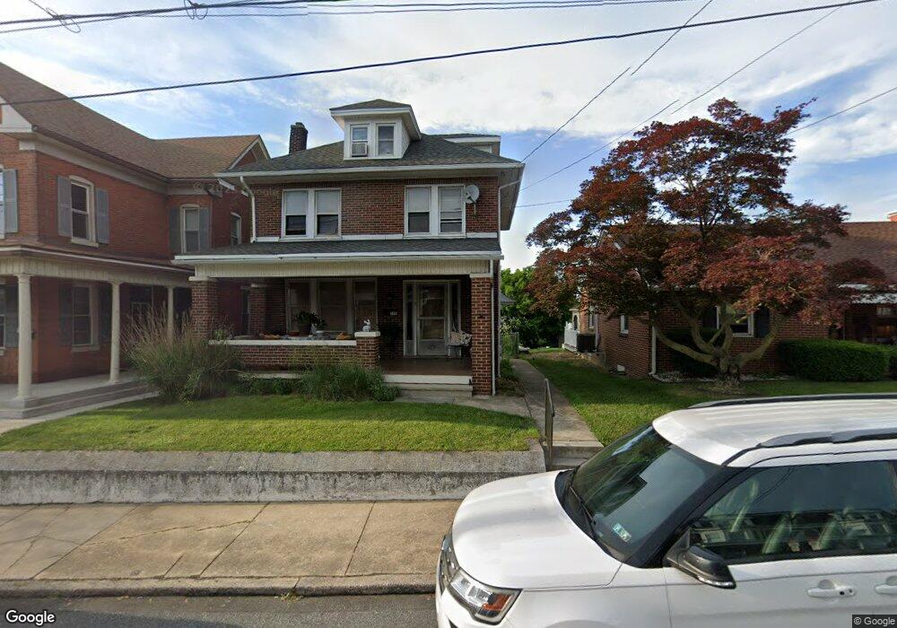
359 E Main St Dallastown, PA 17313
Estimated Value: $192,000 - $224,000
3
Beds
1
Bath
1,640
Sq Ft
$127/Sq Ft
Est. Value
About This Home
This home is located at 359 E Main St, Dallastown, PA 17313 and is currently estimated at $208,207, approximately $126 per square foot. 359 E Main St is a home located in York County with nearby schools including Dallastown Elementary School, Dallastown Area Middle School, and Dallastown Area High School.
Ownership History
Date
Name
Owned For
Owner Type
Purchase Details
Closed on
Feb 4, 2011
Sold by
Stojowski Lisa M
Bought by
Wade Amie B
Current Estimated Value
Home Financials for this Owner
Home Financials are based on the most recent Mortgage that was taken out on this home.
Original Mortgage
$121,705
Outstanding Balance
$83,240
Interest Rate
4.77%
Mortgage Type
FHA
Estimated Equity
$124,967
Purchase Details
Closed on
Nov 12, 2003
Sold by
Gromling Harvey C
Bought by
Stojowski Lisa M
Home Financials for this Owner
Home Financials are based on the most recent Mortgage that was taken out on this home.
Original Mortgage
$89,990
Interest Rate
5.81%
Mortgage Type
Purchase Money Mortgage
Purchase Details
Closed on
Jul 26, 2002
Sold by
Foulk Susan J and Foulk Wayne R
Bought by
Gromling Harvey C
Home Financials for this Owner
Home Financials are based on the most recent Mortgage that was taken out on this home.
Original Mortgage
$73,900
Interest Rate
6.73%
Create a Home Valuation Report for This Property
The Home Valuation Report is an in-depth analysis detailing your home's value as well as a comparison with similar homes in the area
Home Values in the Area
Average Home Value in this Area
Purchase History
| Date | Buyer | Sale Price | Title Company |
|---|---|---|---|
| Wade Amie B | $124,900 | None Available | |
| Stojowski Lisa M | $89,990 | -- | |
| Gromling Harvey C | $73,900 | Lawyers Title Insurance Corp |
Source: Public Records
Mortgage History
| Date | Status | Borrower | Loan Amount |
|---|---|---|---|
| Open | Wade Amie B | $121,705 | |
| Previous Owner | Stojowski Lisa M | $89,990 | |
| Previous Owner | Gromling Harvey C | $73,900 |
Source: Public Records
Tax History Compared to Growth
Tax History
| Year | Tax Paid | Tax Assessment Tax Assessment Total Assessment is a certain percentage of the fair market value that is determined by local assessors to be the total taxable value of land and additions on the property. | Land | Improvement |
|---|---|---|---|---|
| 2025 | $3,148 | $90,640 | $20,010 | $70,630 |
| 2024 | $3,148 | $90,640 | $20,010 | $70,630 |
| 2023 | $3,148 | $90,640 | $20,010 | $70,630 |
| 2022 | $3,048 | $90,640 | $20,010 | $70,630 |
| 2021 | $2,874 | $90,640 | $20,010 | $70,630 |
| 2020 | $2,874 | $90,640 | $20,010 | $70,630 |
| 2019 | $2,865 | $90,640 | $20,010 | $70,630 |
| 2018 | $2,865 | $90,640 | $20,010 | $70,630 |
| 2017 | $2,754 | $90,640 | $20,010 | $70,630 |
| 2016 | $0 | $90,640 | $20,010 | $70,630 |
| 2015 | -- | $90,640 | $20,010 | $70,630 |
| 2014 | -- | $90,640 | $20,010 | $70,630 |
Source: Public Records
Map
Nearby Homes
- 56 E Frederick St
- 64 S Pleasant Ave
- 122 S Pleasant Ave
- 74 S Main St
- 0 S Franklin St
- 355 W Main St
- 106 Teila Dr
- 260 Country Ridge Dr
- 136 Teila Dr
- 732 Blossom Hill Ln
- 2855 Springwood Rd
- 428 W Main St
- 126 Country Ridge Dr
- 211 Country Ridge Dr
- 156 Country Ridge Dr
- 168 Country Ridge Dr
- 774 Blossom Hill Ln
- 435 Frederick Dr
- 131 Country Ridge Dr
- 840 Country Club Rd