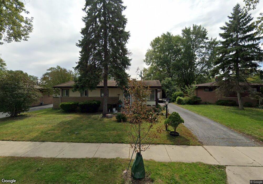
359 E Normandy Dr Addison, IL 60101
Estimated Value: $321,695 - $361,000
3
Beds
2
Baths
1,354
Sq Ft
$249/Sq Ft
Est. Value
About This Home
This home is located at 359 E Normandy Dr, Addison, IL 60101 and is currently estimated at $336,924, approximately $248 per square foot. 359 E Normandy Dr is a home located in DuPage County with nearby schools including Fullerton Elementary School, Indian Trail Jr High School, and Addison Trail High School.
Ownership History
Date
Name
Owned For
Owner Type
Purchase Details
Closed on
Jun 29, 2010
Sold by
Chicago Title Land Trust Company
Bought by
Hernandez Hilario
Current Estimated Value
Home Financials for this Owner
Home Financials are based on the most recent Mortgage that was taken out on this home.
Original Mortgage
$172,674
Outstanding Balance
$115,259
Interest Rate
4.81%
Mortgage Type
FHA
Estimated Equity
$221,665
Create a Home Valuation Report for This Property
The Home Valuation Report is an in-depth analysis detailing your home's value as well as a comparison with similar homes in the area
Home Values in the Area
Average Home Value in this Area
Purchase History
| Date | Buyer | Sale Price | Title Company |
|---|---|---|---|
| Hernandez Hilario | $175,000 | Multiple |
Source: Public Records
Mortgage History
| Date | Status | Borrower | Loan Amount |
|---|---|---|---|
| Open | Hernandez Hilario | $172,674 |
Source: Public Records
Tax History
| Year | Tax Paid | Tax Assessment Tax Assessment Total Assessment is a certain percentage of the fair market value that is determined by local assessors to be the total taxable value of land and additions on the property. | Land | Improvement |
|---|---|---|---|---|
| 2024 | $5,661 | $88,319 | $37,551 | $50,768 |
| 2023 | $5,388 | $81,190 | $34,520 | $46,670 |
| 2022 | $5,139 | $75,770 | $32,220 | $43,550 |
| 2021 | $4,917 | $72,570 | $30,860 | $41,710 |
| 2020 | $4,777 | $69,510 | $29,560 | $39,950 |
| 2019 | $4,737 | $66,830 | $28,420 | $38,410 |
| 2018 | $4,677 | $63,610 | $27,050 | $36,560 |
| 2017 | $4,548 | $60,790 | $25,850 | $34,940 |
| 2016 | $4,412 | $56,130 | $23,870 | $32,260 |
| 2015 | $4,286 | $51,850 | $22,050 | $29,800 |
| 2014 | $4,245 | $51,120 | $20,210 | $30,910 |
| 2013 | $4,163 | $52,160 | $20,620 | $31,540 |
Source: Public Records
Map
Nearby Homes
- 128 S Michigan Ave
- 434 S Yale Ave
- 29 S Iowa Ave
- 204 S Iowa Ave
- 2 N Wisconsin Ave
- 14 N Wisconsin Ave
- 45 N Wisconsin Ave
- 200 Addison Rd
- 437 E Lorraine Ave
- 133 E Lake St
- 225 N State St
- 163 S Ruga Ct
- 238 N Hillcrest Ave
- 215 E Oak St
- 902 E Krage Dr
- 102 N Oakleaf Dr
- 215 S Hale St Unit 9B
- 740 N Junior Terrace
- 10 N Adams Dr
- 646 W Babcock Ave
- 363 E Normandy Dr Unit 1
- 403 E Normandy Dr
- 338 E Hilton Ave
- 358 E Normandy Dr
- 362 E Normandy Dr
- 342 E Hilton Ave
- 332 E Hilton Ave
- 402 E Normandy Dr
- 411 E Normandy Dr
- 352 E Normandy Dr
- 344 E Normandy Dr
- 326 E Hilton Ave
- 348 E Hilton Ave
- 341 E Normandy Dr
- 136 E Normandy Dr
- 338 E Wrightwood Ave
- 415 E Normandy Dr
- 400 E Hilton Ave
- 346 E Normandy Dr
- 208 S Princeton St
Your Personal Tour Guide
Ask me questions while you tour the home.