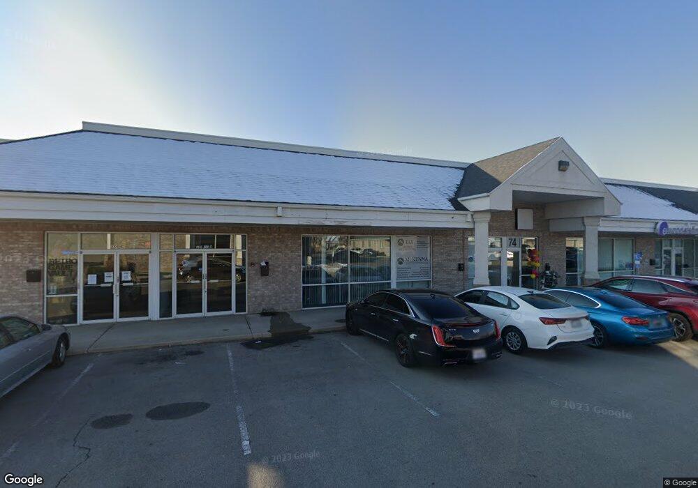
359 E State Rd Unit 7 American Fork, UT 84003
Studio
--
Bath
13,212
Sq Ft
13,068
Sq Ft
About This Home
This home is located at 359 E State Rd Unit 7, American Fork, UT 84003. 359 E State Rd Unit 7 is a home located in Utah County with nearby schools including Forbes Elementary School, American Fork Junior High School, and American Fork High School.
Ownership History
Date
Name
Owned For
Owner Type
Purchase Details
Closed on
Dec 3, 2021
Sold by
Porter Real Property Llc
Bought by
Porter Real Property Llc
Purchase Details
Closed on
Jun 10, 2019
Sold by
Landmark Holdings Llc
Bought by
Porter Real Property Llc and Clayton Properties Llc
Home Financials for this Owner
Home Financials are based on the most recent Mortgage that was taken out on this home.
Original Mortgage
$1,293,750
Interest Rate
4.2%
Mortgage Type
Commercial
Purchase Details
Closed on
May 31, 2018
Sold by
Alphine Square Associates Lc
Bought by
Landmark Holding Llc
Home Financials for this Owner
Home Financials are based on the most recent Mortgage that was taken out on this home.
Original Mortgage
$915,000
Interest Rate
4.4%
Mortgage Type
Purchase Money Mortgage
Create a Home Valuation Report for This Property
The Home Valuation Report is an in-depth analysis detailing your home's value as well as a comparison with similar homes in the area
Home Values in the Area
Average Home Value in this Area
Purchase History
| Date | Buyer | Sale Price | Title Company |
|---|---|---|---|
| Porter Real Property Llc | -- | None Listed On Document | |
| Porter Real Property Llc | -- | Provo Land Title Company | |
| Landmark Holding Llc | -- | Stewart Title Ins Agency |
Source: Public Records
Mortgage History
| Date | Status | Borrower | Loan Amount |
|---|---|---|---|
| Previous Owner | Porter Real Property Llc | $1,293,750 | |
| Previous Owner | Landmark Holding Llc | $915,000 |
Source: Public Records
Tax History
| Year | Tax Paid | Tax Assessment Tax Assessment Total Assessment is a certain percentage of the fair market value that is determined by local assessors to be the total taxable value of land and additions on the property. | Land | Improvement |
|---|---|---|---|---|
| 2025 | $16,888 | $1,913,900 | $516,700 | $1,397,200 |
| 2024 | $16,888 | $1,876,400 | $0 | $0 |
| 2023 | $15,702 | $1,849,700 | $0 | $0 |
| 2022 | $13,638 | $1,585,500 | $506,500 | $1,079,000 |
| 2021 | $15,876 | $1,585,500 | $506,500 | $1,079,000 |
| 2020 | $16,369 | $1,585,500 | $506,500 | $1,079,000 |
| 2019 | $11,211 | $1,123,100 | $506,500 | $616,600 |
| 2018 | $11,647 | $1,115,600 | $422,100 | $693,500 |
| 2017 | $13,531 | $1,271,800 | $0 | $0 |
| 2016 | $11,498 | $1,004,100 | $0 | $0 |
| 2015 | $12,115 | $1,004,100 | $0 | $0 |
| 2014 | $12,282 | $1,004,100 | $0 | $0 |
Source: Public Records
Map
Nearby Homes
- 359 E State Rd Unit 3
- 359 E State Rd
- 359 E State Rd Unit 2
- 359 E Empire Dr Unit 151
- 347 E State Rd
- 347 E State Rd
- 349 E Empire Dr Unit 152
- 349 E Empire Dr Unit 153
- 339 E Empire Dr Unit 153
- 356 E State Rd
- 355 E 50 S
- 357 E 50 S
- 321 E State Rd Unit 2
- 321 E State Rd Unit 1
- 321 E State Rd Unit 100
- 393 E Empire Dr Unit 148
- 356 E 20 S
- 383 E Empire Dr Unit 149
- 399 E State Rd
- 24 S 400 E
Your Personal Tour Guide
Ask me questions while you tour the home.