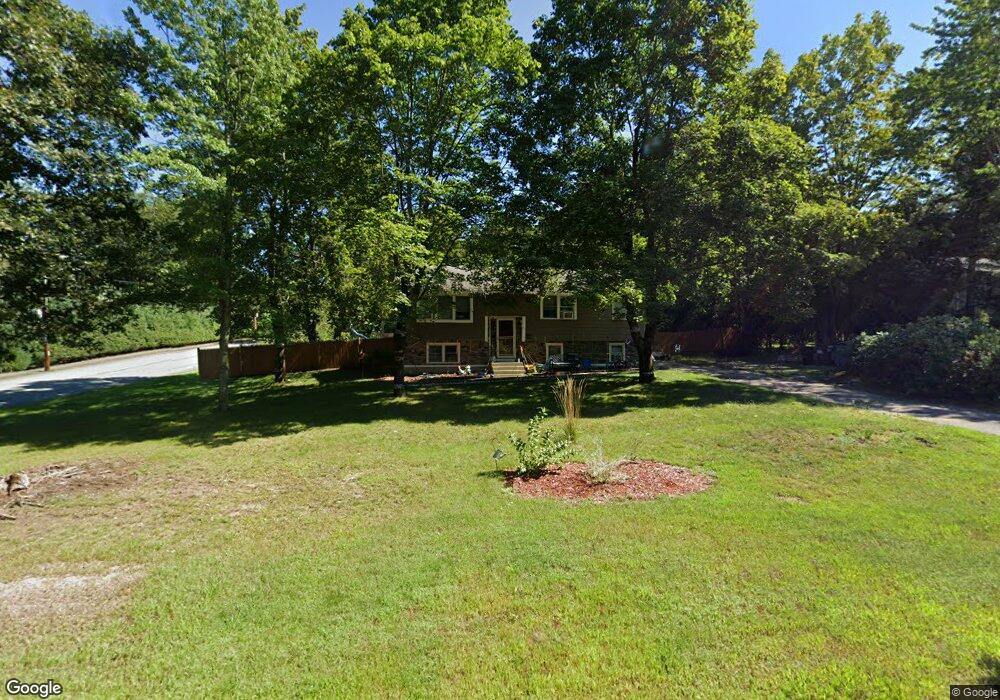
359 Madison St Wrentham, MA 02093
Estimated Value: $644,000 - $665,000
3
Beds
2
Baths
1,710
Sq Ft
$383/Sq Ft
Est. Value
About This Home
This home is located at 359 Madison St, Wrentham, MA 02093 and is currently estimated at $654,124, approximately $382 per square foot. 359 Madison St is a home located in Norfolk County with nearby schools including Delaney Elementary School, Charles E Roderick, and Discovery Daycare Center.
Ownership History
Date
Name
Owned For
Owner Type
Purchase Details
Closed on
Mar 31, 2023
Sold by
Feid Ashley
Bought by
Willcutt Jason and Willcutt Ashley
Current Estimated Value
Home Financials for this Owner
Home Financials are based on the most recent Mortgage that was taken out on this home.
Original Mortgage
$315,000
Outstanding Balance
$306,325
Interest Rate
6.65%
Mortgage Type
Stand Alone Refi Refinance Of Original Loan
Estimated Equity
$347,799
Purchase Details
Closed on
Jul 6, 2016
Sold by
Lotfy John and Lotfy Lynn M
Bought by
Feid Ashley
Purchase Details
Closed on
Oct 15, 2014
Sold by
Braida Josephine L Est
Bought by
Lofty John and Lofty Lynn M
Create a Home Valuation Report for This Property
The Home Valuation Report is an in-depth analysis detailing your home's value as well as a comparison with similar homes in the area
Purchase History
| Date | Buyer | Sale Price | Title Company |
|---|---|---|---|
| Willcutt Jason | -- | None Available | |
| Feid Ashley | -- | -- | |
| Lofty John | $165,000 | -- |
Source: Public Records
Mortgage History
| Date | Status | Borrower | Loan Amount |
|---|---|---|---|
| Open | Willcutt Jason | $315,000 |
Source: Public Records
Tax History
| Year | Tax Paid | Tax Assessment Tax Assessment Total Assessment is a certain percentage of the fair market value that is determined by local assessors to be the total taxable value of land and additions on the property. | Land | Improvement |
|---|---|---|---|---|
| 2025 | $6,372 | $549,800 | $284,200 | $265,600 |
| 2024 | $5,990 | $499,200 | $284,200 | $215,000 |
| 2023 | $5,718 | $453,100 | $258,500 | $194,600 |
| 2022 | $5,368 | $392,700 | $221,900 | $170,800 |
| 2021 | $5,182 | $368,300 | $233,100 | $135,200 |
| 2020 | $4,921 | $345,300 | $165,100 | $180,200 |
| 2019 | $4,640 | $328,600 | $157,900 | $170,700 |
| 2018 | $4,525 | $317,800 | $158,000 | $159,800 |
| 2017 | $4,308 | $302,300 | $155,000 | $147,300 |
| 2016 | $4,517 | $316,300 | $167,200 | $149,100 |
| 2015 | $4,160 | $277,700 | $146,100 | $131,600 |
| 2014 | $4,108 | $268,300 | $140,600 | $127,700 |
Source: Public Records
Map
Nearby Homes
- 282 Thurston St
- 483 Thurston St
- 10 Nature View Dr
- 15 Nature View Dr
- 3 Earle Stewart Ln
- 10 Earle Stewart Ln Unit Lot 5
- 2 Earle Stewart Ln
- 12 Earle Stewart Ln
- 135 Creek St Unit 2
- 46 Mirimichi St
- 160 Washington St Unit 22
- 576 Dedham St
- 25 Foxboro Rd
- 126 Washington St
- 130 Washington St
- 124 Washington St
- 158 Washington St
- 16 Treasure Island Rd
- 131 Washington St Unit 42
- 131 Washington St Unit 50
- 369 Madison St
- 354 Madison St
- 376 Madison St
- 375 Madison St
- 345 Madison St
- 10 Stoney Brook Ln
- 336 Madison St
- 335 Madison St
- 378 Madison St
- 15 Stoney Brook Ln
- 405 Madison St
- 20 Stoney Brook Ln
- 25 Stoney Brook Ln
- 380 Madison St
- 323 Madison St
- 324 Madison St
- 346 Madison St
- 415 Madison St
- 385 Madison St
- 30 Stoney Brook Ln
Your Personal Tour Guide
Ask me questions while you tour the home.