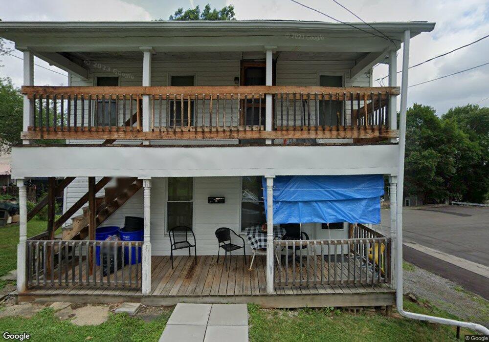
359 Michael Ave Butler, PA 16001
Butler NeighborhoodEstimated Value: $93,000 - $161,000
3
Beds
2
Baths
960
Sq Ft
$128/Sq Ft
Est. Value
About This Home
This home is located at 359 Michael Ave, Butler, PA 16001 and is currently estimated at $123,333, approximately $128 per square foot. 359 Michael Ave is a home located in Butler County with nearby schools including Butler Middle School, Butler Intermediate High School, and Butler Catholic School.
Ownership History
Date
Name
Owned For
Owner Type
Purchase Details
Closed on
May 11, 2021
Sold by
Liberty & Freedom Management Llc
Bought by
Rodgers Thomas D
Current Estimated Value
Home Financials for this Owner
Home Financials are based on the most recent Mortgage that was taken out on this home.
Original Mortgage
$35,000
Interest Rate
2.9%
Mortgage Type
Purchase Money Mortgage
Purchase Details
Closed on
Jul 31, 2008
Sold by
Patricia A Green Tr
Bought by
Liberty And Freedom Management
Home Financials for this Owner
Home Financials are based on the most recent Mortgage that was taken out on this home.
Original Mortgage
$17,000
Interest Rate
6.47%
Mortgage Type
New Conventional
Create a Home Valuation Report for This Property
The Home Valuation Report is an in-depth analysis detailing your home's value as well as a comparison with similar homes in the area
Home Values in the Area
Average Home Value in this Area
Purchase History
| Date | Buyer | Sale Price | Title Company |
|---|---|---|---|
| Rodgers Thomas D | $35,000 | None Available | |
| Liberty And Freedom Management | $25,000 | -- |
Source: Public Records
Mortgage History
| Date | Status | Borrower | Loan Amount |
|---|---|---|---|
| Previous Owner | Rodgers Thomas D | $35,000 | |
| Previous Owner | Liberty And Freedom Management | $17,000 |
Source: Public Records
Tax History Compared to Growth
Tax History
| Year | Tax Paid | Tax Assessment Tax Assessment Total Assessment is a certain percentage of the fair market value that is determined by local assessors to be the total taxable value of land and additions on the property. | Land | Improvement |
|---|---|---|---|---|
| 2025 | $914 | $5,040 | $990 | $4,050 |
| 2024 | $900 | $5,040 | $990 | $4,050 |
| 2023 | $885 | $5,040 | $990 | $4,050 |
| 2022 | $885 | $5,040 | $990 | $4,050 |
| 2021 | $686 | $5,040 | $0 | $0 |
| 2020 | $882 | $5,040 | $990 | $4,050 |
| 2019 | $866 | $5,040 | $990 | $4,050 |
| 2018 | $866 | $5,040 | $990 | $4,050 |
| 2017 | $850 | $5,040 | $990 | $4,050 |
| 2016 | $236 | $5,040 | $990 | $4,050 |
| 2015 | $148 | $5,040 | $990 | $4,050 |
| 2014 | $148 | $5,040 | $990 | $4,050 |
Source: Public Records
Map
Nearby Homes
- 221 Brown Ave
- 104 Standard Ave
- 149 Standard Ave
- 115 Spring St
- 425 Brown Ave
- 207 S Monroe St Unit 209
- 109 Morton Ave
- 126 W Boyd Ave
- 716 Hettie Way
- 108 E Christie Ave
- 806 Center Ave
- 332 S Main St
- 424 Zeigler Ave
- 201 E Rockenstein Ave
- 117 S Mckean St
- 129 Slagle Ave
- 311 Negley Ave Unit 313
- 134 S Main St
- 461 Zeigler Ave
- 123 W Muntz Ave
- 205 Brown Ave
- 209 Brown Ave
- 360 Michael Ave
- 203 Brown Ave
- 213 Brown Ave
- 201 Brown Ave
- 215 Brown Ave
- 217 Brown Ave
- 404 Center Ave., Apt S Main St
- 200 Brown Ave
- 214 Brown Ave
- 212 Brown Ave Unit 214
- 416 Center Ave
- 208 Brown Ave
- 204 Brown Ave
- 114 Brown Ave
- 301 Brown Ave
- 214 1/2 Brown Ave Unit . 1
- 214 1/2 Brown Ave
- 220 Brown Ave