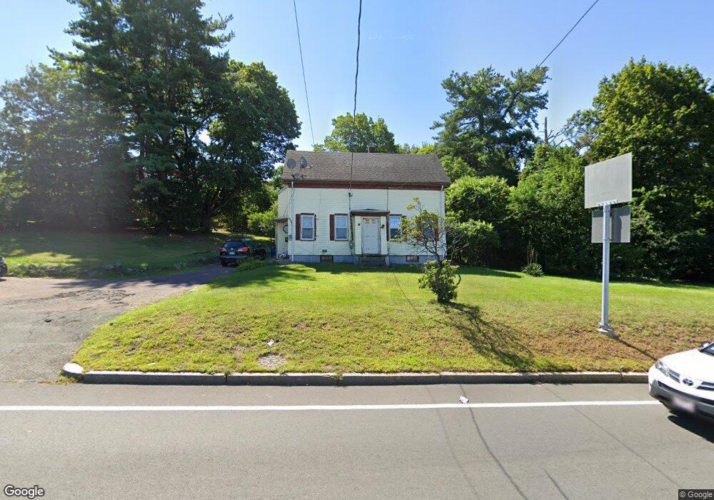
359 Mishawum Rd Woburn, MA 01801
Mishawum NeighborhoodEstimated Value: $760,495 - $977,000
5
Beds
3
Baths
1,990
Sq Ft
$425/Sq Ft
Est. Value
About This Home
This home is located at 359 Mishawum Rd, Woburn, MA 01801 and is currently estimated at $846,624, approximately $425 per square foot. 359 Mishawum Rd is a home located in Middlesex County with nearby schools including Mary D. Altavesta Elementary School, John F. Kennedy Middle School, and Woburn High School.
Ownership History
Date
Name
Owned For
Owner Type
Purchase Details
Closed on
Sep 29, 2006
Sold by
359 Mishawum Road Rt and Donohoe
Bought by
Daxlink Llc
Current Estimated Value
Home Financials for this Owner
Home Financials are based on the most recent Mortgage that was taken out on this home.
Original Mortgage
$402,500
Outstanding Balance
$240,975
Interest Rate
6.52%
Mortgage Type
Purchase Money Mortgage
Estimated Equity
$605,649
Create a Home Valuation Report for This Property
The Home Valuation Report is an in-depth analysis detailing your home's value as well as a comparison with similar homes in the area
Home Values in the Area
Average Home Value in this Area
Purchase History
| Date | Buyer | Sale Price | Title Company |
|---|---|---|---|
| Daxlink Llc | $575,000 | -- | |
| Daxlink Llc | $575,000 | -- |
Source: Public Records
Mortgage History
| Date | Status | Borrower | Loan Amount |
|---|---|---|---|
| Open | Daxlink Llc | $402,500 | |
| Closed | Daxlink Llc | $402,500 |
Source: Public Records
Tax History Compared to Growth
Tax History
| Year | Tax Paid | Tax Assessment Tax Assessment Total Assessment is a certain percentage of the fair market value that is determined by local assessors to be the total taxable value of land and additions on the property. | Land | Improvement |
|---|---|---|---|---|
| 2025 | $5,373 | $629,200 | $308,000 | $321,200 |
| 2024 | $4,791 | $594,400 | $294,300 | $300,100 |
| 2023 | $4,829 | $555,100 | $267,600 | $287,500 |
| 2022 | $4,671 | $500,100 | $235,100 | $265,000 |
| 2021 | $3,285 | $461,700 | $224,800 | $236,900 |
| 2020 | $4,290 | $460,300 | $224,800 | $235,500 |
| 2019 | $3,014 | $445,400 | $215,000 | $230,400 |
| 2018 | $3,969 | $401,300 | $198,800 | $202,500 |
| 2017 | $6,413 | $379,900 | $190,200 | $189,700 |
| 2016 | $3,620 | $360,200 | $179,000 | $181,200 |
| 2015 | $3,498 | $344,000 | $168,500 | $175,500 |
| 2014 | $3,450 | $330,500 | $168,500 | $162,000 |
Source: Public Records
Map
Nearby Homes
- 75 Border Rd
- 246 Walnut St
- 133 Pine Ridge Rd
- 13 Elaine Rd
- 295 Salem St Unit 42
- 295 Salem St Unit 69
- 57 Wescroft Rd
- 175 West St
- 3 Highet Ave
- 89 Walnut St
- 18 Wescroft Rd
- 6 Callahan Dr
- 20 Barbara Cir
- 62 Abigail Way Unit 2007
- 62 Abigail Way Unit 3004
- 266 West St
- 36 Forest St
- 16 Munroe Ave
- 97 Oak St
- 52 Middle St
- 4 Garden Terrace
- 2 Garden Terrace
- 361 Mishawum Rd
- 6 Garden Terrace
- 420 Washington St
- 422 Washington St
- 8 Garden Terrace
- 8 Garden Terrace Unit 1
- 3 Garden Terrace
- 1 Garden Terrace
- 12 Garden Terrace
- 9 Garden Terrace
- 11 Garden Terrace
- 444 Washington St Unit 401
- 444 Washington St
- 444 Washington St Unit 304
- 9 Richard Cir
- 11 Richard Cir
- 11 Richard Cir Unit 1
- 13 Richard Cir