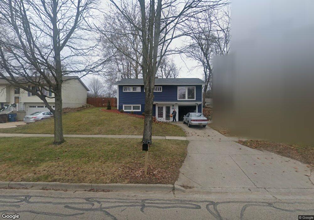
359 Summit Ave NE Rockford, MI 49341
Estimated Value: $282,000 - $344,000
3
Beds
1
Bath
962
Sq Ft
$335/Sq Ft
Est. Value
About This Home
This home is located at 359 Summit Ave NE, Rockford, MI 49341 and is currently estimated at $322,703, approximately $335 per square foot. 359 Summit Ave NE is a home located in Kent County with nearby schools including Valley View Elementary School, North Rockford Middle School, and Rockford High School.
Ownership History
Date
Name
Owned For
Owner Type
Purchase Details
Closed on
Jan 23, 2018
Sold by
Rouse Raeann S and Rouse Robert
Bought by
Rouse Robert
Current Estimated Value
Home Financials for this Owner
Home Financials are based on the most recent Mortgage that was taken out on this home.
Original Mortgage
$118,200
Outstanding Balance
$99,747
Interest Rate
3.94%
Mortgage Type
Purchase Money Mortgage
Estimated Equity
$222,956
Purchase Details
Closed on
Oct 30, 1996
Sold by
Rasmussen David L
Bought by
D.K. Holdings, L.L.C. and Rouse Reann S
Create a Home Valuation Report for This Property
The Home Valuation Report is an in-depth analysis detailing your home's value as well as a comparison with similar homes in the area
Home Values in the Area
Average Home Value in this Area
Purchase History
| Date | Buyer | Sale Price | Title Company |
|---|---|---|---|
| Rouse Robert | -- | None Available | |
| D.K. Holdings, L.L.C. | -- | -- |
Source: Public Records
Mortgage History
| Date | Status | Borrower | Loan Amount |
|---|---|---|---|
| Open | Rouse Robert | $118,200 |
Source: Public Records
Tax History Compared to Growth
Tax History
| Year | Tax Paid | Tax Assessment Tax Assessment Total Assessment is a certain percentage of the fair market value that is determined by local assessors to be the total taxable value of land and additions on the property. | Land | Improvement |
|---|---|---|---|---|
| 2025 | $2,176 | $142,400 | $0 | $0 |
| 2024 | $2,176 | $124,400 | $0 | $0 |
| 2023 | $2,079 | $107,700 | $0 | $0 |
| 2022 | $2,406 | $87,100 | $0 | $0 |
| 2021 | $2,339 | $82,600 | $0 | $0 |
| 2020 | $1,905 | $77,000 | $0 | $0 |
| 2019 | $2,279 | $72,700 | $0 | $0 |
| 2018 | $2,284 | $68,700 | $0 | $0 |
| 2017 | $2,227 | $59,100 | $0 | $0 |
| 2016 | $2,061 | $55,200 | $0 | $0 |
| 2015 | -- | $55,200 | $0 | $0 |
| 2013 | -- | $49,400 | $0 | $0 |
Source: Public Records
Map
Nearby Homes
- 156 Kinross Ct NE
- 273 Summit Ave NE
- 3883 11 Mile Rd NE
- 315 N Main St
- 574 Legacy Ct NE
- 116 Kara Ct
- 678 Elstar Dr NE
- 684 Elstar Dr NE
- 150 Glencarin Dr NE
- 204 Lewis St
- 179 Tamarack Ln NE
- 126 N Monroe St
- 4139 Whirlwind Dr NE Unit 60
- 609 Elstar Dr NE
- 340 Norwood St
- 459 Park Place Dr NE
- 299 Glenbrook Dr
- 165 Hawthorne Ct NE
- 335 Lewis St
- 107 S Main St
- 369 Summit Ave NE
- 353 Summit Ave NE
- 356 Kinross Dr NE
- 128 Glen Eagle Dr NE
- 347 Summit Ave NE
- 350 Kinross Dr NE
- 354 Summit Ave NE
- 341 Summit Ave NE
- 356 Summit Ave NE
- 379 Summit Ave NE
- 350 Summit Ave NE
- 344 Kinross Dr NE
- 123 Glen Eagle Dr NE
- 360 Summit Ave NE
- 129 Glen Eagle Dr NE
- 348 Summit Ave NE
- 338 Kinross Dr NE
- 137 Highland View Ct NE
- 140 Glen Eagle Dr NE
- 333 Summit Ave NE