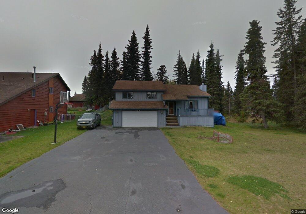
359 W Vine Ave Soldotna, AK 99669
Estimated Value: $147,000 - $405,804
4
Beds
3
Baths
2,074
Sq Ft
$149/Sq Ft
Est. Value
About This Home
This home is located at 359 W Vine Ave, Soldotna, AK 99669 and is currently estimated at $309,201, approximately $149 per square foot. 359 W Vine Ave is a home located in Kenai Peninsula Borough with nearby schools including Redoubt Elementary School, Skyview Middle School, and Soldotna High School.
Ownership History
Date
Name
Owned For
Owner Type
Purchase Details
Closed on
Aug 15, 2005
Sold by
Berrig Sanne
Bought by
Kuntz Betty L and Kuntz Dominic J
Current Estimated Value
Home Financials for this Owner
Home Financials are based on the most recent Mortgage that was taken out on this home.
Original Mortgage
$128,000
Interest Rate
5.56%
Mortgage Type
Purchase Money Mortgage
Purchase Details
Closed on
Feb 8, 2001
Sold by
Moen James A and Moen Anne Cuciti
Bought by
Berrig Sanne
Home Financials for this Owner
Home Financials are based on the most recent Mortgage that was taken out on this home.
Original Mortgage
$124,800
Interest Rate
6.89%
Create a Home Valuation Report for This Property
The Home Valuation Report is an in-depth analysis detailing your home's value as well as a comparison with similar homes in the area
Home Values in the Area
Average Home Value in this Area
Purchase History
| Date | Buyer | Sale Price | Title Company |
|---|---|---|---|
| Kuntz Betty L | -- | -- | |
| Berrig Sanne | -- | -- |
Source: Public Records
Mortgage History
| Date | Status | Borrower | Loan Amount |
|---|---|---|---|
| Closed | Kuntz Betty L | $128,000 | |
| Previous Owner | Berrig Sanne | $124,800 |
Source: Public Records
Tax History Compared to Growth
Tax History
| Year | Tax Paid | Tax Assessment Tax Assessment Total Assessment is a certain percentage of the fair market value that is determined by local assessors to be the total taxable value of land and additions on the property. | Land | Improvement |
|---|---|---|---|---|
| 2025 | -- | $335,800 | $32,800 | $303,000 |
| 2024 | $1,380 | $310,300 | $32,000 | $278,300 |
| 2023 | $1,380 | $281,900 | $29,000 | $252,900 |
| 2022 | $0 | $251,000 | $27,700 | $223,300 |
| 2021 | $1,380 | $248,000 | $22,000 | $226,000 |
| 2020 | $1,492 | $230,800 | $22,000 | $208,800 |
| 2019 | $1,492 | $243,000 | $20,000 | $223,000 |
| 2018 | $1,380 | $218,100 | $20,000 | $198,100 |
| 2017 | $1,403 | $231,100 | $20,000 | $211,100 |
| 2016 | $1,492 | $239,800 | $20,000 | $219,800 |
| 2015 | $1,293 | $229,400 | $20,000 | $209,400 |
| 2014 | $1,293 | $206,600 | $20,000 | $186,600 |
Source: Public Records
Map
Nearby Homes
- 386 W Corral Ave
- 265 Charity Cir
- 169 N Brentwood St
- 000 Ridgewood Dr
- 35868 Everwell Place
- 35856 Everwell Place
- 35840 Everwell Place
- 366 Diane Ln
- 327 Knight Dr
- 256 Upper Rosian Dr
- 35839 Irons Ave
- 35841 Irons Ave
- 35870 Glory St
- 253 Upper Rosian Dr
- 385 W Riverview Ave
- L42 N Aspen Dr
- 235 N Aspen Dr
- 36050 Irons Ave
- 172 Linda Ln
- 36060 Greenridge St
- 353 W Vine Ave
- L16 B3 Rockwell
- L1 B5 Rockwell
- 360 W Rockwell Ave
- 368 W Rockwell Ave
- 255 N Brentwood St
- 373 W Vine Ave
- L4B5 Rockwell
- 360 W Vine Ave
- 374 W Rockwell Ave
- 368 W Vine Ave
- 354 W Vine Ave
- 270 N Brentwood St
- L1 B3 Vine
- 379 W Vine Ave
- L15 B5 Katmai
- L12 B3 Rockwell
- L12 Rockwell
- 374 W Vine Ave
- 382 W Katmai Ave