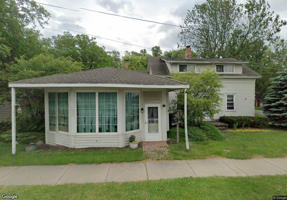
35914 Green St Unit Bldg-Unit New Baltimore, MI 48047
Estimated Value: $239,000 - $346,000
3
Beds
1
Bath
2,100
Sq Ft
$141/Sq Ft
Est. Value
About This Home
This home is located at 35914 Green St Unit Bldg-Unit, New Baltimore, MI 48047 and is currently estimated at $295,958, approximately $140 per square foot. 35914 Green St Unit Bldg-Unit is a home located in Macomb County with nearby schools including Lottie M. Schmidt Elementary School, Anchor Bay Middle School South, and Anchor Bay High School.
Ownership History
Date
Name
Owned For
Owner Type
Purchase Details
Closed on
Aug 31, 2018
Sold by
Lamileo Auto Care Llc
Bought by
Aeck Abbie and Dewitt Dolores
Current Estimated Value
Home Financials for this Owner
Home Financials are based on the most recent Mortgage that was taken out on this home.
Original Mortgage
$118,750
Outstanding Balance
$103,344
Interest Rate
4.5%
Mortgage Type
New Conventional
Estimated Equity
$192,614
Purchase Details
Closed on
Aug 16, 2002
Sold by
Abdelnour Janeth L Trust
Bought by
Lamileo Auto Care Llc
Create a Home Valuation Report for This Property
The Home Valuation Report is an in-depth analysis detailing your home's value as well as a comparison with similar homes in the area
Home Values in the Area
Average Home Value in this Area
Purchase History
| Date | Buyer | Sale Price | Title Company |
|---|---|---|---|
| Aeck Abbie | $125,000 | None Available | |
| Lamileo Auto Care Llc | $159,000 | -- |
Source: Public Records
Mortgage History
| Date | Status | Borrower | Loan Amount |
|---|---|---|---|
| Open | Aeck Abbie | $118,750 |
Source: Public Records
Tax History Compared to Growth
Tax History
| Year | Tax Paid | Tax Assessment Tax Assessment Total Assessment is a certain percentage of the fair market value that is determined by local assessors to be the total taxable value of land and additions on the property. | Land | Improvement |
|---|---|---|---|---|
| 2025 | $4,471 | $116,800 | $0 | $0 |
| 2024 | $2,921 | $117,300 | $0 | $0 |
| 2023 | $2,778 | $102,500 | $0 | $0 |
| 2022 | $3,166 | $86,700 | $0 | $0 |
| 2021 | $3,048 | $83,500 | $0 | $0 |
| 2020 | $2,571 | $84,600 | $0 | $0 |
| 2019 | $2,903 | $71,400 | $0 | $0 |
| 2018 | $3,774 | $65,600 | $0 | $0 |
| 2017 | $3,761 | $65,400 | $30,200 | $35,200 |
| 2016 | $3,731 | $65,400 | $0 | $0 |
| 2015 | -- | $65,600 | $0 | $0 |
| 2014 | -- | $60,800 | $0 | $0 |
Source: Public Records
Map
Nearby Homes
- 1 Hamer St
- 2 Hamer St
- 50716 Taylor St
- 36465 Main St
- 50630 Base St
- 36542 Marquardt Ct
- 51060 Blackwell St
- 51520 Bedford St
- 51400 Ashley St
- 35786 Walden Ct
- 50731 Harbour View Dr N Unit 26
- 50676 Jefferson Ave Unit E-14
- 50578 Woodbury Dr Unit 73
- 50725 Baltimore St
- 53120 Fox Pointe Dr
- 52657 Huntley Ave
- 34697 E Wilma Ct
- 34707 Shorewood St
- 34735 Joel St
- 36285 Jackson St
- 35914 Green St
- 51136 Rose St
- 51149 Taylor St
- 51135 Taylor St
- 35870 Green St
- 35911 Alfred St
- 51125 Taylor St
- 51111 Taylor St
- 35850 Green St
- 35869 Alfred St
- 51130 Taylor St
- 51090 Rose St
- 51237 Taylor St
- 51148 Taylor St
- 51160 Taylor St
- 51136 Taylor St
- 35810 Green St
- 35819 Green St
- 51112 Taylor St
- 51061 Taylor St