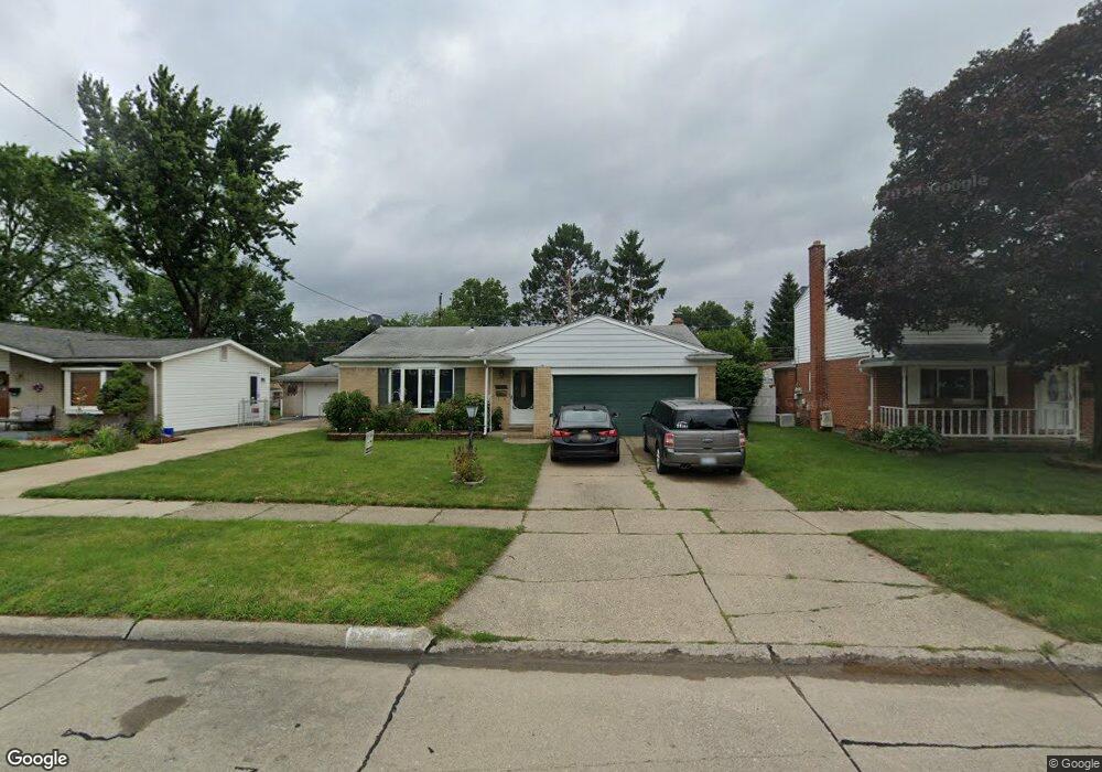
35918 Somerset St Unit Bldg-Unit Westland, MI 48186
Estimated Value: $262,813 - $332,000
3
Beds
2
Baths
1,434
Sq Ft
$197/Sq Ft
Est. Value
About This Home
This home is located at 35918 Somerset St Unit Bldg-Unit, Westland, MI 48186 and is currently estimated at $282,453, approximately $196 per square foot. 35918 Somerset St Unit Bldg-Unit is a home located in Wayne County with nearby schools including Wildwood Elementary School, Marshall Upper Elementary School, and Adlai Stevenson Middle School.
Ownership History
Date
Name
Owned For
Owner Type
Purchase Details
Closed on
Jan 5, 2018
Sold by
Shipman Linda
Bought by
Wright Siccara L
Current Estimated Value
Purchase Details
Closed on
Oct 17, 2017
Sold by
Diangelo Nancy J and Dudde Jack
Bought by
Dudde Jack
Purchase Details
Closed on
May 23, 2013
Sold by
Dudde Mary Jane
Bought by
Dudde Jack L
Purchase Details
Closed on
Dec 31, 2001
Sold by
Demoss Jamie L
Bought by
Dudde Jack L
Home Financials for this Owner
Home Financials are based on the most recent Mortgage that was taken out on this home.
Original Mortgage
$125,600
Interest Rate
7.11%
Purchase Details
Closed on
Nov 13, 2000
Sold by
Forry Carolyn B
Bought by
Taylor Chad J
Create a Home Valuation Report for This Property
The Home Valuation Report is an in-depth analysis detailing your home's value as well as a comparison with similar homes in the area
Home Values in the Area
Average Home Value in this Area
Purchase History
| Date | Buyer | Sale Price | Title Company |
|---|---|---|---|
| Wright Siccara L | $147,000 | None Available | |
| Dudde Jack | -- | None Available | |
| Dudde Jack L | -- | None Available | |
| Dudde Jack L | $157,000 | -- | |
| Taylor Chad J | $153,000 | -- |
Source: Public Records
Mortgage History
| Date | Status | Borrower | Loan Amount |
|---|---|---|---|
| Previous Owner | Dudde Jack L | $125,600 |
Source: Public Records
Tax History Compared to Growth
Tax History
| Year | Tax Paid | Tax Assessment Tax Assessment Total Assessment is a certain percentage of the fair market value that is determined by local assessors to be the total taxable value of land and additions on the property. | Land | Improvement |
|---|---|---|---|---|
| 2025 | $3,412 | $111,700 | $0 | $0 |
| 2024 | $3,412 | $103,300 | $0 | $0 |
| 2023 | $3,258 | $93,400 | $0 | $0 |
| 2022 | $3,750 | $83,300 | $0 | $0 |
| 2021 | $3,657 | $79,800 | $0 | $0 |
| 2020 | $3,617 | $73,100 | $0 | $0 |
| 2019 | $3,486 | $70,200 | $0 | $0 |
| 2018 | $1,756 | $61,400 | $0 | $0 |
| 2017 | $820 | $56,100 | $0 | $0 |
| 2016 | $2,237 | $56,800 | $0 | $0 |
| 2015 | $4,348 | $52,370 | $0 | $0 |
| 2013 | $4,402 | $44,020 | $0 | $0 |
| 2012 | $2,068 | $45,740 | $0 | $0 |
Source: Public Records
Map
Nearby Homes
- 35608 Somerset St
- 36034 Rolf St
- 540 Dartmouth Crescent Ct
- 624 N Parent St
- 612 Bedford Dr
- 36293 Monroe Ave
- 36323 Monroe Ave
- 35720 Glen St
- 35193 Sansburn St
- 344 S Christine
- 35228 Rosslyn St
- 35209 Sheridan St
- 35236 Glen St
- 357 S Dobson St
- 34728 Somerset St
- 34610 School St
- 284 S Byfield St
- 1519 S Dowling St
- 1309 Shoemaker Dr
- 232 S Wildwood St
- 35918 Somerset St
- 35906 Somerset St
- 35930 Somerset St
- 35921 Fernwood St
- 35909 Fernwood St
- 35933 Fernwood St
- 35942 Somerset St
- 35917 Somerset St
- 35945 Fernwood St
- 35905 Somerset St
- 35929 Somerset St
- 35866 Somerset St
- 35954 Somerset St
- 35941 Somerset St
- 35865 Fernwood St
- 35957 Fernwood St
- 0 Fernwood St
- 35854 Somerset St
- 35966 Somerset St
- 35953 Somerset St