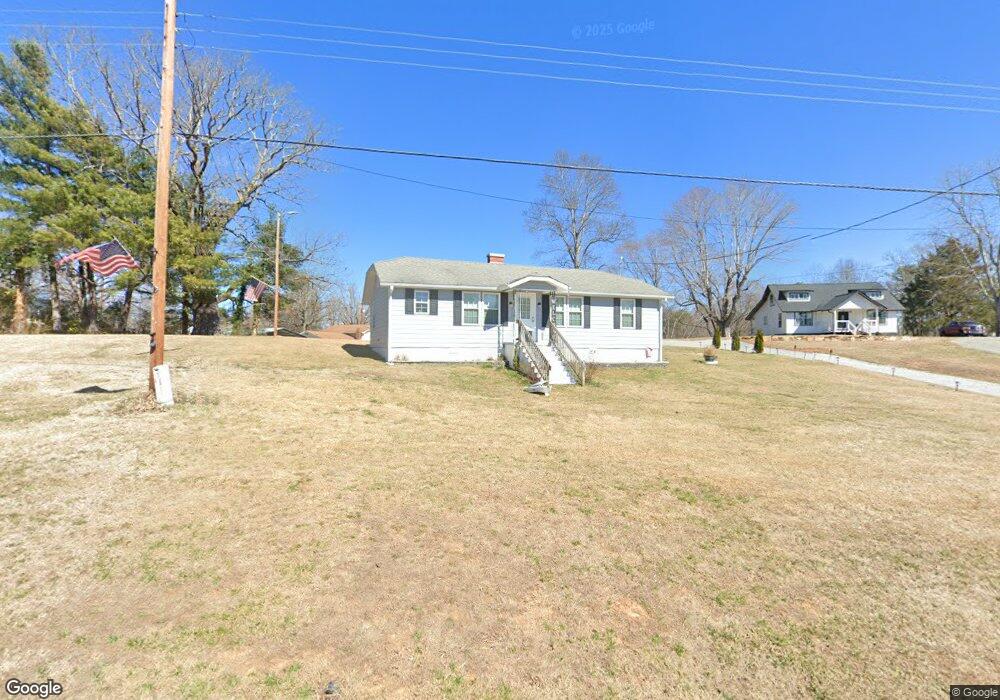
Estimated Value: $100,000 - $538,000
2
Beds
1
Bath
900
Sq Ft
$264/Sq Ft
Est. Value
About This Home
As of August 2017great value that does need attention
Home Details
Home Type
- Single Family
Est. Annual Taxes
- $284
Year Built
- Built in 1949
Lot Details
- 0.5
Parking
- Gravel Driveway
Flooring
- Wood
- Vinyl
Additional Features
- 1 Full Bathroom
- Crawl Space
- Level Lot
- Well
Listing and Financial Details
- Assessor Parcel Number 1723 00 61 9343
Ownership History
Date
Name
Owned For
Owner Type
Purchase Details
Closed on
Oct 13, 2025
Sold by
Burgin Ronnie Melvin and Burgin Debra H
Bought by
Burgin Ronnie Melvin and Burgin Debra H
Current Estimated Value
Purchase Details
Listed on
Aug 1, 2017
Closed on
Aug 2, 2017
Sold by
Beam Dorothy R and Beam Hugh F
Bought by
Burgin Ronnie Melvin
List Price
$28,000
Sold Price
$28,000
Home Financials for this Owner
Home Financials are based on the most recent Mortgage that was taken out on this home.
Avg. Annual Appreciation
29.74%
Purchase Details
Closed on
Dec 1, 1984
Bought by
Beam Dorothy R
Create a Home Valuation Report for This Property
The Home Valuation Report is an in-depth analysis detailing your home's value as well as a comparison with similar homes in the area
Home Values in the Area
Average Home Value in this Area
Purchase History
| Date | Buyer | Sale Price | Title Company |
|---|---|---|---|
| Burgin Ronnie Melvin | -- | None Listed On Document | |
| Burgin Ronnie Melvin | $28,000 | None Available | |
| Beam Dorothy R | $31,500 | -- |
Source: Public Records
Property History
| Date | Event | Price | List to Sale | Price per Sq Ft |
|---|---|---|---|---|
| 08/07/2017 08/07/17 | Sold | $28,000 | 0.0% | $31 / Sq Ft |
| 08/01/2017 08/01/17 | For Sale | $28,000 | -- | $31 / Sq Ft |
Source: Canopy MLS (Canopy Realtor® Association)
Tax History Compared to Growth
Tax History
| Year | Tax Paid | Tax Assessment Tax Assessment Total Assessment is a certain percentage of the fair market value that is determined by local assessors to be the total taxable value of land and additions on the property. | Land | Improvement |
|---|---|---|---|---|
| 2025 | $387 | $57,940 | $20,000 | $37,940 |
| 2024 | $387 | $57,940 | $20,000 | $37,940 |
| 2023 | $387 | $57,940 | $20,000 | $37,940 |
| 2022 | $349 | $51,420 | $12,000 | $39,420 |
| 2021 | $349 | $51,420 | $12,000 | $39,420 |
| 2020 | $354 | $51,420 | $0 | $0 |
| 2019 | $354 | $44,480 | $0 | $0 |
| 2017 | $289 | $44,480 | $0 | $0 |
| 2016 | $289 | $44,480 | $12,000 | $32,480 |
| 2014 | $285 | $44,480 | $12,000 | $32,480 |
| 2013 | -- | $44,480 | $12,000 | $32,480 |
Source: Public Records
Map
Source: Canopy MLS (Canopy Realtor® Association)
MLS Number: CAR18817
APN: 1723-00-61-9343
Nearby Homes
- 489 Ned McGimsey Rd
- 58 Pilot Ridge Dr Unit 29
- 141 Willets Point Blvd
- 488 John Swofford Rd
- 178 Beacon Ridge Dr
- 342 Waters Edge Dr Unit 6-16,7-16,8-16,9-16
- 521 Waters Edge Dr
- 2116 October Dr Unit 146
- 90 High Lake Dr
- 152 Dockside Dr
- Lot 43 Winghaven Dr
- 65 Dockside Dr Unit 2
- TBD Dockside Dr Unit 13A
- 285 High Trail Dr Unit 48-11
- 761 High Trail Dr Unit 39
- 00 High Trail Dr
- 619 High Trail Dr
- 138 & 139 High Trail Dr
- 139 Larkhaven Dr
- 35-12 Sycamore Dr Unit 35-12
- 45 Ned McGimsey Rd
- 61 Ned McGimsey Rd
- 155 Ned McGimsey Rd
- 000 Off Wildlife Rd
- 26 Wildlife Rd
- 186 Wildlife Rd
- 159 Ned McGimsey Rd
- 161 Ned McGimsey Rd
- 150 Mocking Bird Ln Unit 23
- 150 Mocking Bird Ln
- 150 Mocking Bird Dr
- 321 Ned McGimsey Rd
- 359 Ned McGimsey Rd
- 321 Wildlife Rd
- 444 Jack Corpening Rd
- 000 S Mockingbird Dr S
- TBD 5.01 acres Ramsey Dr
- 00 Mt Nebo Dr
- 466 Ned McGimsey Rd
- 389 Wildlife Rd
