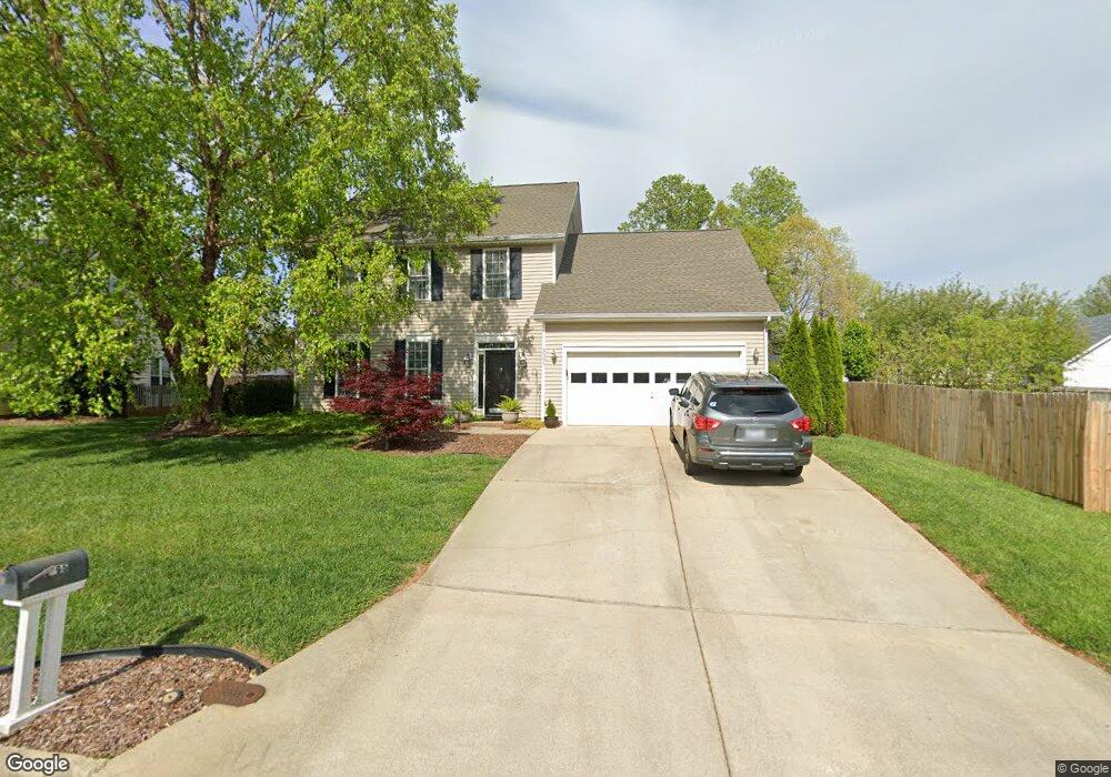
3595 Bent Trace Dr High Point, NC 27265
Bent Tree NeighborhoodEstimated Value: $314,000 - $401,000
3
Beds
3
Baths
2,296
Sq Ft
$158/Sq Ft
Est. Value
About This Home
This home is located at 3595 Bent Trace Dr, High Point, NC 27265 and is currently estimated at $362,321, approximately $157 per square foot. 3595 Bent Trace Dr is a home located in Guilford County with nearby schools including Southwest Elementary School, Southwest Guilford Middle School, and Southwest Guilford High School.
Ownership History
Date
Name
Owned For
Owner Type
Purchase Details
Closed on
Sep 8, 1999
Sold by
Horton D R Inc Greensboro
Bought by
Masi Gary M and Masi Barbara S
Current Estimated Value
Home Financials for this Owner
Home Financials are based on the most recent Mortgage that was taken out on this home.
Original Mortgage
$150,000
Outstanding Balance
$41,675
Interest Rate
7%
Estimated Equity
$320,646
Create a Home Valuation Report for This Property
The Home Valuation Report is an in-depth analysis detailing your home's value as well as a comparison with similar homes in the area
Home Values in the Area
Average Home Value in this Area
Purchase History
| Date | Buyer | Sale Price | Title Company |
|---|---|---|---|
| Masi Gary M | $165,500 | -- |
Source: Public Records
Mortgage History
| Date | Status | Borrower | Loan Amount |
|---|---|---|---|
| Open | Masi Gary M | $150,000 |
Source: Public Records
Tax History
| Year | Tax Paid | Tax Assessment Tax Assessment Total Assessment is a certain percentage of the fair market value that is determined by local assessors to be the total taxable value of land and additions on the property. | Land | Improvement |
|---|---|---|---|---|
| 2025 | $4,149 | $301,100 | $60,000 | $241,100 |
| 2024 | $4,149 | $301,100 | $60,000 | $241,100 |
| 2023 | $4,149 | $301,100 | $60,000 | $241,100 |
| 2022 | $4,059 | $301,100 | $60,000 | $241,100 |
| 2021 | $2,618 | $190,000 | $34,000 | $156,000 |
| 2020 | $2,618 | $190,000 | $34,000 | $156,000 |
| 2019 | $2,618 | $190,000 | $0 | $0 |
| 2018 | $2,605 | $190,000 | $0 | $0 |
| 2017 | $2,618 | $190,000 | $0 | $0 |
| 2016 | $2,527 | $180,200 | $0 | $0 |
| 2015 | $2,541 | $180,200 | $0 | $0 |
| 2014 | $2,584 | $180,200 | $0 | $0 |
Source: Public Records
Map
Nearby Homes
- 4485 Alderny Cir
- 4323 Holstein Dr
- 4413 Edbury Ct
- 3650 Single Leaf Ct
- 770 King Fisher Ln
- 3696 Waterford Oak Ct
- 748 Carneros Cir
- 3855 Thistleberry Rd
- 4346 Trotting Brook Ln
- 3740 Cottesmore Dr
- 3273 Alyssa Way
- 715 Piedmont Crossing Dr Unit 14
- 1515 Skeet Club Rd
- 3023 Maple Branch Dr
- 1517 Skeet Club Rd
- 4716 Willowstone Dr
- 4710 Willowstone Dr
- 4712 Willowstone Dr
- 4714 Willowstone Dr
- 4722 Willowstone Dr
- 3593 Bent Trace Dr
- 3659 Shadow Ridge Dr
- 3663 Shadow Ridge Dr
- 3667 Shadow Ridge Dr
- 3589 Bent Trace Dr
- 4350 Trotting Brook Trail Unit Lot 38
- 4354 Trotting Brook Trail
- 4352 Trotting Brook Trail Unit Lot 37
- 4344 Trotting Brook Trail Unit Lot 41
- 4334 Trotting Brook Trail Unit Lot 45
- 4338 Trotting Brook Trail Unit Lot 43
- 3596 Bent Trace Dr
- 3598 Bent Trace Dr
- 3682 Wood Cove Dr
- 3592 Bent Trace Dr
- 3686 Wood Cove Dr
- 3690 Wood Cove Dr
- 3678 Wood Cove Dr
- 3585 Bent Trace Dr
Your Personal Tour Guide
Ask me questions while you tour the home.