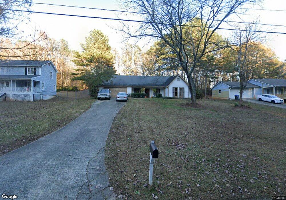
3595 Knoll Crest Trail Buford, GA 30519
Estimated Value: $360,000 - $377,000
3
Beds
2
Baths
1,602
Sq Ft
$230/Sq Ft
Est. Value
About This Home
This home is located at 3595 Knoll Crest Trail, Buford, GA 30519 and is currently estimated at $368,145, approximately $229 per square foot. 3595 Knoll Crest Trail is a home located in Gwinnett County with nearby schools including Patrick Elementary School, Glenn C. Jones Middle School, and Sugar Hill Christian Academy.
Ownership History
Date
Name
Owned For
Owner Type
Purchase Details
Closed on
Jan 11, 1999
Sold by
Osborne Flora Gail
Bought by
Anderson Scott R
Current Estimated Value
Home Financials for this Owner
Home Financials are based on the most recent Mortgage that was taken out on this home.
Original Mortgage
$102,700
Outstanding Balance
$22,673
Interest Rate
6.72%
Mortgage Type
New Conventional
Estimated Equity
$345,472
Create a Home Valuation Report for This Property
The Home Valuation Report is an in-depth analysis detailing your home's value as well as a comparison with similar homes in the area
Home Values in the Area
Average Home Value in this Area
Purchase History
| Date | Buyer | Sale Price | Title Company |
|---|---|---|---|
| Anderson Scott R | $105,900 | -- |
Source: Public Records
Mortgage History
| Date | Status | Borrower | Loan Amount |
|---|---|---|---|
| Open | Anderson Scott R | $102,700 |
Source: Public Records
Tax History Compared to Growth
Tax History
| Year | Tax Paid | Tax Assessment Tax Assessment Total Assessment is a certain percentage of the fair market value that is determined by local assessors to be the total taxable value of land and additions on the property. | Land | Improvement |
|---|---|---|---|---|
| 2025 | $3,232 | $126,760 | $32,800 | $93,960 |
| 2024 | $3,381 | $128,320 | $26,400 | $101,920 |
| 2023 | $3,381 | $96,320 | $29,200 | $67,120 |
| 2022 | $2,217 | $73,760 | $25,600 | $48,160 |
| 2021 | $2,056 | $64,680 | $20,800 | $43,880 |
| 2020 | $2,004 | $61,640 | $18,560 | $43,080 |
| 2019 | $1,816 | $54,960 | $16,400 | $38,560 |
| 2018 | $1,635 | $46,800 | $10,000 | $36,800 |
| 2016 | $1,658 | $46,800 | $10,000 | $36,800 |
| 2015 | $1,674 | $46,800 | $10,000 | $36,800 |
| 2014 | $1,601 | $43,160 | $8,000 | $35,160 |
Source: Public Records
Map
Nearby Homes
- 3570 Knoll Crest Trail
- 1781 Plunketts Rd
- 1510 Oklahoma Dr
- 1785 Plunketts Rd
- 3735 Fir Dr
- 3962 Adler Cir Unit 7
- 4152 Adler Cir Unit 42
- 4202 Adler Cir
- 4002 Adler Cir
- 4202 Adler Cir Unit 47
- 3962 Adler Cir
- 4152 Adler Cir
- 2689 Woodward Down Trail NE
- 3367 Greyhawk Crossing
- 1970 Sturbridge Ln Unit 1
- 3476 Harvest Ridge Ln
- 3410 Coles Creek Dr
- 2040 Harvest Ridge Cir
- 2040 Harvest Ridge Cir NE
- 3605 Knoll Crest Trail
- 3585 Knoll Crest Trail
- 3615 Knoll Crest Trail
- 3575 Knoll Crest Trail
- 3625 Knoll Crest Trail Unit 5
- 3590 Knoll Crest Trail
- 3580 Knoll Crest Trail
- 3565 Knoll Crest Trail
- 3600 Knoll Crest Trail
- 3570 Knoll Crest Trail Unit 15
- 3610 Knoll Crest Trail
- 3635 Knoll Crest Trail
- 3560 Knoll Crest Trail
- 3620 Knoll Crest Trail
- 3645 Knoll Crest Trail
- 3555 Knoll Crest Trail
- 3550 Knoll Crest Trail Unit L13
- 3550 Knoll Crest Trail
- 1701 Plunketts Rd
- 1691 Plunketts Rd