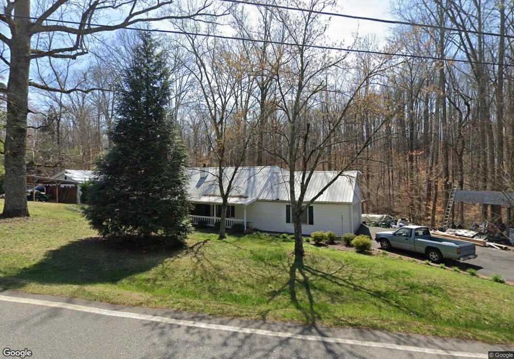
3595 Watson Rd Cumming, GA 30028
Estimated Value: $349,889 - $1,060,000
2
Beds
1
Bath
2,860
Sq Ft
$201/Sq Ft
Est. Value
About This Home
This home is located at 3595 Watson Rd, Cumming, GA 30028 and is currently estimated at $575,722, approximately $201 per square foot. 3595 Watson Rd is a home located in Forsyth County with nearby schools including Poole's Mill Elementary School, Liberty Middle School, and West Forsyth High School.
Ownership History
Date
Name
Owned For
Owner Type
Purchase Details
Closed on
Sep 30, 2022
Sold by
Dodd Charles Lynn
Bought by
Dodd Charles Lynn and Dodd Linda H
Current Estimated Value
Purchase Details
Closed on
Sep 7, 2022
Sold by
Lynn Dodd Charles
Bought by
Dodd Charles Lynn and Dodd Linda H
Purchase Details
Closed on
Nov 22, 2017
Sold by
Dodd Charles Lynn
Bought by
Dodd Charles Lynn and Dodd Linda H
Purchase Details
Closed on
Jul 20, 2005
Sold by
Dodd Horace
Bought by
Welch Sarah
Create a Home Valuation Report for This Property
The Home Valuation Report is an in-depth analysis detailing your home's value as well as a comparison with similar homes in the area
Home Values in the Area
Average Home Value in this Area
Purchase History
| Date | Buyer | Sale Price | Title Company |
|---|---|---|---|
| Dodd Charles Lynn | -- | -- | |
| Dodd Charles Lynn | -- | -- | |
| Dodd Charles Lynn | $80,000 | -- | |
| Dodd Charles Lynn | -- | -- | |
| Welch Sarah | -- | -- |
Source: Public Records
Tax History Compared to Growth
Tax History
| Year | Tax Paid | Tax Assessment Tax Assessment Total Assessment is a certain percentage of the fair market value that is determined by local assessors to be the total taxable value of land and additions on the property. | Land | Improvement |
|---|---|---|---|---|
| 2025 | $294 | $135,272 | $54,672 | $80,600 |
| 2024 | $294 | $108,876 | $31,356 | $77,520 |
| 2023 | $190 | $103,768 | $33,768 | $70,000 |
| 2022 | $302 | $69,920 | $20,520 | $49,400 |
| 2021 | $284 | $69,920 | $20,520 | $49,400 |
| 2020 | $282 | $67,960 | $20,520 | $47,440 |
| 2019 | $280 | $63,000 | $15,960 | $47,040 |
| 2018 | $264 | $42,880 | $15,960 | $26,920 |
| 2017 | $1,084 | $39,040 | $14,440 | $24,600 |
| 2016 | $999 | $36,000 | $11,400 | $24,600 |
| 2015 | $1,001 | $36,000 | $11,400 | $24,600 |
| 2014 | $842 | $31,800 | $9,120 | $22,680 |
Source: Public Records
Map
Nearby Homes
- 3505 Watson Rd
- 4275 Hunters Walk Way
- 4305 Hunters Walk Way
- 4225 Penion Point
- 3975 Silverthorn Trace
- 3875 Deer Run Dr
- 3880 Deer Run Dr
- 3220 Carswell Bend
- 3705 Williams Point Dr
- 3330 Carswell Bend
- 4015 Fouts Dr
- 4059 Yellow Creek Trail
- 2850 Willow Bend Dr
- 3820 Pheasant Run Trace
- 3970 Fouts Dr
- 3525 Montebello Pkwy
- 4845 Haley Farms Dr
- 3830 Williams Point Dr
- 3905 Hurt Bridge Rd
- WESTERLY Plan at Haven Abbey
- 3610 Watson Rd
- 3583 Watson Rd
- 3585 Watson Rd
- 3590 Watson Rd
- 3581 Watson Rd
- 3516 Watson Rd
- 3580 Watson Rd
- 3580 Watson Rd
- 3655 Watson Rd
- 3620 Watson Rd
- 3563 Watson Rd
- 3560 Watson Rd
- 3530 Watson Rd
- 3630 Watson Rd
- 3527 Watson Rd
- 3510 Watson Rd
- 3525 Watson Rd
- 3500 Watson Rd
- 3450 Bridgeshaw Dr
- 3511 Watson Rd