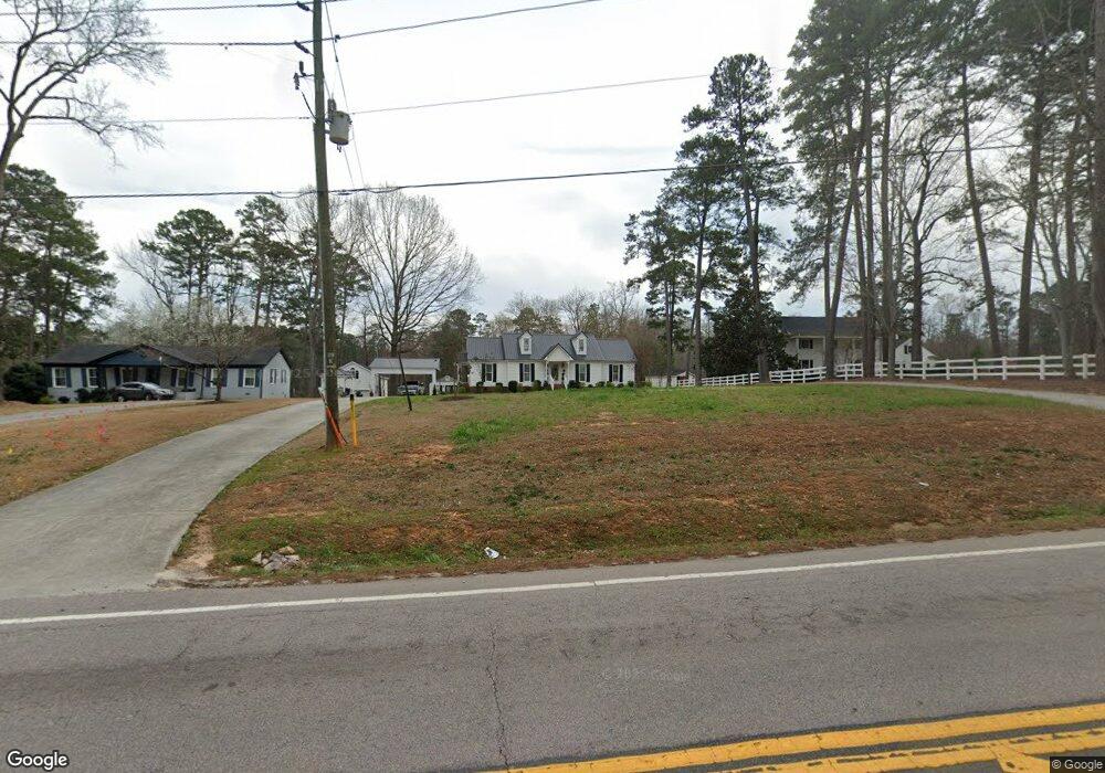
3599 Nc Highway 42 W Clayton, NC 27520
42 West NeighborhoodEstimated Value: $335,000 - $368,000
3
Beds
2
Baths
1,823
Sq Ft
$193/Sq Ft
Est. Value
About This Home
This home is located at 3599 Nc Highway 42 W, Clayton, NC 27520 and is currently estimated at $351,978, approximately $193 per square foot. 3599 Nc Highway 42 W is a home with nearby schools including Cleveland Elementary School, Clayton Middle School, and Cleveland High School.
Ownership History
Date
Name
Owned For
Owner Type
Purchase Details
Closed on
Aug 18, 2020
Sold by
Johnson Deborah Evans
Bought by
Johnson Evan M
Current Estimated Value
Home Financials for this Owner
Home Financials are based on the most recent Mortgage that was taken out on this home.
Original Mortgage
$188,000
Outstanding Balance
$166,769
Interest Rate
3%
Mortgage Type
New Conventional
Estimated Equity
$185,209
Create a Home Valuation Report for This Property
The Home Valuation Report is an in-depth analysis detailing your home's value as well as a comparison with similar homes in the area
Home Values in the Area
Average Home Value in this Area
Purchase History
| Date | Buyer | Sale Price | Title Company |
|---|---|---|---|
| Johnson Evan M | $235,000 | None Available |
Source: Public Records
Mortgage History
| Date | Status | Borrower | Loan Amount |
|---|---|---|---|
| Open | Johnson Evan M | $188,000 |
Source: Public Records
Tax History Compared to Growth
Tax History
| Year | Tax Paid | Tax Assessment Tax Assessment Total Assessment is a certain percentage of the fair market value that is determined by local assessors to be the total taxable value of land and additions on the property. | Land | Improvement |
|---|---|---|---|---|
| 2025 | $1,987 | $312,950 | $72,760 | $240,190 |
| 2024 | $1,432 | $176,750 | $34,920 | $141,830 |
| 2023 | $1,383 | $176,750 | $34,920 | $141,830 |
| 2022 | $1,454 | $176,750 | $34,920 | $141,830 |
| 2021 | $1,454 | $176,750 | $34,920 | $141,830 |
| 2020 | $1,471 | $176,750 | $34,920 | $141,830 |
| 2019 | $1,471 | $176,750 | $34,920 | $141,830 |
| 2018 | $1,236 | $145,030 | $26,190 | $118,840 |
| 2017 | $1,236 | $145,030 | $26,190 | $118,840 |
| 2016 | $1,236 | $145,030 | $26,190 | $118,840 |
| 2015 | $1,243 | $145,830 | $26,990 | $118,840 |
| 2014 | $1,243 | $145,830 | $26,990 | $118,840 |
Source: Public Records
Map
Nearby Homes
- 2004 Spring Valley Dr
- 133 Aleah Ct
- 120 Kelsey Ct
- 116 Bornean Dr
- 212 Long Needle Dr
- Raleigh Plan at Ford Meadows
- Stanley Plan at Ford Meadows
- Ellerbe Plan at Ford Meadows
- Davidson Plan at Ford Meadows
- Drexel Plan at Ford Meadows
- Graham Plan at Ford Meadows
- Cypress Plan at Ford Meadows
- Avery Plan at Ford Meadows
- Wescott Plan at Ford Meadows
- 240 David Ln
- 83 Artic Cir
- 150 Steppe Way
- 143 Steppe Way
- 46 Steppe Way
- 36 Steppe Way
- 3625 Nc Highway 42 W
- 3625 N Carolina 42
- 3615 Nc Highway 42 W
- 3555 Nc Highway 42 W
- 107 Lisann Ct
- 3575 Nc 42 Hwy W
- 108 Lisann Ct
- 103 Lisann Ct
- 3585 Nc Highway 42 W
- 3585 Nc Highway 42 W
- 1 Austin Pond Rd
- 3 Austin Pond Rd
- 104 Lisann Ct
- 79 Austin Pond Rd
- 21 Austin Pond Rd
- 62 Austin Pond Rd
- 23 Austin Pond Rd
- 53 Austin Pond Rd
- 3535 Nc Highway 42 W
- 3693 Nc 42 Hwy