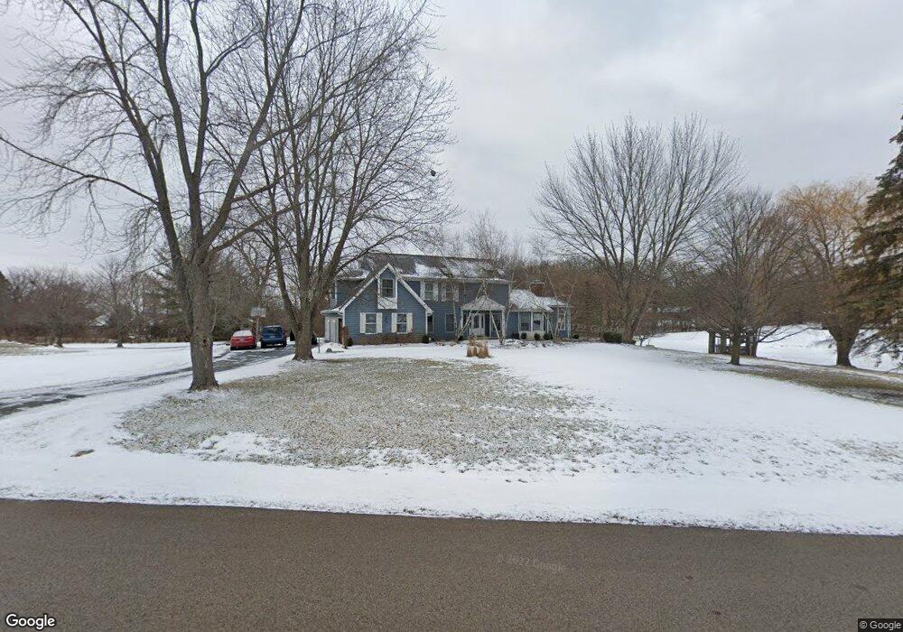
35W529 Parsons Rd Dundee, IL 60118
Estimated Value: $549,000 - $700,000
4
Beds
3
Baths
2,798
Sq Ft
$225/Sq Ft
Est. Value
About This Home
This home is located at 35W529 Parsons Rd, Dundee, IL 60118 and is currently estimated at $628,402, approximately $224 per square foot. 35W529 Parsons Rd is a home located in Kane County with nearby schools including Liberty Elementary School, Dundee Middle School, and Harry D Jacobs High School.
Ownership History
Date
Name
Owned For
Owner Type
Purchase Details
Closed on
Jun 6, 2002
Sold by
Ogara Thomas C and Ogara Suzanne Curry
Bought by
Derosa John H and Gilmore Rebecca C
Current Estimated Value
Home Financials for this Owner
Home Financials are based on the most recent Mortgage that was taken out on this home.
Original Mortgage
$263,200
Outstanding Balance
$112,387
Interest Rate
6.95%
Estimated Equity
$516,015
Purchase Details
Closed on
Nov 3, 1994
Sold by
Suburban Bank Of Barrington
Bought by
Dranka George W and Dranka Sandra
Create a Home Valuation Report for This Property
The Home Valuation Report is an in-depth analysis detailing your home's value as well as a comparison with similar homes in the area
Home Values in the Area
Average Home Value in this Area
Purchase History
| Date | Buyer | Sale Price | Title Company |
|---|---|---|---|
| Derosa John H | $329,000 | Greater Illinois Title Compa | |
| Dranka George W | $93,000 | Chicago Title Insurance Co |
Source: Public Records
Mortgage History
| Date | Status | Borrower | Loan Amount |
|---|---|---|---|
| Open | Derosa John H | $263,200 |
Source: Public Records
Tax History Compared to Growth
Tax History
| Year | Tax Paid | Tax Assessment Tax Assessment Total Assessment is a certain percentage of the fair market value that is determined by local assessors to be the total taxable value of land and additions on the property. | Land | Improvement |
|---|---|---|---|---|
| 2024 | $9,867 | $155,215 | $40,095 | $115,120 |
| 2023 | $9,299 | $139,657 | $36,076 | $103,581 |
| 2022 | $8,380 | $119,940 | $36,076 | $83,864 |
| 2021 | $8,100 | $113,247 | $34,063 | $79,184 |
| 2020 | $7,924 | $110,701 | $33,297 | $77,404 |
| 2019 | $8,729 | $118,056 | $31,609 | $86,447 |
| 2018 | $9,169 | $120,382 | $30,984 | $89,398 |
| 2017 | $8,747 | $112,612 | $28,984 | $83,628 |
| 2016 | $9,409 | $109,036 | $28,064 | $80,972 |
| 2015 | -- | $102,170 | $26,297 | $75,873 |
| 2014 | -- | $96,511 | $25,571 | $70,940 |
| 2013 | -- | $99,465 | $26,354 | $73,111 |
Source: Public Records
Map
Nearby Homes
- 35W543 Miller Rd
- 3404 Green Pastures Rd
- 0000 State Route 31
- 18N732 Westhill Rd
- Route 31 Route
- 3835 Parsons Rd
- 6109 Dunroven Lakes Ct
- 1681 Highmeadow Ln
- 6415 Grassmere Ln
- 5 Lancaster Ct
- 17N448 Il Route 31
- 1551 Westbourne Pkwy
- 1530 Westbourne Pkwy
- 1540 Westbourne Pkwy
- 6 Greyshire Ct
- lot 009 Huntley Rd
- 6850 Huntley Rd
- 7046 Nathan Ln
- 2705 Westwood Cir
- Lot 84 Spruce Dr
- 35W533 Parsons Rd
- 35W527 Parsons Rd
- 35W530 Parsons Rd
- 35W532 Parsons Rd
- 35W535 Parsons Rd
- 35W426 Miller Rd
- 35W525 Parsons Rd
- 35W411 Country School Rd
- 35W528 Parsons Rd
- 35W537 Parsons Rd
- 35W424 Miller Rd
- 35W523 Parsons Rd
- 35W550 Parsons Rd
- 35W526 Parsons Rd
- 35W524 Parsons Rd Unit 1
- 35W547 Parsons Rd
- 35W457 Country School Rd
- 35W640 Parsons Rd
- 35W636 Parsons Rd
- 35W461 Country School Rd