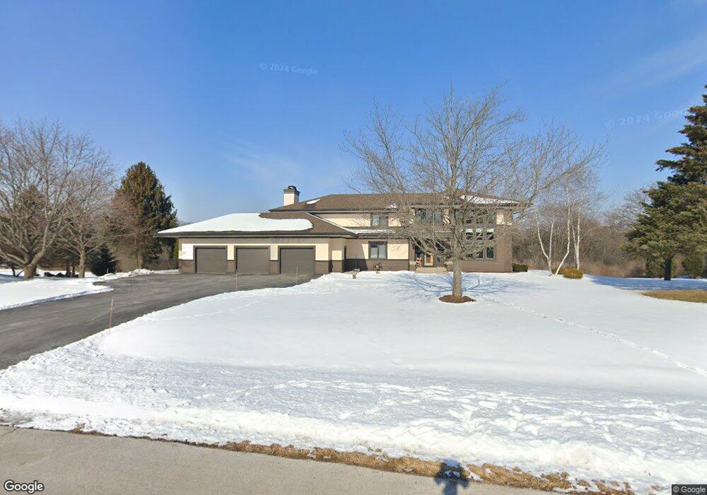
35W611 Parsons Rd Dundee, IL 60118
Estimated Value: $709,576 - $749,000
3
Beds
4
Baths
3,954
Sq Ft
$185/Sq Ft
Est. Value
About This Home
This home is located at 35W611 Parsons Rd, Dundee, IL 60118 and is currently estimated at $730,394, approximately $184 per square foot. 35W611 Parsons Rd is a home located in Kane County with nearby schools including Liberty Elementary School, Dundee Middle School, and Harry D Jacobs High School.
Ownership History
Date
Name
Owned For
Owner Type
Purchase Details
Closed on
Apr 18, 2008
Sold by
Bain Charles E
Bought by
Whalen Emma and Traiforos Mark
Current Estimated Value
Home Financials for this Owner
Home Financials are based on the most recent Mortgage that was taken out on this home.
Original Mortgage
$400,000
Interest Rate
5.88%
Mortgage Type
Purchase Money Mortgage
Purchase Details
Closed on
Jun 27, 1997
Sold by
Bain Cindy Jo
Bought by
Bain Charles E
Home Financials for this Owner
Home Financials are based on the most recent Mortgage that was taken out on this home.
Original Mortgage
$190,000
Interest Rate
8%
Create a Home Valuation Report for This Property
The Home Valuation Report is an in-depth analysis detailing your home's value as well as a comparison with similar homes in the area
Home Values in the Area
Average Home Value in this Area
Purchase History
| Date | Buyer | Sale Price | Title Company |
|---|---|---|---|
| Whalen Emma | $700,000 | Chicago Title Insurance Co | |
| Bain Charles E | -- | Republic Title |
Source: Public Records
Mortgage History
| Date | Status | Borrower | Loan Amount |
|---|---|---|---|
| Closed | Whalen Emma | $400,000 | |
| Previous Owner | Bain Charles E | $190,000 |
Source: Public Records
Tax History Compared to Growth
Tax History
| Year | Tax Paid | Tax Assessment Tax Assessment Total Assessment is a certain percentage of the fair market value that is determined by local assessors to be the total taxable value of land and additions on the property. | Land | Improvement |
|---|---|---|---|---|
| 2024 | $13,169 | $193,805 | $36,790 | $157,015 |
| 2023 | $12,512 | $174,379 | $33,102 | $141,277 |
| 2022 | $11,608 | $156,900 | $33,102 | $123,798 |
| 2021 | $11,608 | $148,145 | $31,255 | $116,890 |
| 2020 | $11,033 | $144,814 | $30,552 | $114,262 |
| 2019 | $12,281 | $156,615 | $29,003 | $127,612 |
| 2018 | $13,373 | $165,523 | $30,984 | $134,539 |
| 2017 | $12,812 | $154,839 | $28,984 | $125,855 |
| 2016 | $13,143 | $149,922 | $28,064 | $121,858 |
| 2015 | -- | $140,482 | $26,297 | $114,185 |
| 2014 | -- | $132,333 | $25,571 | $106,762 |
| 2013 | -- | $136,384 | $26,354 | $110,030 |
Source: Public Records
Map
Nearby Homes
- 18N732 Westhill Rd
- 3404 Green Pastures Rd
- 35W543 Miller Rd
- 0000 State Route 31
- 3835 Parsons Rd
- Route 31 Route
- 1681 Highmeadow Ln
- 5 Lancaster Ct
- 6415 Grassmere Ln
- 6109 Dunroven Lakes Ct
- 1551 Westbourne Pkwy
- 1530 Westbourne Pkwy
- 1540 Westbourne Pkwy
- 6 Greyshire Ct
- 2219 Barrett Dr
- lot 009 Huntley Rd
- 6850 Huntley Rd
- 17N448 Il Route 31
- 7349 Grandview Ct Unit 103
- 2705 Westwood Cir
- 35W625 Parsons Rd
- 35W547 Parsons Rd
- 35W550 Parsons Rd
- 35W636 Parsons Rd
- 35W635 Parsons Rd Unit 2
- 35W537 Parsons Rd
- 35W637 Parsons Rd
- 35W532 Parsons Rd
- 35W640 Parsons Rd
- 35W535 Parsons Rd
- 18N600 Westhill Rd
- 35W645 Parsons Rd
- 35W533 Parsons Rd
- 18N614 Westhill Rd
- 35W530 Parsons Rd
- 35W646 Parsons Rd
- 35W744 Valley View Rd
- 35W741 Valley View Rd
- 35W740 Valley View Rd
- 35W707 Parsons Rd