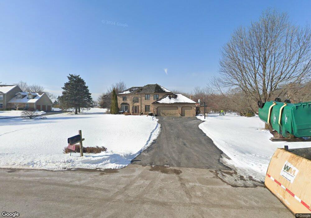
35W837 Parsons Rd Dundee, IL 60118
Estimated Value: $526,668 - $676,000
4
Beds
--
Bath
3,330
Sq Ft
$190/Sq Ft
Est. Value
About This Home
This home is located at 35W837 Parsons Rd, Dundee, IL 60118 and is currently estimated at $633,167, approximately $190 per square foot. 35W837 Parsons Rd is a home located in Kane County with nearby schools including Liberty Elementary School, Dundee Middle School, and West Prairie Middle School.
Ownership History
Date
Name
Owned For
Owner Type
Purchase Details
Closed on
Aug 18, 1999
Sold by
Dalton John T and Callahan Laura B
Bought by
Fessler Arthur J
Current Estimated Value
Home Financials for this Owner
Home Financials are based on the most recent Mortgage that was taken out on this home.
Original Mortgage
$240,000
Outstanding Balance
$64,132
Interest Rate
6.75%
Estimated Equity
$569,035
Create a Home Valuation Report for This Property
The Home Valuation Report is an in-depth analysis detailing your home's value as well as a comparison with similar homes in the area
Home Values in the Area
Average Home Value in this Area
Purchase History
| Date | Buyer | Sale Price | Title Company |
|---|---|---|---|
| Fessler Arthur J | $305,000 | -- |
Source: Public Records
Mortgage History
| Date | Status | Borrower | Loan Amount |
|---|---|---|---|
| Open | Fessler Arthur J | $240,000 |
Source: Public Records
Tax History Compared to Growth
Tax History
| Year | Tax Paid | Tax Assessment Tax Assessment Total Assessment is a certain percentage of the fair market value that is determined by local assessors to be the total taxable value of land and additions on the property. | Land | Improvement |
|---|---|---|---|---|
| 2024 | $10,972 | $162,806 | $36,024 | $126,782 |
| 2023 | $10,414 | $146,487 | $32,413 | $114,074 |
| 2022 | $9,897 | $134,652 | $32,413 | $102,239 |
| 2021 | $9,897 | $127,138 | $30,604 | $96,534 |
| 2020 | $9,401 | $124,280 | $29,916 | $94,364 |
| 2019 | $10,420 | $133,787 | $28,399 | $105,388 |
| 2018 | $11,593 | $144,293 | $30,984 | $113,309 |
| 2017 | $11,103 | $134,979 | $28,984 | $105,995 |
| 2016 | $11,387 | $130,693 | $28,064 | $102,629 |
| 2015 | -- | $122,464 | $26,297 | $96,167 |
| 2014 | -- | $115,485 | $25,571 | $89,914 |
| 2013 | -- | $119,020 | $26,354 | $92,666 |
Source: Public Records
Map
Nearby Homes
- 3404 Green Pastures Rd
- 3314 Blue Ridge Dr
- 3434 Blue Ridge Dr
- 35W543 Miller Rd
- 0000 State Route 31
- 36W340 Huntley Rd
- 6850 Huntley Rd
- lot 009 Huntley Rd
- Route 31 Route
- 36W461 Binnie Rd
- 8304 Sierra Woods Ln Unit 8304
- 36W690 Winding Trail
- 8022 Sierra Woods Ln Unit 8022
- 1950 Broadsmore Dr
- 1530 Westbourne Pkwy
- 1540 Westbourne Pkwy
- 2254 Stonegate Rd
- 17N448 Il Route 31
- 7 Shade Tree Ct Unit 214
- 2304 Stonegate Rd Unit 321
- 35W833 Parsons Rd
- 35W839 Parsons Rd Unit 3
- 35W980 Miller Rd
- 18N250 Sawyer Rd
- 35W834 Parsons Rd
- 35W840 Parsons Rd
- 35W998 Miller Rd
- 3800 Parsons Rd Unit 6
- 18N304 Sawyer Rd
- 35W816 Parsons Rd
- 35W988 Miller Rd
- 3534 High Ridge Rd
- 3420 Green Pastures Rd Unit 6
- 3532 High Ridge Rd
- 3536 High Ridge Rd
- 3802 Parsons Rd Unit 6
- 3418 Green Pastures Rd
- 18N306 Sawyer Rd
- 3538 High Ridge Rd
- 18N301 Sawyer Rd