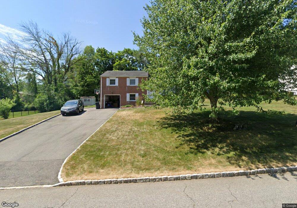
36 Adams Dr Whippany, NJ 07981
Estimated Value: $726,000 - $795,000
Studio
--
Bath
1,624
Sq Ft
$466/Sq Ft
Est. Value
About This Home
This home is located at 36 Adams Dr, Whippany, NJ 07981 and is currently estimated at $756,094, approximately $465 per square foot. 36 Adams Dr is a home located in Morris County with nearby schools including Whippany Park High School, Arrow Academy, and Allegro School.
Ownership History
Date
Name
Owned For
Owner Type
Purchase Details
Closed on
Aug 1, 2008
Sold by
Konikowski Mary Ellen
Bought by
Millichap Matthew M and Millichap Stacy
Current Estimated Value
Home Financials for this Owner
Home Financials are based on the most recent Mortgage that was taken out on this home.
Original Mortgage
$60,000
Outstanding Balance
$39,515
Interest Rate
6.4%
Mortgage Type
Credit Line Revolving
Estimated Equity
$716,579
Purchase Details
Closed on
Sep 29, 2004
Sold by
Konikowski Albert
Bought by
Konikowski Mary
Create a Home Valuation Report for This Property
The Home Valuation Report is an in-depth analysis detailing your home's value as well as a comparison with similar homes in the area
Home Values in the Area
Average Home Value in this Area
Purchase History
| Date | Buyer | Sale Price | Title Company |
|---|---|---|---|
| Millichap Matthew M | $510,000 | None Available | |
| Konikowski Mary | -- | -- |
Source: Public Records
Mortgage History
| Date | Status | Borrower | Loan Amount |
|---|---|---|---|
| Open | Millichap Matthew M | $60,000 | |
| Open | Millichap Matthew M | $350,000 |
Source: Public Records
Tax History
| Year | Tax Paid | Tax Assessment Tax Assessment Total Assessment is a certain percentage of the fair market value that is determined by local assessors to be the total taxable value of land and additions on the property. | Land | Improvement |
|---|---|---|---|---|
| 2025 | $8,390 | $398,000 | $216,500 | $181,500 |
| 2024 | $8,260 | $398,000 | $216,500 | $181,500 |
Source: Public Records
Map
Nearby Homes
- 17 Hilltop Cir
- 601 Monroe Ct
- 201 Monroe Ct
- 68 Fairchild Place
- 42 Gladstone Ct
- 96 Parsippany Rd
- 3 Fillmore Dr
- 27 Wilson Dr
- 103 Woodcrest Dr
- 25 Washington Ave
- 30 Polhemus Terrace
- 104 Ridgedale Ave
- 22 Arrowhead Rd
- 15 S Belair Ave
- 00 Algonquin Pkwy
- 20 Farview Ave
- 4 Punch Bowl Rd
- 100 Louis St
- 3 Vanderbilt Blvd Unit 406
- 4 Forest Hill Ct
Your Personal Tour Guide
Ask me questions while you tour the home.