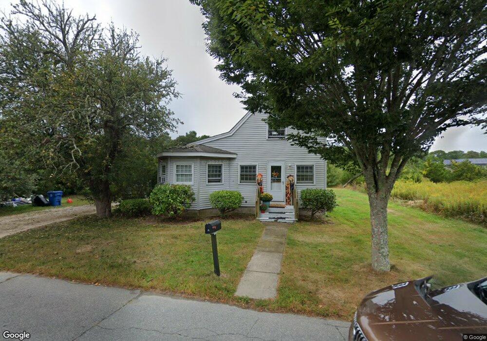
36 Barrows Rd East Falmouth, MA 02536
Estimated Value: $537,149 - $594,000
3
Beds
1
Bath
800
Sq Ft
$703/Sq Ft
Est. Value
About This Home
This home is located at 36 Barrows Rd, East Falmouth, MA 02536 and is currently estimated at $562,037, approximately $702 per square foot. 36 Barrows Rd is a home located in Barnstable County with nearby schools including East Falmouth Elementary School, Morse Pond School, and Lawrence School.
Ownership History
Date
Name
Owned For
Owner Type
Purchase Details
Closed on
Jul 20, 2010
Sold by
Edwards Donna M
Bought by
Sassyoh T T and Sassyoh Edwards
Current Estimated Value
Purchase Details
Closed on
Apr 28, 2000
Sold by
Mrg Dev Corp Inc
Bought by
Edwards Donna M
Purchase Details
Closed on
Dec 21, 1999
Sold by
Family Svc Assn Grtr and Costa
Bought by
Mrg Dev Corp Inc
Create a Home Valuation Report for This Property
The Home Valuation Report is an in-depth analysis detailing your home's value as well as a comparison with similar homes in the area
Home Values in the Area
Average Home Value in this Area
Purchase History
| Date | Buyer | Sale Price | Title Company |
|---|---|---|---|
| Sassyoh T T | -- | -- | |
| Edwards Donna M | $170,000 | -- | |
| Mrg Dev Corp Inc | $165,000 | -- |
Source: Public Records
Mortgage History
| Date | Status | Borrower | Loan Amount |
|---|---|---|---|
| Previous Owner | Mrg Dev Corp Inc | $150,000 | |
| Previous Owner | Mrg Dev Corp Inc | $161,000 | |
| Previous Owner | Mrg Dev Corp Inc | $256,000 | |
| Previous Owner | Mrg Dev Corp Inc | $161,000 |
Source: Public Records
Tax History Compared to Growth
Tax History
| Year | Tax Paid | Tax Assessment Tax Assessment Total Assessment is a certain percentage of the fair market value that is determined by local assessors to be the total taxable value of land and additions on the property. | Land | Improvement |
|---|---|---|---|---|
| 2025 | $2,545 | $433,500 | $216,000 | $217,500 |
| 2024 | $2,459 | $391,500 | $196,000 | $195,500 |
| 2023 | $2,627 | $379,600 | $196,000 | $183,600 |
| 2022 | $2,341 | $290,800 | $123,400 | $167,400 |
| 2021 | $2,320 | $272,900 | $118,000 | $154,900 |
| 2020 | $2,252 | $262,200 | $107,300 | $154,900 |
| 2019 | $2,176 | $254,200 | $107,300 | $146,900 |
| 2018 | $2,161 | $251,300 | $107,300 | $144,000 |
| 2017 | $2,015 | $236,200 | $107,300 | $128,900 |
| 2016 | $1,977 | $236,200 | $107,300 | $128,900 |
| 2015 | $1,906 | $232,700 | $107,300 | $125,400 |
| 2014 | $1,846 | $226,500 | $112,700 | $113,800 |
Source: Public Records
Map
Nearby Homes
- 35 Barrows Rd
- 32 Barrows Rd
- 41 Barrows Rd
- 50 Barrows Rd
- 26 Barrows Rd
- 25 Barrows Rd
- 25 Barrows Rd Unit 2Fam
- 95 Baptiste Ln
- 38 Royal Cir
- 0 Baptiste Unit 72386276
- 0 Baptiste Unit 72285078
- 0 Baptiste Unit 72528046
- 131 Fresh Pond Rd
- 34 Royal Cir
- 58 Barrows Rd
- 37 Leonard Dr
- 17 Barrows Rd
- 96 Baptiste Ln
- 30 Royal Cir
- 121 Fresh Pond Rd