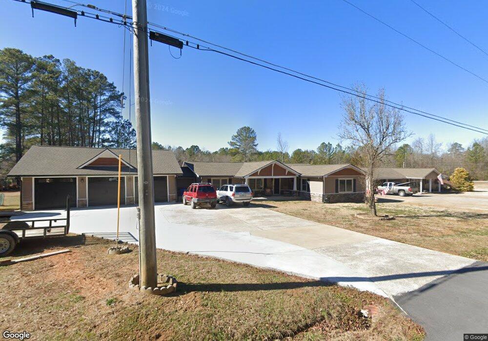
36 Bradshaw Dr Cedartown, GA 30125
Estimated Value: $233,000 - $397,000
3
Beds
3
Baths
2,151
Sq Ft
$143/Sq Ft
Est. Value
About This Home
This home is located at 36 Bradshaw Dr, Cedartown, GA 30125 and is currently estimated at $307,845, approximately $143 per square foot. 36 Bradshaw Dr is a home located in Polk County with nearby schools including Cedar Christian School.
Ownership History
Date
Name
Owned For
Owner Type
Purchase Details
Closed on
Oct 12, 1987
Sold by
Baxter William H
Bought by
Forrister Greg L
Current Estimated Value
Purchase Details
Closed on
Mar 13, 1974
Sold by
Citizens Fed Savings & Loan
Bought by
Baxter William H
Purchase Details
Closed on
Feb 5, 1974
Sold by
Bones Gary Dean
Bought by
Citizens Fed Savings & Loan
Purchase Details
Closed on
Sep 25, 1972
Sold by
Owens Herbert B
Bought by
Bones Gary Dean
Purchase Details
Closed on
Mar 9, 1972
Sold by
Forrister Douglas
Bought by
Owens Herbert B
Purchase Details
Closed on
Jul 3, 1970
Bought by
Forrister Douglas
Create a Home Valuation Report for This Property
The Home Valuation Report is an in-depth analysis detailing your home's value as well as a comparison with similar homes in the area
Home Values in the Area
Average Home Value in this Area
Purchase History
| Date | Buyer | Sale Price | Title Company |
|---|---|---|---|
| Forrister Greg L | $45,000 | -- | |
| Baxter William H | -- | -- | |
| Citizens Fed Savings & Loan | -- | -- | |
| Bones Gary Dean | -- | -- | |
| Owens Herbert B | -- | -- | |
| Forrister Douglas | -- | -- |
Source: Public Records
Tax History Compared to Growth
Tax History
| Year | Tax Paid | Tax Assessment Tax Assessment Total Assessment is a certain percentage of the fair market value that is determined by local assessors to be the total taxable value of land and additions on the property. | Land | Improvement |
|---|---|---|---|---|
| 2024 | $2,548 | $123,876 | $3,200 | $120,676 |
| 2023 | $1,918 | $82,838 | $3,200 | $79,638 |
| 2022 | $1,269 | $55,459 | $3,200 | $52,259 |
| 2021 | $1,285 | $55,459 | $3,200 | $52,259 |
| 2020 | $1,288 | $55,459 | $3,200 | $52,259 |
| 2019 | $1,027 | $40,256 | $1,862 | $38,394 |
| 2018 | $712 | $27,824 | $1,702 | $26,122 |
| 2017 | $703 | $27,824 | $1,702 | $26,122 |
| 2016 | $703 | $27,824 | $1,702 | $26,122 |
| 2015 | $706 | $27,871 | $1,702 | $26,168 |
| 2014 | $711 | $27,871 | $1,702 | $26,168 |
Source: Public Records
Map
Nearby Homes
- 966 Judkin Mill Rd
- 0 Judkin Mill Rd Unit LotWP001 19369404
- 1789 Johnson Lake Rd
- 00 Cornelius Rd
- 0 Old Esom Hill Loop Unit 10611077
- 0 Old Esom Hill Loop Unit 7654342
- 1810 Piedmont Hwy
- 1806 Piedmont Hwy
- 240 Benedict Loop
- 0 Old Potash Rd Unit 7675402
- 0 Old Potash Rd Unit 10636176
- 142 Acres On Judkin Mill Rd
- 0 Wieuca Way Unit 10614129
- 00 Buchanan Hwy
- 000 Wieuca Way
- 1987 Buchanan Hwy
- 35 Harris Loop
- 35 Old Mill Rd
- 1003 Fairview Ave
- 820 Potash Rd
- 26 Bradshaw Dr
- 54 Bradshaw Dr
- 2027 Johnson Lake Rd
- 66 Bradshaw Dr
- 11 Bradshaw Dr
- 2051 Johnson Lake Rd
- 76 Bradshaw Dr
- 0 Cornelius Rd 40 +- Acres Unit 7353168
- 0 Cornelius Rd 34 Acres
- 1974 Johnson Lake Rd
- 98 Bradshaw Dr
- 97 Bradshaw Dr
- 2083 Johnson Lake Rd
- 99 Cornelius Rd
- 70 Cornelius Rd
- 1911 Johnson Lake Rd
- 2099 Johnson Lake Rd
- 2093 Johnson Lake Rd
- 118 Bradshaw Dr
- 94 Cornelius Rd