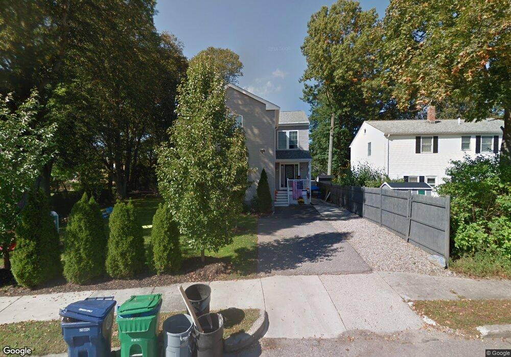
36 Caldon Path Newton, MA 02459
Mount Ida NeighborhoodEstimated Value: $1,579,000 - $1,801,000
4
Beds
3
Baths
2,464
Sq Ft
$686/Sq Ft
Est. Value
About This Home
This home is located at 36 Caldon Path, Newton, MA 02459 and is currently estimated at $1,689,243, approximately $685 per square foot. 36 Caldon Path is a home located in Middlesex County with nearby schools including Memorial Spaulding Elementary School, Oak Hill Middle School, and Newton South High School.
Ownership History
Date
Name
Owned For
Owner Type
Purchase Details
Closed on
Dec 7, 2010
Sold by
Lang Marion and Tramonte Cynthia L
Bought by
Royfman Edward and Breger Dina
Current Estimated Value
Home Financials for this Owner
Home Financials are based on the most recent Mortgage that was taken out on this home.
Original Mortgage
$485,000
Outstanding Balance
$320,430
Interest Rate
4.22%
Mortgage Type
Purchase Money Mortgage
Estimated Equity
$1,368,813
Create a Home Valuation Report for This Property
The Home Valuation Report is an in-depth analysis detailing your home's value as well as a comparison with similar homes in the area
Home Values in the Area
Average Home Value in this Area
Purchase History
| Date | Buyer | Sale Price | Title Company |
|---|---|---|---|
| Royfman Edward | $325,000 | -- |
Source: Public Records
Mortgage History
| Date | Status | Borrower | Loan Amount |
|---|---|---|---|
| Open | Royfman Edward | $485,000 |
Source: Public Records
Tax History
| Year | Tax Paid | Tax Assessment Tax Assessment Total Assessment is a certain percentage of the fair market value that is determined by local assessors to be the total taxable value of land and additions on the property. | Land | Improvement |
|---|---|---|---|---|
| 2025 | $12,042 | $1,228,800 | $620,300 | $608,500 |
| 2024 | $11,644 | $1,193,000 | $602,200 | $590,800 |
| 2023 | $10,998 | $1,080,400 | $453,600 | $626,800 |
| 2022 | $10,524 | $1,000,400 | $420,000 | $580,400 |
| 2021 | $10,155 | $943,800 | $396,200 | $547,600 |
| 2020 | $9,853 | $943,800 | $396,200 | $547,600 |
| 2019 | $9,575 | $916,300 | $384,700 | $531,600 |
| 2018 | $9,133 | $844,100 | $349,300 | $494,800 |
| 2017 | $8,069 | $725,600 | $329,500 | $396,100 |
| 2016 | $6,965 | $612,000 | $307,900 | $304,100 |
| 2015 | $6,641 | $572,000 | $287,800 | $284,200 |
Source: Public Records
Map
Nearby Homes
- 17 Caldon Path
- 90 Mccarthy Rd
- 30 K Roadway
- 25 Cavanaugh Path
- 544 Saw Mill Brook Pkwy
- 36 Ober Rd
- 21 Lovett Rd
- 210 Nahanton St Unit 404
- 50 Lovett Rd
- 577 Baker St Unit 577
- 931 Lagrange St
- 923 Lagrange St
- 28 Cottonwood Rd
- 845 Lagrange St Unit 4
- 17 Tirrell Crescent
- 135 Hartman Rd
- 93 Sevland Rd
- 63 Drumlin Rd
- 41 Juniper Ln
- 16 Dorcar Rd
- 30 Caldon Path
- 8 Early Path
- 35 Caldon Path
- 15 Cibel Path
- 24 Caldon Path
- 9 Callahan Path
- 25 Caldon Path
- 9 Cibel Path
- 18 Caldon Path
- 16 Cibel Path
- 21 Callahan Path
- 689 Saw Mill Brook Pkwy
- 655 Saw Mill Brook Pkwy Unit E
- 655 Saw Mill Brook Pkwy Unit 20
- 655 Saw Mill Brook Pkwy Unit 19
- 655 Saw Mill Brook Pkwy Unit 18
- 655 Saw Mill Brook Pkwy Unit 17
- 655 Saw Mill Brook Pkwy Unit 16
- 655 Saw Mill Brook Pkwy Unit 15
- 655 Saw Mill Brook Pkwy Unit 14