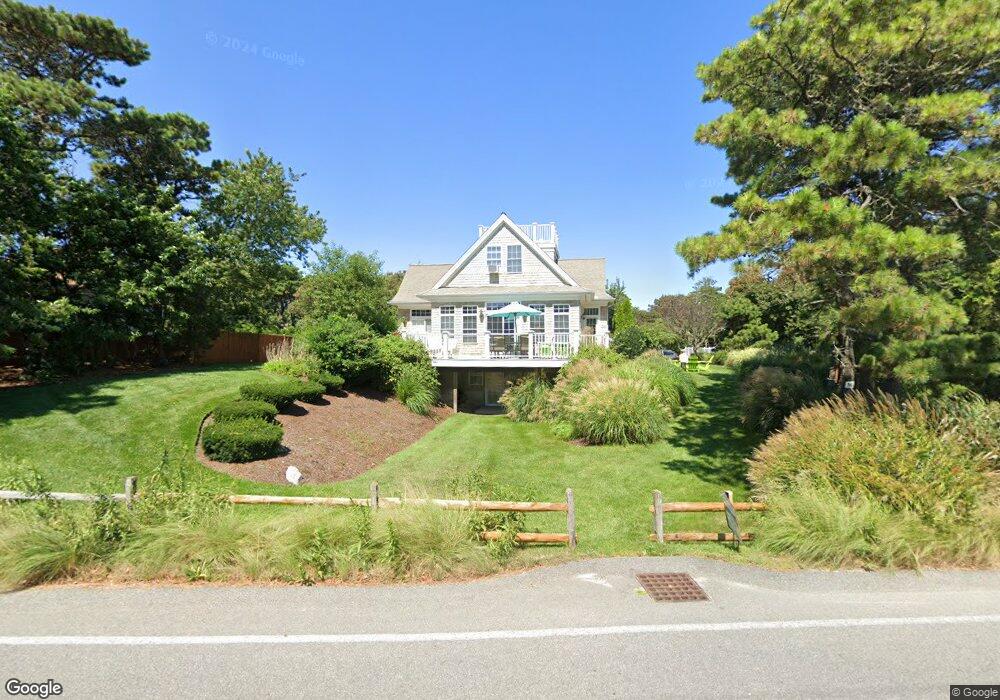
36 Chase Ave Dennis Port, MA 2639
Dennis Port NeighborhoodEstimated Value: $913,000 - $1,502,000
3
Beds
3
Baths
2,015
Sq Ft
$608/Sq Ft
Est. Value
About This Home
This home is located at 36 Chase Ave, Dennis Port, MA 2639 and is currently estimated at $1,224,461, approximately $607 per square foot. 36 Chase Ave is a home located in Barnstable County with nearby schools including Dennis-Yarmouth Regional High School and St. Pius X. School.
Ownership History
Date
Name
Owned For
Owner Type
Purchase Details
Closed on
May 10, 2016
Sold by
Corsair Resort Motel R
Bought by
Downey Brothers Nt
Current Estimated Value
Purchase Details
Closed on
Mar 18, 2011
Sold by
Goodhall Ruth C
Bought by
Corsair Resort Motel T
Home Financials for this Owner
Home Financials are based on the most recent Mortgage that was taken out on this home.
Original Mortgage
$728,500
Interest Rate
4.84%
Mortgage Type
Purchase Money Mortgage
Create a Home Valuation Report for This Property
The Home Valuation Report is an in-depth analysis detailing your home's value as well as a comparison with similar homes in the area
Home Values in the Area
Average Home Value in this Area
Purchase History
| Date | Buyer | Sale Price | Title Company |
|---|---|---|---|
| Downey Brothers Nt | -- | -- | |
| Corsair Resort Motel T | $490,000 | -- |
Source: Public Records
Mortgage History
| Date | Status | Borrower | Loan Amount |
|---|---|---|---|
| Previous Owner | Corsair Resort Motel T | $728,500 |
Source: Public Records
Tax History Compared to Growth
Tax History
| Year | Tax Paid | Tax Assessment Tax Assessment Total Assessment is a certain percentage of the fair market value that is determined by local assessors to be the total taxable value of land and additions on the property. | Land | Improvement |
|---|---|---|---|---|
| 2025 | $5,409 | $1,249,100 | $433,200 | $815,900 |
| 2024 | $5,488 | $1,250,100 | $416,600 | $833,500 |
| 2023 | $5,346 | $1,144,800 | $378,700 | $766,100 |
| 2022 | $4,808 | $858,500 | $357,000 | $501,500 |
| 2021 | $4,735 | $785,300 | $350,000 | $435,300 |
| 2020 | $4,606 | $755,000 | $388,900 | $366,100 |
| 2019 | $4,505 | $730,100 | $381,300 | $348,800 |
| 2018 | $4,164 | $656,800 | $304,900 | $351,900 |
| 2017 | $4,280 | $695,900 | $304,900 | $391,000 |
| 2016 | $4,117 | $630,400 | $297,600 | $332,800 |
| 2015 | $4,035 | $630,400 | $297,600 | $332,800 |
| 2014 | $4,027 | $634,200 | $290,400 | $343,800 |
Source: Public Records
Map
Nearby Homes
- 11 Ocean Park W
- 9 Chase Ave Unit 6
- 405 Old Wharf Rd Unit B204
- 405 Old Wharf Rd Unit B204
- 402 Old Wharf Rd
- 402 Old Wharf Rd
- 1 E Belmont Unit 630
- 1 Belmont Rd Unit 630
- 1 Belmont Rd Unit 513
- 102 Sea St
- 26 Manning Rd
- 22 Ferncliff Rd
- 12 Cross St
- 159 Center St Unit 22
- 3 Fairbanks Dr
- 37-A Beach Hills Rd
- 37 Beach Hills Rd
- 73 Division St
- 262 Old Wharf Rd Unit 67
- 262 Old Wharf Rd Unit 5
- 26 Chase St
- 44 Chase Ave
- 11 Birch Hill Rd
- 14 Ocean Park E
- 5 Ocean Park E Unit 27
- 5 Ocean Park E
- 5 Ocean Park E Unit 28
- 46 Chase Ave
- 8 Ocean Dr
- 0 Chase Ave
- 12 Birch Hill Rd
- 0 Ocean Park E Unit 1
- 3 Albert Rd
- 5 Albert Rd
- 41 Chase Ave Unit 16
- 41 Chase Ave Unit 25
- 41 Chase Ave Unit 7
- 41 Chase Ave Unit 3
- 41 Chase Ave Unit 17
- 41 Chase Ave Unit 12