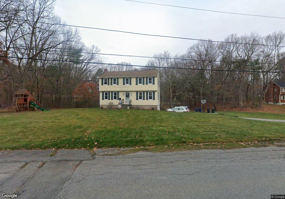
36 Colonial Dr Dracut, MA 01826
Estimated Value: $632,591 - $728,000
4
Beds
2
Baths
1,800
Sq Ft
$378/Sq Ft
Est. Value
About This Home
This home is located at 36 Colonial Dr, Dracut, MA 01826 and is currently estimated at $680,398, approximately $377 per square foot. 36 Colonial Dr is a home located in Middlesex County with nearby schools including Joseph A. Campbell Elementary School, Richardson Middle School, and Dracut Senior High School.
Ownership History
Date
Name
Owned For
Owner Type
Purchase Details
Closed on
May 14, 2010
Sold by
Nielsen Robert E and Nielsen Linda M
Bought by
Brown Jarrod and Brown Ashleigh
Current Estimated Value
Home Financials for this Owner
Home Financials are based on the most recent Mortgage that was taken out on this home.
Original Mortgage
$315,748
Outstanding Balance
$212,254
Interest Rate
5.11%
Mortgage Type
Purchase Money Mortgage
Estimated Equity
$468,144
Purchase Details
Closed on
Nov 30, 1993
Sold by
Quinn Judith
Bought by
Nielsen Robert and Nielsen Linda
Home Financials for this Owner
Home Financials are based on the most recent Mortgage that was taken out on this home.
Original Mortgage
$151,900
Interest Rate
6.72%
Mortgage Type
Purchase Money Mortgage
Purchase Details
Closed on
Jun 5, 1987
Sold by
Towell Andrew R
Bought by
Quinn Edward B
Home Financials for this Owner
Home Financials are based on the most recent Mortgage that was taken out on this home.
Original Mortgage
$114,000
Interest Rate
10.38%
Mortgage Type
Purchase Money Mortgage
Create a Home Valuation Report for This Property
The Home Valuation Report is an in-depth analysis detailing your home's value as well as a comparison with similar homes in the area
Home Values in the Area
Average Home Value in this Area
Purchase History
| Date | Buyer | Sale Price | Title Company |
|---|---|---|---|
| Brown Jarrod | $320,000 | -- | |
| Nielsen Robert | $159,900 | -- | |
| Quinn Edward B | $205,000 | -- |
Source: Public Records
Mortgage History
| Date | Status | Borrower | Loan Amount |
|---|---|---|---|
| Open | Brown Jarrod | $315,748 | |
| Previous Owner | Quinn Edward B | $23,000 | |
| Previous Owner | Quinn Edward B | $151,900 | |
| Previous Owner | Quinn Edward B | $115,000 | |
| Previous Owner | Quinn Edward B | $114,000 |
Source: Public Records
Tax History
| Year | Tax Paid | Tax Assessment Tax Assessment Total Assessment is a certain percentage of the fair market value that is determined by local assessors to be the total taxable value of land and additions on the property. | Land | Improvement |
|---|---|---|---|---|
| 2025 | $5,529 | $546,300 | $251,600 | $294,700 |
| 2024 | $5,332 | $510,200 | $239,700 | $270,500 |
| 2023 | $5,162 | $445,800 | $208,500 | $237,300 |
| 2022 | $5,018 | $408,300 | $189,600 | $218,700 |
| 2021 | $4,980 | $382,800 | $172,200 | $210,600 |
| 2020 | $4,837 | $362,300 | $167,000 | $195,300 |
| 2019 | $4,641 | $337,500 | $159,000 | $178,500 |
| 2018 | $9,345 | $329,900 | $159,000 | $170,900 |
| 2017 | $0 | $329,900 | $159,000 | $170,900 |
| 2016 | $4,719 | $318,000 | $159,800 | $158,200 |
| 2015 | $4,582 | $306,900 | $159,800 | $147,100 |
| 2014 | $4,309 | $297,400 | $159,800 | $137,600 |
Source: Public Records
Map
Nearby Homes
- 277 Loon Hill Rd
- 315 Broadway Rd Unit 1
- 315 Broadway Rd Unit 7
- 10 Lanseigne St
- 287 Fox Ave
- 785 Broadway Rd
- 84 Tellier Way
- 144 Thissell Ave Unit 11
- 30 Parker Rd
- 4 Hazelwood Ave Unit 12
- 69 Arlington St
- 700 Robbins Ave Unit 6
- 668 Robbins Ave Unit 1
- 40 Arlington Ave
- 170 E Richardson Rd
- 11 Joseph Ave
- 175 Willard St Unit 9
- 89 Newbury St
- 1391 Bridge St
- 1563 Bridge St
- 54 Colonial Dr
- 26 Colonial Dr
- 187 Trout Brook Rd
- 39 Colonial Dr
- 49 Colonial Dr
- 31 Colonial Dr
- 177 Trout Brook Rd
- 62 Colonial Dr
- 16 Colonial Dr
- 59 Colonial Dr
- 167 Trout Brook Rd
- 207 Trout Brook Rd
- 197 Trout Brook Rd
- 19 Colonial Dr
- 157 Trout Brook Rd
- 72 Colonial Dr
- 69 Colonial Dr
- 217 Trout Brook Rd
- 176 Trout Brook Rd
- 6 Colonial Dr
Your Personal Tour Guide
Ask me questions while you tour the home.