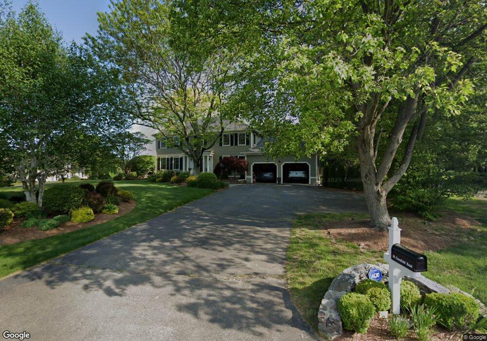
36 Cornfield Rd Trumbull, CT 06611
Trumbull Center NeighborhoodEstimated Value: $1,068,834 - $1,188,000
4
Beds
4
Baths
3,536
Sq Ft
$321/Sq Ft
Est. Value
About This Home
This home is located at 36 Cornfield Rd, Trumbull, CT 06611 and is currently estimated at $1,135,709, approximately $321 per square foot. 36 Cornfield Rd is a home located in Fairfield County with nearby schools including Booth Hill School, Hillcrest Middle School, and Trumbull High School.
Ownership History
Date
Name
Owned For
Owner Type
Purchase Details
Closed on
Jan 15, 2004
Sold by
Malski Kathryn A and Malski James A
Bought by
Donegan Patrick and Donegan Mary Ellen
Current Estimated Value
Purchase Details
Closed on
May 27, 1999
Sold by
York Theodore C and York Penelope
Bought by
Malski Kathryn A and Malski James J
Create a Home Valuation Report for This Property
The Home Valuation Report is an in-depth analysis detailing your home's value as well as a comparison with similar homes in the area
Home Values in the Area
Average Home Value in this Area
Purchase History
| Date | Buyer | Sale Price | Title Company |
|---|---|---|---|
| Donegan Patrick | $745,000 | -- | |
| Malski Kathryn A | $505,000 | -- |
Source: Public Records
Mortgage History
| Date | Status | Borrower | Loan Amount |
|---|---|---|---|
| Open | Malski Kathryn A | $107,175 | |
| Open | Malski Kathryn A | $520,000 | |
| Closed | Malski Kathryn A | $540,000 |
Source: Public Records
Tax History
| Year | Tax Paid | Tax Assessment Tax Assessment Total Assessment is a certain percentage of the fair market value that is determined by local assessors to be the total taxable value of land and additions on the property. | Land | Improvement |
|---|---|---|---|---|
| 2025 | $18,931 | $512,190 | $170,030 | $342,160 |
| 2024 | $18,387 | $512,190 | $170,030 | $342,160 |
| 2023 | $18,106 | $512,190 | $170,030 | $342,160 |
| 2022 | $17,827 | $512,190 | $170,030 | $342,160 |
| 2021 | $16,838 | $468,300 | $173,880 | $294,420 |
| 2020 | $16,838 | $468,300 | $173,880 | $294,420 |
| 2018 | $16,470 | $468,300 | $173,880 | $294,420 |
| 2017 | $16,156 | $468,300 | $173,880 | $294,420 |
| 2016 | $15,133 | $447,020 | $173,880 | $273,140 |
| 2015 | $14,525 | $431,000 | $173,900 | $257,100 |
| 2014 | $14,214 | $431,000 | $173,900 | $257,100 |
Source: Public Records
Map
Nearby Homes
- 40 Puritan Rd
- 22 Beverly Rd
- 7 E Lake Rd
- 0 Lot #4 & Lot #5 W Mischa Rd Unit 24138429
- 3 Wheeler Dr
- 85 Teeter Rock Rd
- 68 Old Dike Rd
- 220 Hilltop Cir
- 101 Golden Hill St
- 0 Pinewood Trail
- 60 Quail Trail
- 38 Macdonald Rd
- 2449 Huntington Turnpike
- 9 Sunnyridge Pkwy
- 11 Knollcrest Dr
- 10 Foxwood Rd
- 244 Strobel Rd
- 877 White Plains Rd
- 58 Daniels Farm Rd
- 176 Strobel Rd
- 32 Cornfield Rd
- 70 Puritan Rd
- 63 Puritan Rd
- 67 Puritan Rd
- 33 Cornfield Rd
- 59 Puritan Rd
- 37 Cornfield Rd
- 74 Puritan Rd
- 43 Old Dairy Rd
- 71 Puritan Rd
- 55 Puritan Rd
- 37 Old Dairy Rd
- 47 Old Dairy Rd
- 50 Puritan Rd
- 37 Robinwood Rd
- 39 Robinwood Rd
- 35 Robinwood Rd
- 45 Robinwood Rd
- 31 Old Dairy Rd
- 51 Puritan Rd
Your Personal Tour Guide
Ask me questions while you tour the home.