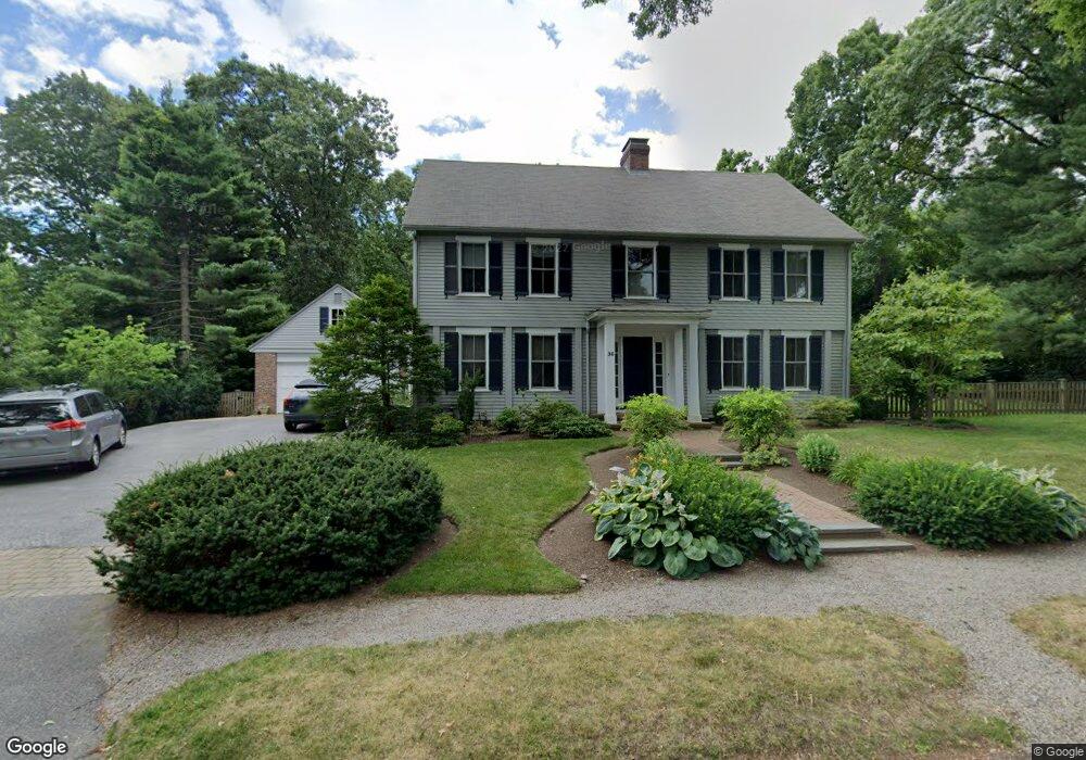
36 Denny Rd Chestnut Hill, MA 02467
Chestnut Hill NeighborhoodEstimated Value: $2,906,000 - $4,020,000
6
Beds
4
Baths
3,258
Sq Ft
$1,061/Sq Ft
Est. Value
About This Home
This home is located at 36 Denny Rd, Chestnut Hill, MA 02467 and is currently estimated at $3,456,029, approximately $1,060 per square foot. 36 Denny Rd is a home located in Norfolk County with nearby schools including Heath Elementary School, Brimmer & May School, and The Chestnut Hill School.
Ownership History
Date
Name
Owned For
Owner Type
Purchase Details
Closed on
Jun 25, 2008
Sold by
36 Denney Road Broo Rt
Bought by
Karlen Frances W and Karlen Jon E
Current Estimated Value
Home Financials for this Owner
Home Financials are based on the most recent Mortgage that was taken out on this home.
Original Mortgage
$1,443,750
Interest Rate
6.07%
Mortgage Type
Purchase Money Mortgage
Purchase Details
Closed on
Nov 7, 2006
Sold by
Anthony Pamela Tw
Bought by
36 Denny Rd Brooklin R
Home Financials for this Owner
Home Financials are based on the most recent Mortgage that was taken out on this home.
Original Mortgage
$1,046,000
Interest Rate
6.47%
Mortgage Type
Purchase Money Mortgage
Purchase Details
Closed on
Dec 30, 1999
Sold by
Reed Dena M and Reed James T
Bought by
Denny Rd Brookline Rt
Home Financials for this Owner
Home Financials are based on the most recent Mortgage that was taken out on this home.
Original Mortgage
$1,046,000
Interest Rate
7.71%
Mortgage Type
Purchase Money Mortgage
Purchase Details
Closed on
Nov 30, 1994
Sold by
Williams Margaret C and Williams Ralph B
Bought by
Reed Dena M and Reed James T
Create a Home Valuation Report for This Property
The Home Valuation Report is an in-depth analysis detailing your home's value as well as a comparison with similar homes in the area
Home Values in the Area
Average Home Value in this Area
Purchase History
| Date | Buyer | Sale Price | Title Company |
|---|---|---|---|
| Karlen Frances W | $1,925,000 | -- | |
| 36 Denny Rd Brooklin R | -- | -- | |
| Anthony Pamela Tw | -- | -- | |
| Denny Rd Brookline Rt | $1,395,000 | -- | |
| Reed Dena M | $505,000 | -- |
Source: Public Records
Mortgage History
| Date | Status | Borrower | Loan Amount |
|---|---|---|---|
| Open | Reed Dena M | $1,323,750 | |
| Closed | Karlen Frances W | $1,443,750 | |
| Closed | Karlen Frances W | $96,250 | |
| Previous Owner | Anthony Pamela Tw | $1,046,000 | |
| Previous Owner | Reed Dena M | $1,046,000 |
Source: Public Records
Tax History Compared to Growth
Tax History
| Year | Tax Paid | Tax Assessment Tax Assessment Total Assessment is a certain percentage of the fair market value that is determined by local assessors to be the total taxable value of land and additions on the property. | Land | Improvement |
|---|---|---|---|---|
| 2025 | $34,947 | $3,540,700 | $1,509,500 | $2,031,200 |
| 2024 | $33,318 | $3,410,200 | $1,451,500 | $1,958,700 |
| 2023 | $31,033 | $3,112,600 | $1,192,000 | $1,920,600 |
| 2022 | $30,206 | $2,964,300 | $1,135,200 | $1,829,100 |
| 2021 | $27,933 | $2,850,300 | $1,091,500 | $1,758,800 |
| 2020 | $25,772 | $2,727,200 | $992,300 | $1,734,900 |
| 2019 | $24,337 | $2,597,300 | $945,000 | $1,652,300 |
| 2018 | $24,511 | $2,591,000 | $950,400 | $1,640,600 |
| 2017 | $24,151 | $2,444,400 | $896,600 | $1,547,800 |
| 2016 | $23,804 | $2,284,500 | $837,900 | $1,446,600 |
| 2015 | $21,030 | $1,969,100 | $783,100 | $1,186,000 |
| 2014 | $22,016 | $1,932,900 | $711,900 | $1,221,000 |
Source: Public Records
Map
Nearby Homes
- 142 Crafts Rd
- 1014 Boylston St
- 76 Norfolk Rd
- 174 Middlesex Rd
- 335 Heath St
- 130 Cabot St
- 88 Cutler Ln
- 30 Ackers Ave
- 55 Reservoir Rd Unit 2
- 675 Chestnut Hill Ave
- 540 Chestnut Hill Ave
- 2400 Beacon St Unit 112
- 0 Glenoe Rd
- 85 Gate House Rd
- 3 Glenoe Rd
- 9 Willard Rd
- 6 Sutherland Rd Unit 41
- 138 Woodland Rd
- 44 Orkney Rd Unit 3
- 39 Clyde St