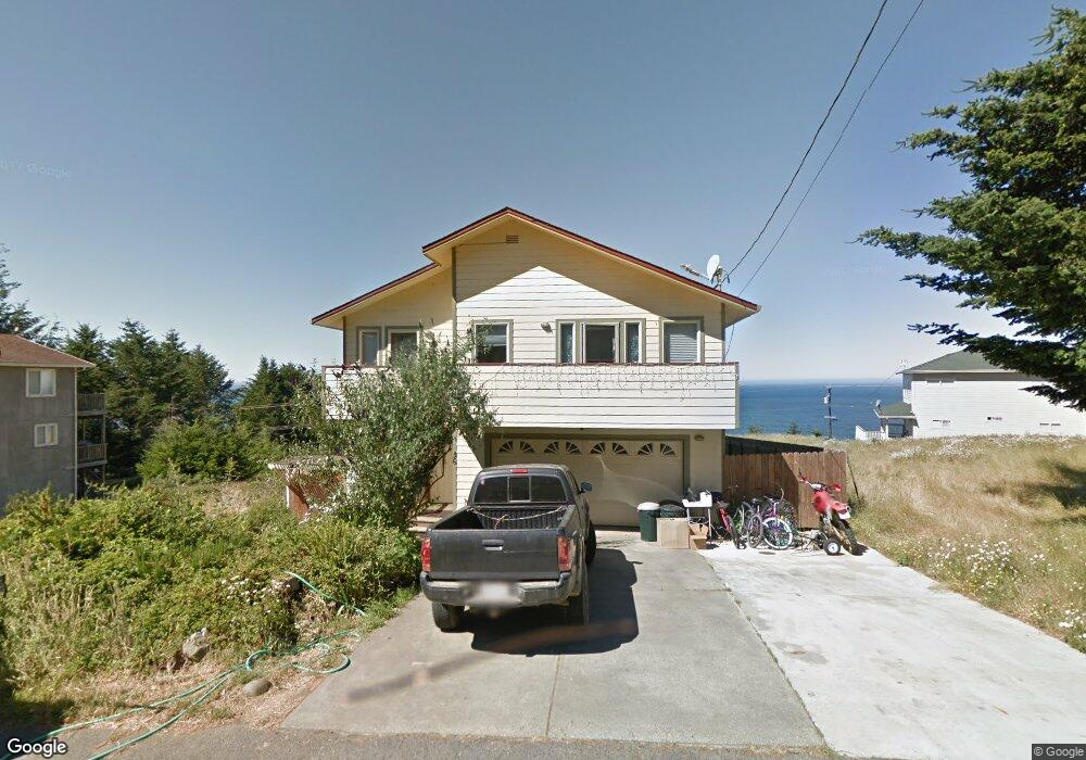
36 Du Luard Rd Whitethorn, CA 95589
Estimated Value: $608,000 - $651,000
Studio
--
Bath
--
Sq Ft
21,257
Sq Ft Lot
About This Home
This home is located at 36 Du Luard Rd, Whitethorn, CA 95589 and is currently estimated at $625,581. 36 Du Luard Rd is a home located in Humboldt County.
Ownership History
Date
Name
Owned For
Owner Type
Purchase Details
Closed on
Dec 8, 2004
Sold by
Vanderpool Richard and Vanderpool Blubell
Bought by
Snodgrass Eryn R
Current Estimated Value
Home Financials for this Owner
Home Financials are based on the most recent Mortgage that was taken out on this home.
Original Mortgage
$318,000
Interest Rate
5.81%
Mortgage Type
New Conventional
Purchase Details
Closed on
Jan 23, 2001
Sold by
Vanderpool Richard L and Vanderpool Bluebell M
Bought by
Vanderpool Richard and Vanderpool Blubell
Create a Home Valuation Report for This Property
The Home Valuation Report is an in-depth analysis detailing your home's value as well as a comparison with similar homes in the area
Home Values in the Area
Average Home Value in this Area
Purchase History
| Date | Buyer | Sale Price | Title Company |
|---|---|---|---|
| Snodgrass Eryn R | $397,500 | First American Title Ins Co | |
| White Kathryn P | $80,000 | First American Title Ins Co | |
| Vanderpool Richard | -- | -- |
Source: Public Records
Mortgage History
| Date | Status | Borrower | Loan Amount |
|---|---|---|---|
| Previous Owner | Snodgrass Eryn R | $318,000 | |
| Closed | Snodgrass Eryn R | $39,750 |
Source: Public Records
Tax History
| Year | Tax Paid | Tax Assessment Tax Assessment Total Assessment is a certain percentage of the fair market value that is determined by local assessors to be the total taxable value of land and additions on the property. | Land | Improvement |
|---|---|---|---|---|
| 2025 | $6,779 | $598,000 | $175,000 | $423,000 |
| 2024 | $6,779 | $598,000 | $175,000 | $423,000 |
| 2023 | $6,932 | $598,000 | $175,000 | $423,000 |
| 2022 | $6,956 | $598,000 | $175,000 | $423,000 |
| 2021 | $4,922 | $433,000 | $85,000 | $348,000 |
| 2020 | $4,999 | $433,000 | $85,000 | $348,000 |
| 2019 | $4,897 | $426,400 | $85,000 | $341,400 |
| 2018 | $4,906 | $426,400 | $85,000 | $341,400 |
Source: Public Records
Map
Nearby Homes
- 26 Rd
- 88 Shaker Rd
- 156 Shaker Rd
- 90 Spur Ct
- 190 Shaker Rd
- 155 Seafoam Rd
- 60 Spruce Rd
- 22 Spruce Ct
- 112 Seafoam Rd
- 189 & 177 Hickory Rd
- 129 & 143 Lower Pacific Dr
- 865 Upper Pacific Dr
- 124 Albatross Rd
- 245 Albatross Rd
- 30 Fir Ct
- 134 Albatross Rd
- 1325&1335 Upper Pacific Dr
- 93 Dolphin Dr
- 170 Wave Dr
- 5 Cinch Ct
Your Personal Tour Guide
Ask me questions while you tour the home.