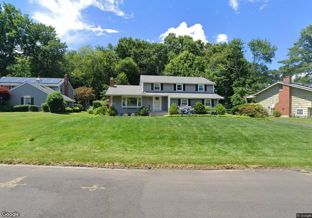
36 Farmstead Ln Windsor, CT 06095
West Windsor NeighborhoodEstimated Value: $468,181 - $512,000
5
Beds
3
Baths
2,260
Sq Ft
$217/Sq Ft
Est. Value
About This Home
This home is located at 36 Farmstead Ln, Windsor, CT 06095 and is currently estimated at $491,545, approximately $217 per square foot. 36 Farmstead Ln is a home located in Hartford County with nearby schools including Oliver Ellsworth School, John F. Kennedy School, and Sage Park Middle School.
Ownership History
Date
Name
Owned For
Owner Type
Purchase Details
Closed on
Nov 30, 1999
Sold by
Chionilos Annette
Bought by
Chionilos Nicholas
Current Estimated Value
Purchase Details
Closed on
Oct 31, 1997
Sold by
Gewehr Herbert
Bought by
Chionilos Nicholas and Chionilos Annette
Create a Home Valuation Report for This Property
The Home Valuation Report is an in-depth analysis detailing your home's value as well as a comparison with similar homes in the area
Home Values in the Area
Average Home Value in this Area
Purchase History
| Date | Buyer | Sale Price | Title Company |
|---|---|---|---|
| Chionilos Nicholas | $16,350 | -- | |
| Chionilos Nicholas | $160,000 | -- |
Source: Public Records
Mortgage History
| Date | Status | Borrower | Loan Amount |
|---|---|---|---|
| Open | Chionilos Nicholas | $185,000 | |
| Closed | Chionilos Nicholas | $185,000 | |
| Closed | Chionilos Nicholas | $204,400 |
Source: Public Records
Tax History
| Year | Tax Paid | Tax Assessment Tax Assessment Total Assessment is a certain percentage of the fair market value that is determined by local assessors to be the total taxable value of land and additions on the property. | Land | Improvement |
|---|---|---|---|---|
| 2025 | $7,498 | $263,550 | $74,620 | $188,930 |
| 2024 | $7,991 | $263,550 | $74,620 | $188,930 |
| 2023 | $5,892 | $175,350 | $57,050 | $118,300 |
| 2022 | $5,834 | $175,350 | $57,050 | $118,300 |
| 2021 | $5,834 | $175,350 | $57,050 | $118,300 |
| 2020 | $5,806 | $175,350 | $57,050 | $118,300 |
| 2019 | $5,678 | $175,350 | $57,050 | $118,300 |
| 2018 | $5,493 | $166,670 | $57,050 | $109,620 |
| 2017 | $5,408 | $166,670 | $57,050 | $109,620 |
| 2016 | $5,253 | $166,670 | $57,050 | $109,620 |
| 2015 | $5,153 | $166,670 | $57,050 | $109,620 |
| 2014 | $5,078 | $166,670 | $57,050 | $109,620 |
Source: Public Records
Map
Nearby Homes
- 16 Cornfield Rd
- 9 Milo Peck Ln
- 22 Eastview Dr
- 22 Apple Tree Ln
- 490 Old Day Hill Rd
- 1 Deanne Lynn Cir
- 268 High Path Rd Unit 268
- 24 Mary Catherine Cir
- 136 High Path Rd
- 118 High Path Rd Unit 118
- 943 High Path Rd Unit 943
- 98 High Path Rd
- 58 High Path Rd Unit 58
- 308 Prospect Hill Rd
- 19 Tiffany Dr
- 10 Cleary Ln
- 608 Kennedy Rd
- 94 Clubhouse Rd
- 105 Trent Dr
- 211 MacKtown Rd
- 32 Farmstead Ln
- 40 Farmstead Ln
- 44 Farmstead Ln
- 28 Farmstead Ln
- 39 Holly Cir
- 48 Farmstead Ln
- 24 Farmstead Ln
- 52 Farmstead Ln
- 42 Holly Cir
- 35 Holly Cir
- 20 Juniper Rd
- 41 Farmstead Ln
- 20 Farmstead Ln
- 24 Juniper Rd
- 16 Juniper Rd
- 56 Farmstead Ln
- 8 Cornfield Rd
- 37 Farmstead Ln
- 25 Farmstead Ln
- 29 Farmstead Ln
Your Personal Tour Guide
Ask me questions while you tour the home.