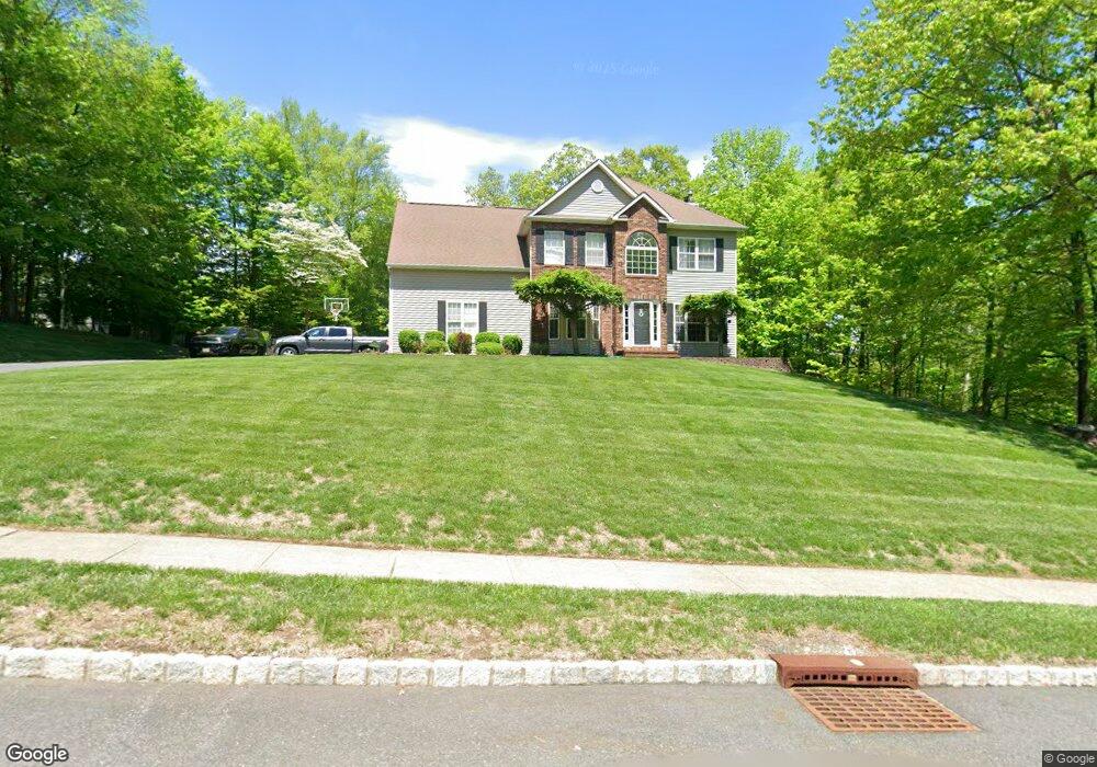
36 Fieldstone Trail Sparta, NJ 07871
Estimated Value: $634,463 - $699,000
--
Bed
--
Bath
2,002
Sq Ft
$328/Sq Ft
Est. Value
About This Home
This home is located at 36 Fieldstone Trail, Sparta, NJ 07871 and is currently estimated at $657,366, approximately $328 per square foot. 36 Fieldstone Trail is a home located in Sussex County with nearby schools including Byram Lakes Elementary School, Byram Township Intermediate School, and Lenape Val Regional High School.
Ownership History
Date
Name
Owned For
Owner Type
Purchase Details
Closed on
Mar 26, 2007
Sold by
Hand Edward L and Hand Lisa A
Bought by
Hough David and Johnson Tara
Current Estimated Value
Home Financials for this Owner
Home Financials are based on the most recent Mortgage that was taken out on this home.
Original Mortgage
$396,000
Outstanding Balance
$239,562
Interest Rate
6.25%
Mortgage Type
New Conventional
Estimated Equity
$417,804
Purchase Details
Closed on
Nov 8, 1999
Sold by
Clarke John J and Clarke Shannon G
Bought by
Hand Edward L and Hand Lisa A
Home Financials for this Owner
Home Financials are based on the most recent Mortgage that was taken out on this home.
Original Mortgage
$229,500
Interest Rate
7.81%
Create a Home Valuation Report for This Property
The Home Valuation Report is an in-depth analysis detailing your home's value as well as a comparison with similar homes in the area
Home Values in the Area
Average Home Value in this Area
Purchase History
| Date | Buyer | Sale Price | Title Company |
|---|---|---|---|
| Hough David | $495,000 | Stewart Title Guaranty Co | |
| Hand Edward L | $270,000 | -- |
Source: Public Records
Mortgage History
| Date | Status | Borrower | Loan Amount |
|---|---|---|---|
| Open | Hough David | $396,000 | |
| Previous Owner | Hand Edward L | $229,500 |
Source: Public Records
Tax History Compared to Growth
Tax History
| Year | Tax Paid | Tax Assessment Tax Assessment Total Assessment is a certain percentage of the fair market value that is determined by local assessors to be the total taxable value of land and additions on the property. | Land | Improvement |
|---|---|---|---|---|
| 2025 | $13,355 | $348,700 | $120,900 | $227,800 |
| 2024 | $13,118 | $348,700 | $120,900 | $227,800 |
| 2023 | $13,118 | $348,700 | $120,900 | $227,800 |
| 2022 | $12,762 | $348,700 | $120,900 | $227,800 |
| 2021 | $12,567 | $348,700 | $120,900 | $227,800 |
| 2020 | $12,463 | $348,700 | $120,900 | $227,800 |
| 2019 | $12,445 | $348,700 | $120,900 | $227,800 |
| 2018 | $12,361 | $348,700 | $120,900 | $227,800 |
| 2017 | $12,145 | $348,700 | $120,900 | $227,800 |
| 2016 | $11,943 | $348,700 | $120,900 | $227,800 |
| 2015 | $11,643 | $348,700 | $120,900 | $227,800 |
| 2014 | $11,580 | $348,700 | $120,900 | $227,800 |
Source: Public Records
Map
Nearby Homes
- 2 Douglas Terrace
- 46 Lynn Dr
- 1 Mayfair Ln
- 74 Cobbler Square Unit 74
- 99 Sleepy Hollow Unit 99
- 46 Glenside Trail
- 449 E Shore Trail
- 330 Springbrook Trail
- 377 E Shore Trail
- 380 E Shore Trail
- 155 Glenside Trail
- 351 E Shore Trail
- 146 Hillside Rd
- 99 Seneca Lake Rd
- 5 Marine Terrace
- 3 Pueblo Pkwy
- 590 W Shore Trail
- 76 Hillside Rd
- 245 E Shore Trail
- 241 Alpine Trail
- 38 Fieldstone Trail
- 30 Fieldstone Trail
- 37 Fieldstone Trail
- 3 N Deer Hill Run
- 35 Fieldstone Trail
- 40 Fieldstone Trail
- 39 Fieldstone Trail
- 41 Fieldstone Trail
- 33 Fieldstone Trail
- 5 N Deer Hill Run
- 42 Fieldstone Trail
- 28 Fieldstone Trail
- 31 Fieldstone Trail
- 4 Douglas Terrace
- 43 Fieldstone Trail
- 4 S Deer Hill Run
- 69 Lynn Dr
- 71 Lynn Dr
- 6 S Deer Hill Run
- 67 Lynn Dr