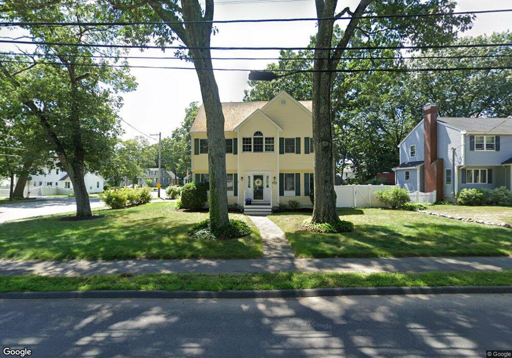
36 Forest St Reading, MA 01867
Estimated Value: $832,000 - $1,147,000
4
Beds
3
Baths
1,958
Sq Ft
$524/Sq Ft
Est. Value
About This Home
This home is located at 36 Forest St, Reading, MA 01867 and is currently estimated at $1,025,678, approximately $523 per square foot. 36 Forest St is a home located in Middlesex County with nearby schools including Birch Meadow Elementary School, Arthur W. Coolidge Middle School, and Reading Memorial High School.
Ownership History
Date
Name
Owned For
Owner Type
Purchase Details
Closed on
Mar 28, 2017
Sold by
Cougar Rt
Bought by
Johnson Judith A and Johnson David W
Current Estimated Value
Home Financials for this Owner
Home Financials are based on the most recent Mortgage that was taken out on this home.
Original Mortgage
$254,500
Outstanding Balance
$211,550
Interest Rate
4.17%
Mortgage Type
New Conventional
Estimated Equity
$814,128
Purchase Details
Closed on
Nov 30, 1995
Sold by
Tierney Martin F and Tierney Linda B
Bought by
Johnson David W and Johnson Judith A
Purchase Details
Closed on
May 22, 1989
Sold by
Barker Douglass L
Bought by
Tierney Martin F
Purchase Details
Closed on
Jan 27, 1989
Sold by
Oneill Exors Mary J
Bought by
Johnson David W
Create a Home Valuation Report for This Property
The Home Valuation Report is an in-depth analysis detailing your home's value as well as a comparison with similar homes in the area
Home Values in the Area
Average Home Value in this Area
Purchase History
| Date | Buyer | Sale Price | Title Company |
|---|---|---|---|
| Johnson Judith A | -- | -- | |
| Johnson David W | $170,000 | -- | |
| Tierney Martin F | $165,000 | -- | |
| Johnson David W | $148,200 | -- |
Source: Public Records
Mortgage History
| Date | Status | Borrower | Loan Amount |
|---|---|---|---|
| Open | Johnson Judith A | $254,500 | |
| Previous Owner | Johnson David W | $171,000 | |
| Previous Owner | Johnson David W | $31,000 |
Source: Public Records
Tax History
| Year | Tax Paid | Tax Assessment Tax Assessment Total Assessment is a certain percentage of the fair market value that is determined by local assessors to be the total taxable value of land and additions on the property. | Land | Improvement |
|---|---|---|---|---|
| 2025 | $11,205 | $983,800 | $475,200 | $508,600 |
| 2024 | $11,077 | $945,100 | $456,500 | $488,600 |
| 2023 | $10,728 | $852,100 | $411,600 | $440,500 |
| 2022 | $10,327 | $774,700 | $374,200 | $400,500 |
| 2021 | $28,233 | $733,800 | $358,600 | $375,200 |
| 2020 | $9,740 | $698,200 | $341,200 | $357,000 |
| 2019 | $9,464 | $665,100 | $325,000 | $340,100 |
| 2018 | $8,699 | $627,200 | $306,500 | $320,700 |
| 2017 | $6,986 | $591,800 | $289,200 | $302,600 |
| 2016 | $8,159 | $562,700 | $259,100 | $303,600 |
| 2015 | $7,643 | $519,900 | $239,400 | $280,500 |
| 2014 | $7,405 | $502,400 | $231,300 | $271,100 |
Source: Public Records
Map
Nearby Homes
- 43 Ashley Place
- 115 Forest St
- 37 Fairchild Dr
- 61 Beaver Rd
- 119 Van Norden Rd
- 64 Longfellow Rd
- 35 Longfellow Rd
- 863 Main St
- 43 Wakefield St
- 25 Wakefield St
- 89 Grand St
- 150 Grove St
- 52 Sanborn St Unit 7
- 103 Orange St
- 41 Winter St
- 31 Zachary Ln
- 34 Plymouth Rd
- 24 Smith Ave
- 5 Washington St Unit D4
- 69 Ash St
Your Personal Tour Guide
Ask me questions while you tour the home.