R
Seller's Agent in 2026
Rosemary Johnson
Keller Williams Gateway Realty
(603) 860-0683
3 in this area
43 Total Sales
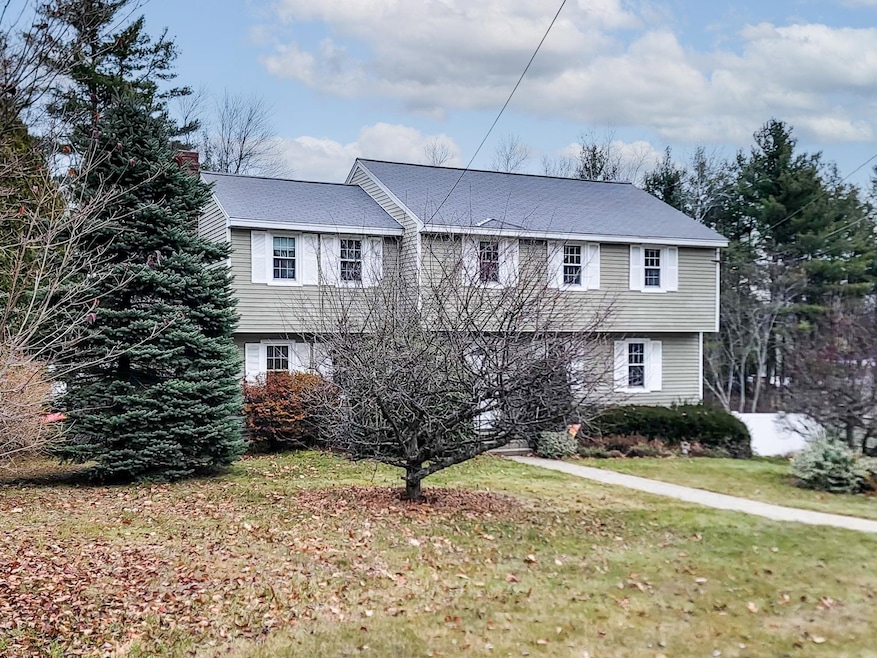
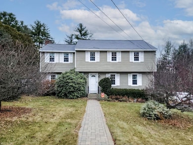
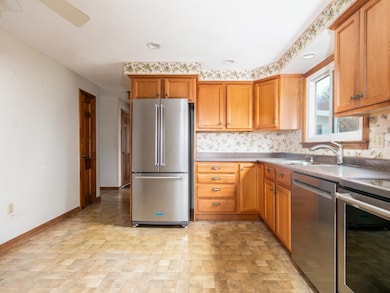
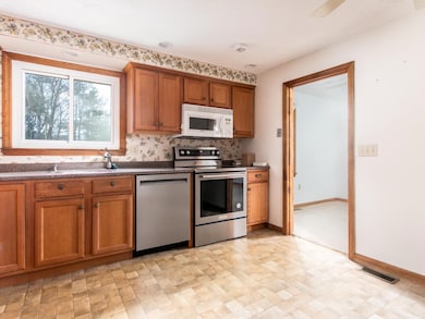
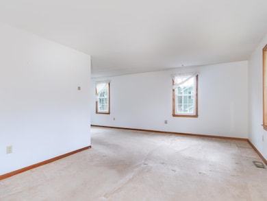
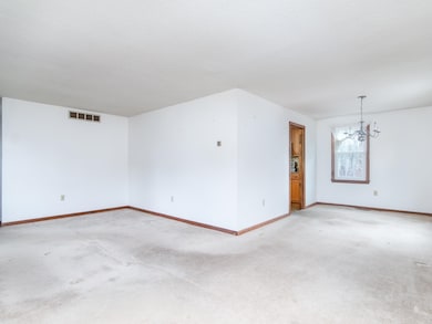
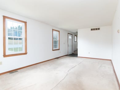
This warm and welcoming home, nestled in one of Nashua’s most sought-after neighborhoods, is ready for your TLC. Step into the spacious sunlit living room, perfect for both casual family gatherings and elegant entertaining. The living room flows into the dining room and then flows into the kitchen. A generous family room with brick fireplace, opens to a delightful three-season porch that overlooks the beautifully landscaped, private back yard. First-floor half bath with laundry. Upstairs the primary suite features double closets and a private full bath. Three additional generous bedrooms share a second full bath, completing the upper level. The basement offers ample storage and direct access to the attached two-car garage. Central Air. Great Commuter Location. Close to Route 3, Restaurants, Shopping, Medical Facilities.
Last Agent to Sell the Property
Keller Williams Gateway Realty License #051485 Listed on: 11/28/2025

| Date | Type | Sale Price | Title Company |
|---|---|---|---|
| Warranty Deed | $530,000 | -- | |
| Warranty Deed | $530,000 | -- | |
| Warranty Deed | $255,000 | -- |
| Date | Status | Loan Amount | Loan Type |
|---|---|---|---|
| Open | $477,000 | New Conventional | |
| Closed | $477,000 | New Conventional | |
| Previous Owner | $89,227 | Unknown | |
| Previous Owner | $100,000 | Purchase Money Mortgage |
| Date | Event | Price | List to Sale | Price per Sq Ft |
|---|---|---|---|---|
| 01/02/2026 01/02/26 | Sold | $530,000 | -2.8% | $268 / Sq Ft |
| 12/04/2025 12/04/25 | Pending | -- | -- | -- |
| 11/28/2025 11/28/25 | For Sale | $545,000 | -- | $276 / Sq Ft |
| Year | Tax Paid | Tax Assessment Tax Assessment Total Assessment is a certain percentage of the fair market value that is determined by local assessors to be the total taxable value of land and additions on the property. | Land | Improvement |
|---|---|---|---|---|
| 2025 | $8,469 | $503,200 | $161,800 | $341,400 |
| 2024 | $8,001 | $503,200 | $161,800 | $341,400 |
| 2023 | $7,633 | $418,700 | $129,500 | $289,200 |
| 2022 | $7,566 | $418,700 | $129,500 | $289,200 |
| 2021 | $7,291 | $314,000 | $90,600 | $223,400 |
| 2020 | $7,100 | $314,000 | $90,600 | $223,400 |
| 2019 | $6,833 | $314,000 | $90,600 | $223,400 |
| 2018 | $6,660 | $314,000 | $90,600 | $223,400 |
| 2017 | $7,162 | $277,700 | $74,000 | $203,700 |
| 2016 | $6,962 | $277,700 | $74,000 | $203,700 |
| 2015 | $6,812 | $277,700 | $74,000 | $203,700 |
| 2014 | $6,679 | $277,700 | $74,000 | $203,700 |
R
Seller's Agent in 2026
Rosemary Johnson
Keller Williams Gateway Realty
(603) 860-0683
3 in this area
43 Total Sales
Seller Co-Listing Agent in 2026
Paul Fortier
Keller Williams Gateway Realty
(603) 484-3397
1 in this area
24 Total Sales
Buyer's Agent in 2026
Nick Turmel
Tri-State Realty, LLC
(603) 566-3073
5 in this area
49 Total Sales
Source: PrimeMLS
MLS Number: 5070791
APN: NASH-000000-000000-000521F
Disclaimer: Certain information contained herein is derived from information provided by parties other than Homes.com. All information provided is deemed reliable, but is not guaranteed to be accurate and should be independently verified.
![]() Copyright 2026 PrimeMLS, Inc. All rights reserved. This information is deemed reliable, but not guaranteed. The data relating to real estate displayed on this display comes in part from the IDX Program of PrimeMLS. The information being provided is for consumers’ personal, non-commercial use and may not be used for any purpose other than to identify prospective properties consumers may be interested in purchasing.
Copyright 2026 PrimeMLS, Inc. All rights reserved. This information is deemed reliable, but not guaranteed. The data relating to real estate displayed on this display comes in part from the IDX Program of PrimeMLS. The information being provided is for consumers’ personal, non-commercial use and may not be used for any purpose other than to identify prospective properties consumers may be interested in purchasing.
Ask me questions while you tour the home.