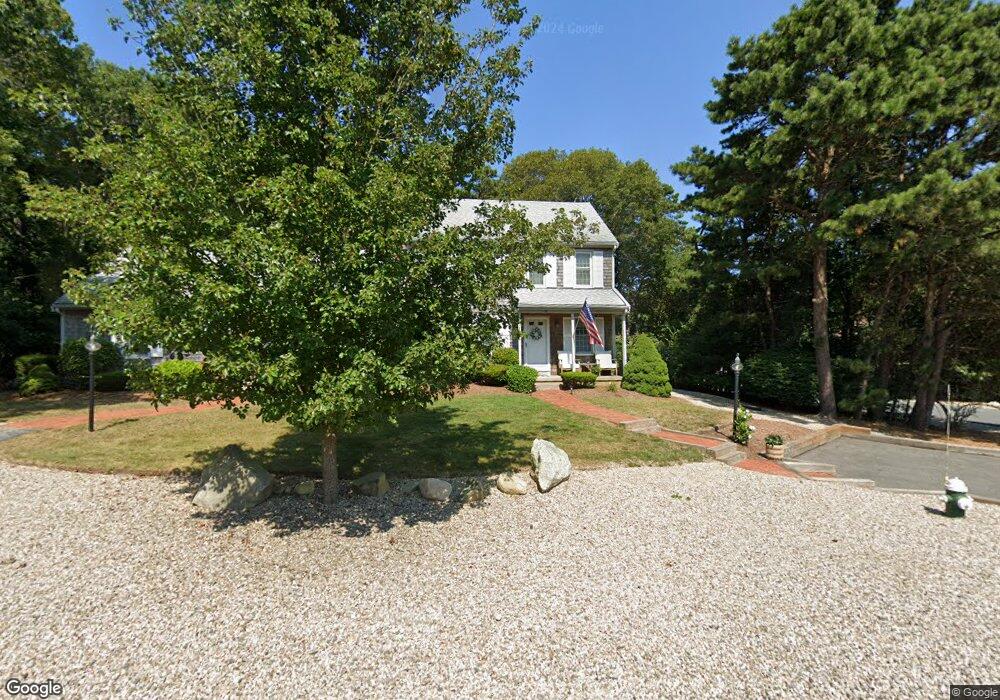
36 Miriah Dr Yarmouth Port, MA 02675
Yarmouth Port NeighborhoodEstimated Value: $428,487 - $496,000
2
Beds
2
Baths
1,240
Sq Ft
$379/Sq Ft
Est. Value
About This Home
This home is located at 36 Miriah Dr, Yarmouth Port, MA 02675 and is currently estimated at $469,372, approximately $378 per square foot. 36 Miriah Dr is a home located in Barnstable County with nearby schools including Dennis-Yarmouth Regional High School and St. Pius X. School.
Ownership History
Date
Name
Owned For
Owner Type
Purchase Details
Closed on
Dec 11, 2019
Sold by
Freeman Robert F and Freeman Judith A
Bought by
Freeman Ft
Current Estimated Value
Purchase Details
Closed on
Jan 3, 2011
Sold by
Strycharz Ralph S and Strycharz Nancy M
Bought by
Freeman Robert F
Purchase Details
Closed on
Aug 27, 1992
Sold by
Clark Marie R
Bought by
Strycharz Ralph S
Home Financials for this Owner
Home Financials are based on the most recent Mortgage that was taken out on this home.
Original Mortgage
$80,000
Interest Rate
8.09%
Mortgage Type
Purchase Money Mortgage
Purchase Details
Closed on
Dec 29, 1989
Sold by
A & R Rt
Bought by
Clark Marie R
Create a Home Valuation Report for This Property
The Home Valuation Report is an in-depth analysis detailing your home's value as well as a comparison with similar homes in the area
Home Values in the Area
Average Home Value in this Area
Purchase History
| Date | Buyer | Sale Price | Title Company |
|---|---|---|---|
| Freeman Ft | -- | None Available | |
| Freeman Robert F | $212,000 | -- | |
| Strycharz Ralph S | $112,500 | -- | |
| Clark Marie R | $104,000 | -- |
Source: Public Records
Mortgage History
| Date | Status | Borrower | Loan Amount |
|---|---|---|---|
| Previous Owner | Clark Marie R | $80,000 |
Source: Public Records
Tax History Compared to Growth
Tax History
| Year | Tax Paid | Tax Assessment Tax Assessment Total Assessment is a certain percentage of the fair market value that is determined by local assessors to be the total taxable value of land and additions on the property. | Land | Improvement |
|---|---|---|---|---|
| 2025 | $2,543 | $359,200 | $0 | $359,200 |
| 2024 | $2,785 | $377,400 | $0 | $377,400 |
| 2023 | $2,770 | $341,600 | $0 | $341,600 |
| 2022 | $2,249 | $245,000 | $0 | $245,000 |
| 2021 | $2,401 | $251,100 | $0 | $251,100 |
| 2020 | $2,539 | $253,900 | $0 | $253,900 |
| 2019 | $2,260 | $223,800 | $0 | $223,800 |
| 2018 | $2,225 | $216,200 | $0 | $216,200 |
| 2017 | $2,141 | $213,700 | $0 | $213,700 |
| 2016 | $1,910 | $191,400 | $0 | $191,400 |
| 2015 | $1,902 | $189,400 | $0 | $189,400 |
Source: Public Records
Map
Nearby Homes
- 16 Warren Rd Unit 16
- 16 Warren Rd
- 8 Rowley Ln
- 0 Forsyth Ave
- 32 Deveau Ln
- 68 Seminole Dr
- 176 Beacon St
- 33 Sparrow Way
- 209 Union St
- 72 Quartermaster Row
- 4 Old Colony Way
- 76 Captain Chase Rd
- 1 Barnacle Rd
- 10 Upton Rd
- 17 Trowbridge Path
- 97 Captain Bacon Rd
- 882 W Yarmouth Rd
- 49 Captain Besse Rd
- 86 Pompano Rd
- 50 Cottonwood St
- 38 Miriah Dr
- 38 Miriah Dr Unit 24A
- 38 Miriah Dr Unit 38
- 22 S Warren Unit 30B
- 11 Warren Rd
- 9 Warren Rd
- 9 Warren Rd Unit 2
- 9 Warren Rd Unit 9
- 9 Warren Rd Unit 25A
- 33 Miriah Dr
- 44 Miriah Dr
- 31 Miriah Dr
- 31 Miriah Dr Unit 31
- 42 Miriah Dr
- 4 Warren Rd
- 6 Warren Rd
- 4 Warren Rd Unit 4
- 4 Warren Rd Unit 32B
- 4 Warren Rd Unit B32
- 37 Miriah Dr