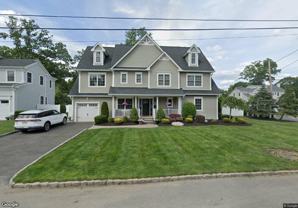
36 Mohawk Trail Westfield, NJ 07090
Estimated Value: $1,188,000 - $1,620,000
Studio
--
Bath
2,694
Sq Ft
$531/Sq Ft
Est. Value
About This Home
This home is located at 36 Mohawk Trail, Westfield, NJ 07090 and is currently estimated at $1,431,001, approximately $531 per square foot. 36 Mohawk Trail is a home located in Union County with nearby schools including Jefferson Elementary School, Edison Intermediate School, and Westfield Senior High School.
Ownership History
Date
Name
Owned For
Owner Type
Purchase Details
Closed on
Jul 29, 2009
Sold by
Plonski Thomas and Plonski Cheryl
Bought by
Calandra Anthony and Calandra Samantha
Current Estimated Value
Home Financials for this Owner
Home Financials are based on the most recent Mortgage that was taken out on this home.
Original Mortgage
$372,000
Outstanding Balance
$236,791
Interest Rate
4.75%
Mortgage Type
Purchase Money Mortgage
Estimated Equity
$1,194,210
Purchase Details
Closed on
Jan 22, 2008
Sold by
Albano Mark A and Solo Francisco
Bought by
Plonski Thomas and Plonski Cheryl
Home Financials for this Owner
Home Financials are based on the most recent Mortgage that was taken out on this home.
Original Mortgage
$50,000
Interest Rate
6.14%
Mortgage Type
Credit Line Revolving
Purchase Details
Closed on
Sep 30, 1997
Sold by
Albano Mark and Soto Francisco
Bought by
Albano Mark and Soto Francisco
Purchase Details
Closed on
Aug 23, 1994
Sold by
Mosher Dorothy H
Bought by
Albano Mark A and Soto Francisco
Create a Home Valuation Report for This Property
The Home Valuation Report is an in-depth analysis detailing your home's value as well as a comparison with similar homes in the area
Home Values in the Area
Average Home Value in this Area
Purchase History
| Date | Buyer | Sale Price | Title Company |
|---|---|---|---|
| Calandra Anthony | $465,000 | None Available | |
| Plonski Thomas | $501,000 | None Available | |
| Albano Mark | -- | -- | |
| Albano Mark A | $195,100 | Attorneys Land Title |
Source: Public Records
Mortgage History
| Date | Status | Borrower | Loan Amount |
|---|---|---|---|
| Open | Calandra Anthony | $372,000 | |
| Previous Owner | Plonski Thomas | $50,000 | |
| Previous Owner | Plonski Thomas | $400,000 |
Source: Public Records
Tax History
| Year | Tax Paid | Tax Assessment Tax Assessment Total Assessment is a certain percentage of the fair market value that is determined by local assessors to be the total taxable value of land and additions on the property. | Land | Improvement |
|---|---|---|---|---|
| 2025 | $21,401 | $950,300 | $366,300 | $584,000 |
| 2024 | $20,964 | $950,300 | $366,300 | $584,000 |
| 2023 | $20,964 | $950,300 | $366,300 | $584,000 |
| 2022 | $20,526 | $950,300 | $366,300 | $584,000 |
| 2021 | $20,555 | $950,300 | $366,300 | $584,000 |
| 2020 | $20,507 | $950,300 | $366,300 | $584,000 |
| 2019 | $23,160 | $1,077,200 | $366,300 | $710,900 |
| 2018 | $14,206 | $152,800 | $48,400 | $104,400 |
| 2017 | $14,128 | $152,800 | $48,400 | $104,400 |
| 2016 | $13,796 | $152,800 | $48,400 | $104,400 |
| 2015 | $13,521 | $152,800 | $48,400 | $104,400 |
| 2014 | $13,075 | $152,800 | $48,400 | $104,400 |
Source: Public Records
Map
Nearby Homes
- 13 Oneida Dr
- 59 Genesee Trail
- 1283 Rahway Ave
- 22 S Wickom Dr
- 817 Summit Ave
- 54 Faulkner Dr
- 631 Kensington Dr
- 26 Manchester Dr
- 125 Pearl St
- 121 Greene Place
- 176 Harrow Rd
- 14 Sandy Hill Rd
- 733 Summit Ave
- 722 Boulevard
- 290 Sycamore St
- 741 Hyslip Ave
- 122 Livingston St
- 443 Pine Ave
- 106 Frazee Ct
- 643 Nottingham Place
- 38 Mohawk Trail
- 1040 Tice Place
- 35 Mohawk Trail
- 32 Mohawk Trail
- 33 Mohawk Trail
- 1032 Tice Place
- 40 Mohawk Trail
- 37 Mohawk Trail
- 1100 Tice Place
- 31 Mohawk Trail
- 39 Mohawk Trail
- 9 Mohawk Trail
- 1024 Tice Place
- 7 Mohawk Trail
- 28 Mohawk Trail
- 29 Mohawk Trail
- 1041 Tice Place
- 41 Mohawk Trail
- 44 Mohawk Trail
- 1116 Tice Place
Your Personal Tour Guide
Ask me questions while you tour the home.